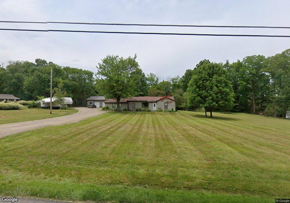
10893 Clapsaddle Ave NE Alliance, OH 44601
Estimated Value: $188,000 - $341,000
3
Beds
1
Bath
2,236
Sq Ft
$128/Sq Ft
Est. Value
About This Home
This home is located at 10893 Clapsaddle Ave NE, Alliance, OH 44601 and is currently estimated at $287,017, approximately $128 per square foot. 10893 Clapsaddle Ave NE is a home located in Stark County with nearby schools including Marlington High School and Regina Coeli/St Joseph School.
Ownership History
Date
Name
Owned For
Owner Type
Purchase Details
Closed on
Aug 28, 2019
Sold by
Reinsel Adam J
Bought by
Reinsel Angela M
Current Estimated Value
Purchase Details
Closed on
Dec 1, 2016
Sold by
Reinsel Adam J
Bought by
Reinsel Realty Llc
Purchase Details
Closed on
Aug 11, 2008
Sold by
Stevens Jarry M
Bought by
Reinsel Adam J and Reinsel Angela M
Home Financials for this Owner
Home Financials are based on the most recent Mortgage that was taken out on this home.
Original Mortgage
$80,750
Interest Rate
6.51%
Mortgage Type
Purchase Money Mortgage
Purchase Details
Closed on
Nov 23, 1993
Create a Home Valuation Report for This Property
The Home Valuation Report is an in-depth analysis detailing your home's value as well as a comparison with similar homes in the area
Home Values in the Area
Average Home Value in this Area
Purchase History
| Date | Buyer | Sale Price | Title Company |
|---|---|---|---|
| Reinsel Angela M | -- | None Available | |
| Reinsel Realty Llc | -- | None Available | |
| Reinsel Family Holdings Llc | -- | None Available | |
| Reinsel Adam J | $85,000 | None Available | |
| -- | -- | -- |
Source: Public Records
Mortgage History
| Date | Status | Borrower | Loan Amount |
|---|---|---|---|
| Previous Owner | Reinsel Adam J | $80,750 |
Source: Public Records
Tax History Compared to Growth
Tax History
| Year | Tax Paid | Tax Assessment Tax Assessment Total Assessment is a certain percentage of the fair market value that is determined by local assessors to be the total taxable value of land and additions on the property. | Land | Improvement |
|---|---|---|---|---|
| 2025 | -- | $81,170 | $33,920 | $47,250 |
| 2024 | -- | $81,170 | $33,920 | $47,250 |
| 2023 | $2,575 | $62,930 | $22,260 | $40,670 |
| 2022 | $2,333 | $62,930 | $22,260 | $40,670 |
| 2021 | $2,341 | $62,930 | $22,260 | $40,670 |
| 2020 | $2,112 | $52,010 | $18,690 | $33,320 |
| 2019 | $2,097 | $51,890 | $18,700 | $33,190 |
| 2018 | $2,003 | $51,890 | $18,700 | $33,190 |
| 2017 | $2,098 | $50,240 | $18,350 | $31,890 |
| 2016 | $2,099 | $50,240 | $18,350 | $31,890 |
| 2015 | $1,866 | $44,540 | $18,350 | $26,190 |
| 2014 | $1,759 | $38,810 | $15,970 | $22,840 |
| 2013 | $860 | $38,810 | $15,970 | $22,840 |
Source: Public Records
Map
Nearby Homes
- 0 Reeder Ave NE
- 10666 Wilma Ave NE
- 12355 Edison St NE
- 12252 Snode St NE
- 11960 Freshley Ave NE
- 12415 Snode St NE
- 13334 Cindy St NE
- 0 Meadow St NE
- 13109 Edison St NE
- 11480 Aebi Ave NE
- 1430 Westwood Ave
- 2377 Ansley St Unit 2377
- 0 W Main St Unit 5090123
- 2081 Marwood Cir
- 2851 Patriots Path Unit 3D
- 2435 Queensbury Rd
- 000 Klinger Ave
- 0 Valewood Cir Unit 5006281
- 14422 Sturbridge Rd NE
- 432 Johnson Ave
- 11206 Clapsaddle Ave NE
- 10859 Clapsaddle Ave NE
- 10953 Clapsaddle Ave NE
- 10829 Clapsaddle Ave NE
- 10870 Clapsaddle Ave NE
- 10838 Clapsaddle Ave NE
- 11067 Clapsaddle Ave NE
- 10785 Clapsaddle Ave NE
- 10785 Clapsaddle Ave NE
- 10861 Clapsaddle Ave NE
- 10970 Clapsaddle Ave NE
- 10790 Clapsaddle Ave NE
- 11028 Clapsaddle Ave NE
- 10770 Clapsaddle Ave NE
- 10730 Clapsaddle Ave NE
- 10690 Clapsaddle Ave NE
- 10636 Clapsaddle Ave NE
- 11095 Clapsaddle Ave NE
- 11124 Clapsaddle Ave NE
- 11004 Clapsaddle Ave NE