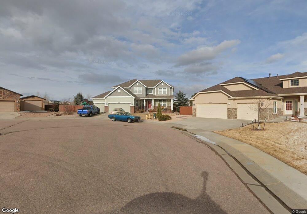
10893 White Sands Ct Peyton, CO 80831
Falcon NeighborhoodEstimated Value: $668,646 - $734,000
6
Beds
4
Baths
3,322
Sq Ft
$214/Sq Ft
Est. Value
About This Home
This home is located at 10893 White Sands Ct, Peyton, CO 80831 and is currently estimated at $712,162, approximately $214 per square foot. 10893 White Sands Ct is a home located in El Paso County with nearby schools including Meridian Ranch Elementary School, Falcon Middle School, and Falcon High School.
Ownership History
Date
Name
Owned For
Owner Type
Purchase Details
Closed on
Nov 2, 2007
Sold by
Tousa Homes Inc
Bought by
Stepanek Douglas J and Stepanek Erica D
Current Estimated Value
Home Financials for this Owner
Home Financials are based on the most recent Mortgage that was taken out on this home.
Original Mortgage
$403,750
Outstanding Balance
$255,983
Interest Rate
6.42%
Mortgage Type
Unknown
Estimated Equity
$456,179
Create a Home Valuation Report for This Property
The Home Valuation Report is an in-depth analysis detailing your home's value as well as a comparison with similar homes in the area
Home Values in the Area
Average Home Value in this Area
Purchase History
| Date | Buyer | Sale Price | Title Company |
|---|---|---|---|
| Stepanek Douglas J | $425,000 | None Available |
Source: Public Records
Mortgage History
| Date | Status | Borrower | Loan Amount |
|---|---|---|---|
| Open | Stepanek Douglas J | $403,750 |
Source: Public Records
Tax History
| Year | Tax Paid | Tax Assessment Tax Assessment Total Assessment is a certain percentage of the fair market value that is determined by local assessors to be the total taxable value of land and additions on the property. | Land | Improvement |
|---|---|---|---|---|
| 2025 | $4,683 | $48,510 | -- | -- |
| 2024 | $4,546 | $49,350 | $9,000 | $40,350 |
| 2022 | $3,506 | $34,740 | $7,390 | $27,350 |
| 2021 | $3,633 | $35,730 | $7,600 | $28,130 |
| 2020 | $3,574 | $32,590 | $6,890 | $25,700 |
| 2019 | $3,554 | $32,590 | $6,890 | $25,700 |
| 2018 | $2,951 | $26,780 | $6,300 | $20,480 |
| 2017 | $2,496 | $23,950 | $6,300 | $17,650 |
| 2016 | $2,313 | $22,730 | $6,970 | $15,760 |
| 2015 | $2,315 | $22,730 | $6,970 | $15,760 |
| 2014 | $2,189 | $21,240 | $5,970 | $15,270 |
Source: Public Records
Map
Nearby Homes
- 12705 Angelina Dr
- 10952 Torreys Peak Way
- 10803 Greenbelt Dr
- 12320 Grand Teton Dr
- 10932 Huron Peak Place
- 12534 Angelina Dr
- 10603 Ross Lake Dr
- 10952 Checo Way
- 10489 Cedar Breaks Dr
- 10488 Cedar Breaks Dr
- 10467 Pictured Rocks Dr
- 10476 Ross Lake Dr
- 10429 Cedar Breaks Dr
- 12431 Mount Bross Place
- 12692 Clark Peak Ct
- 12698 Culebra Peak Dr
- 10388 Mount Wilson Place
- 10342 Biscayne Dr
- 12252 Point Reyes Dr
- 12150 Fox Brush Dr
- 10873 White Sands Ct
- 10892 White Sands Ct
- 10853 White Sands Ct
- 10852 White Sands Ct
- 10833 White Sands Ct
- 10832 White Sands Ct
- 10813 White Sands Ct
- 10812 White Sands Ct
- 12255 Ozark Place
- 12745 Angelina Dr
- 12284 Ozark Place
- 12695 Angelina Dr
- 12225 Ozark Place
- 12734 Angelina Dr
- 12755 Angelina Dr
- 12724 Angelina Dr
- 10857 Greenbelt Dr
- 12744 Angelina Dr
- 12714 Angelina Dr
- 12685 Angelina Dr
Your Personal Tour Guide
Ask me questions while you tour the home.