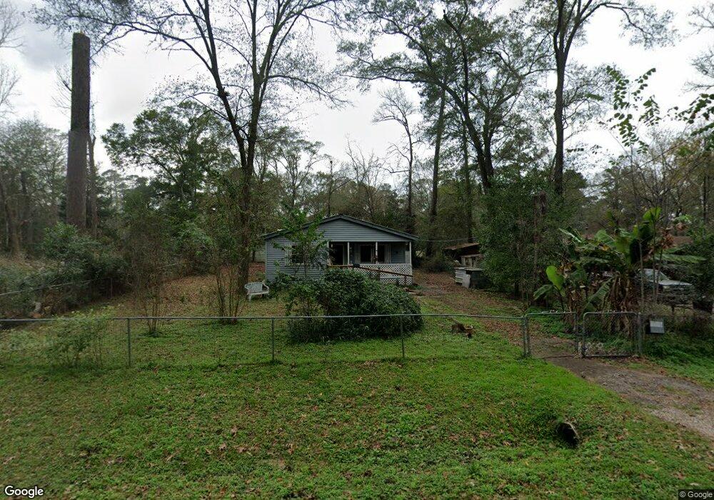
10895 Sandalwood St Conroe, TX 77303
Estimated Value: $142,821 - $209,000
--
Bed
1
Bath
1,212
Sq Ft
$154/Sq Ft
Est. Value
About This Home
This home is located at 10895 Sandalwood St, Conroe, TX 77303 and is currently estimated at $186,955, approximately $154 per square foot. 10895 Sandalwood St is a home located in Montgomery County with nearby schools including Patterson Elementary School, Bozman Intermediate School, and Stockton Junior High School.
Ownership History
Date
Name
Owned For
Owner Type
Purchase Details
Closed on
Aug 26, 2019
Sold by
Dietz Kory K
Bought by
Ali Adil
Current Estimated Value
Purchase Details
Closed on
Feb 19, 2015
Sold by
Warren William and Warren Donna K
Bought by
Dietz Kory K
Purchase Details
Closed on
Feb 18, 2015
Sold by
Warren Donna K
Bought by
Dietz Kory K
Purchase Details
Closed on
Oct 29, 1996
Sold by
Davis Jas W
Bought by
Dietz Kory K
Create a Home Valuation Report for This Property
The Home Valuation Report is an in-depth analysis detailing your home's value as well as a comparison with similar homes in the area
Home Values in the Area
Average Home Value in this Area
Purchase History
| Date | Buyer | Sale Price | Title Company |
|---|---|---|---|
| Ali Adil | -- | Fidelity National Title | |
| Dietz Kory K | -- | -- | |
| Dietz Kory K | -- | -- | |
| Dietz Kory K | -- | -- |
Source: Public Records
Tax History Compared to Growth
Tax History
| Year | Tax Paid | Tax Assessment Tax Assessment Total Assessment is a certain percentage of the fair market value that is determined by local assessors to be the total taxable value of land and additions on the property. | Land | Improvement |
|---|---|---|---|---|
| 2025 | $1,540 | $102,383 | $7,934 | $94,449 |
| 2024 | $1,306 | $97,134 | $7,934 | $89,200 |
| 2023 | $1,306 | $82,280 | $7,930 | $74,350 |
| 2022 | $1,544 | $88,630 | $9,760 | $78,870 |
| 2021 | $976 | $52,770 | $1,460 | $51,310 |
| 2020 | $860 | $44,220 | $1,460 | $42,760 |
| 2019 | $873 | $43,320 | $1,460 | $41,860 |
| 2018 | $898 | $44,570 | $1,460 | $43,110 |
| 2017 | $901 | $44,580 | $1,460 | $43,120 |
| 2016 | $901 | $44,590 | $1,460 | $43,130 |
| 2015 | $417 | $39,940 | $1,460 | $38,480 |
| 2014 | $417 | $20,480 | $1,460 | $19,020 |
Source: Public Records
Map
Nearby Homes
- 12056 Forest Glen Dr
- 0 Lakeside Dr Unit 90370648
- 11045 Woodview Dr
- TBD Rollingwood Loop
- 00 Rollingwood Loop
- 12604 Rollingwood Loop
- 11976 Rollingwood Loop
- TBD Copperhead Rd
- 11332 Highcrest Dr
- 11429 Landry Ln
- 0 Copperhead Rd
- 12535 Nicholson Rd
- 11408 Landry Ln
- 10388 Champion Village Dr
- 7027 Allen Rd
- 4409 Wapama Falls Loop
- Littleton Plan at Sweetwater Ridge
- Oxford Plan at Sweetwater Ridge
- Newlin Plan at Sweetwater Ridge
- Ramsey Plan at Sweetwater Ridge
- 10911 Sandalwood St
- 10928 White Oak Dr
- 10878 Sandalwood St
- 10925 White Oak Dr
- 10961 White Oak Dr
- 10970 White Oak Dr
- Lot 3-B Forest Glen
- 0 Parkwood
- 87 White Oak Manor Unit 118
- TBD1 Forest Glen
- TBD3 Forest Glen
- TBD2 Forest Glen
- 10994 Parkwood
- 01 Lakeside
- 02 Lakeside
- 11980 Forest Glen Dr
- 10959 Parkwood
- 10989 Parkwood
- 10997 Parkwood
- 0 Tbd Forest Glen Dr Unit 19787673