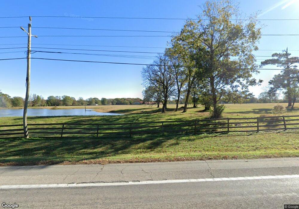
10899 Highway 31 N Austin, AR 72007
Estimated Value: $295,000 - $649,466
--
Bed
--
Bath
1,368
Sq Ft
$345/Sq Ft
Est. Value
About This Home
This home is located at 10899 Highway 31 N, Austin, AR 72007 and is currently estimated at $472,233, approximately $345 per square foot. 10899 Highway 31 N is a home with nearby schools including Stagecoach Elementary School, Cabot Middle School North, and Cabot Junior High North.
Ownership History
Date
Name
Owned For
Owner Type
Purchase Details
Closed on
Mar 2, 2020
Sold by
Alexander Hubert W
Bought by
Alexaner Jan E
Current Estimated Value
Purchase Details
Closed on
Sep 14, 2001
Bought by
Bryant Fam Liv Trust
Purchase Details
Closed on
Apr 20, 1998
Bought by
Bryant and Bryant Wife
Purchase Details
Closed on
Oct 7, 1985
Bought by
State Hwy Comm
Create a Home Valuation Report for This Property
The Home Valuation Report is an in-depth analysis detailing your home's value as well as a comparison with similar homes in the area
Home Values in the Area
Average Home Value in this Area
Purchase History
| Date | Buyer | Sale Price | Title Company |
|---|---|---|---|
| Alexaner Jan E | -- | None Available | |
| Bryant Fam Liv Trust | $1,000 | -- | |
| Bryant Fam Liv Trust | $1,000 | -- | |
| Bryant | $150,000 | -- | |
| State Hwy Comm | -- | -- |
Source: Public Records
Tax History Compared to Growth
Tax History
| Year | Tax Paid | Tax Assessment Tax Assessment Total Assessment is a certain percentage of the fair market value that is determined by local assessors to be the total taxable value of land and additions on the property. | Land | Improvement |
|---|---|---|---|---|
| 2025 | $3,354 | $72,080 | $4,750 | $67,330 |
| 2024 | $3,354 | $72,080 | $4,750 | $67,330 |
| 2023 | $3,354 | $72,080 | $4,750 | $67,330 |
| 2022 | $3,354 | $72,080 | $4,750 | $67,330 |
| 2021 | $3,317 | $72,080 | $4,750 | $67,330 |
| 2020 | $3,020 | $64,800 | $4,370 | $60,430 |
| 2019 | $3,020 | $64,800 | $4,370 | $60,430 |
| 2018 | $3,020 | $64,800 | $4,370 | $60,430 |
| 2017 | $2,748 | $64,800 | $4,370 | $60,430 |
| 2016 | $3,020 | $64,800 | $4,370 | $60,430 |
| 2015 | $2,770 | $65,340 | $3,600 | $61,740 |
| 2014 | $3,005 | $65,340 | $3,600 | $61,740 |
Source: Public Records
Map
Nearby Homes
- 10340 Hwy 31 N
- 10340 Highway 31 N
- 0 Hicks Rd Unit 25037662
- 365 Maple Tree Cove
- 0000 Clay Hill Tract 3 Rd
- 135 Red Bud Ln
- Lot 31 Whitetail Ridge Rd
- 00 Hwy 321
- 1303 Highway 236 E
- 50 Saddle Brook Cove
- 2236 Tippitt Rd
- 45 Willow Tree Rd
- 1145 Mccollum Rd
- 84 E Green Tree Rd
- 2494 Arkansas 236
- 158 Coyote Cir
- 82 Lenderman Trl Trail
- 215 Rainwater Dr
- 00 Jones Rd
- Lot 13 Chasey Cove
- 426 Casteen Rd
- 10681 Highway 31 N
- 10681 Highway 31 N
- 264 Casteen Rd
- 102 Bethlehem Rd
- 124 Bethlehem Rd
- 11174 Highway 31 N
- 11174 Ar Hwy 31 N
- 402 Casteen Rd
- 11176 Highway 31 N
- 00 Bethlehem Rd
- 481 Bethlehem Rd
- 7446 Highway 321 E
- 11256 Highway 31 N
- 11256 Highway 31 N
- 11299 Arkansas 31
- 11277 Highway 31 N
- 0 Ar Hwy 31 N Unit 16007253
- 523 Bethlehem Rd
- 362 Bethlehem Rd
