Estimated Value: $397,809 - $478,000
4
Beds
3
Baths
2,395
Sq Ft
$181/Sq Ft
Est. Value
About This Home
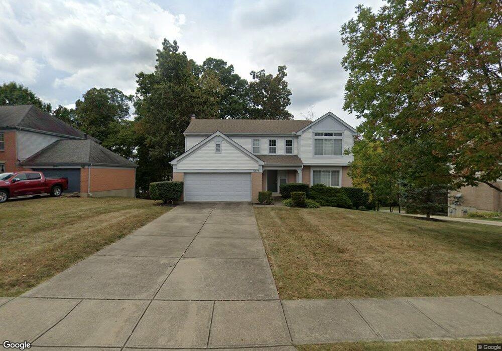
This home is located at 10899 War Admiral Dr, Union, KY 41091 and is currently estimated at $433,202, approximately $180 per square foot. 10899 War Admiral Dr is a home located in Boone County with nearby schools including Shirley Mann Elementary School, Gray Middle School, and Larry A. Ryle High School.
Ownership History
Date
Name
Owned For
Owner Type
Purchase Details
Closed on
Aug 2, 2006
Sold by
Curby Eric B
Bought by
Forsman Keith W
Current Estimated Value
Home Financials for this Owner
Home Financials are based on the most recent Mortgage that was taken out on this home.
Original Mortgage
$13,000
Interest Rate
6.58%
Mortgage Type
Credit Line Revolving
Purchase Details
Closed on
Jul 2, 1998
Sold by
Jarnecke Duane R
Bought by
Curby Eric B
Home Financials for this Owner
Home Financials are based on the most recent Mortgage that was taken out on this home.
Original Mortgage
$136,500
Interest Rate
7.1%
Mortgage Type
New Conventional
Purchase Details
Closed on
May 5, 1997
Sold by
Fischer Management Inc
Bought by
Duane R Jarneke
Home Financials for this Owner
Home Financials are based on the most recent Mortgage that was taken out on this home.
Original Mortgage
$154,200
Interest Rate
7.75%
Mortgage Type
New Conventional
Create a Home Valuation Report for This Property
The Home Valuation Report is an in-depth analysis detailing your home's value as well as a comparison with similar homes in the area
Home Values in the Area
Average Home Value in this Area
Purchase History
| Date | Buyer | Sale Price | Title Company |
|---|---|---|---|
| Forsman Keith W | $215,000 | First Title Inc | |
| Curby Eric B | $182,000 | -- | |
| Duane R Jarneke | $192,750 | -- |
Source: Public Records
Mortgage History
| Date | Status | Borrower | Loan Amount |
|---|---|---|---|
| Previous Owner | Forsman Keith W | $13,000 | |
| Previous Owner | Curby Eric B | $136,500 | |
| Previous Owner | Duane R Jarneke | $154,200 |
Source: Public Records
Tax History Compared to Growth
Tax History
| Year | Tax Paid | Tax Assessment Tax Assessment Total Assessment is a certain percentage of the fair market value that is determined by local assessors to be the total taxable value of land and additions on the property. | Land | Improvement |
|---|---|---|---|---|
| 2024 | $3,023 | $268,400 | $50,000 | $218,400 |
| 2023 | $3,129 | $268,400 | $50,000 | $218,400 |
| 2022 | $3,013 | $268,400 | $50,000 | $218,400 |
| 2021 | $3,095 | $268,400 | $50,000 | $218,400 |
| 2020 | $2,175 | $190,000 | $38,000 | $152,000 |
| 2019 | $2,201 | $190,000 | $38,000 | $152,000 |
| 2018 | $2,243 | $190,000 | $38,000 | $152,000 |
| 2017 | $2,168 | $190,000 | $38,000 | $152,000 |
| 2015 | $2,141 | $190,000 | $38,000 | $152,000 |
| 2013 | -- | $190,000 | $38,000 | $152,000 |
Source: Public Records
Map
Nearby Homes
- 10869 Arcaro Ln
- 1049 Swale Ct
- 1042 Spectacular Bid Dr
- 6800 Green Isle Ln
- 815 Devin Ct
- 1018 Whirlaway Dr
- 10730 Stone St
- 10713 Stone St
- 1052 Aristides Dr
- 10819 Sawgrass Ct
- 952 Dustwhirl Dr
- 10807 Doral Ct
- 10880 Saint Andrews Dr
- 985 Oakmont Ct
- 10007 Glensprings Place
- 1655 Frogtown Rd
- 658 Coaltown Ct
- 10723 Saint Leger Cir
- 14086 Bridlegate Dr
- 11179 War Admiral Dr
- 10903 War Admiral Dr
- 10887 War Admiral Dr
- 10911 War Admiral Dr
- 10879 War Admiral Dr
- 1124 Samuel Ct
- 1104 Whirlaway Dr
- 10895 War Admiral Dr
- 10898 War Admiral Dr
- 1132 Samuel Ct
- 10891 War Admiral Dr
- 10894 War Admiral Dr
- 10919 War Admiral Dr
- 10871 War Admiral Dr
- 1111 Whirlaway Dr
- 1140 Samuel Ct
- 1096 Whirlaway Dr
- 10878 War Admiral Dr
- 10888 War Admiral Dr
- 10863 War Admiral Dr
- 10920 War Admiral Dr