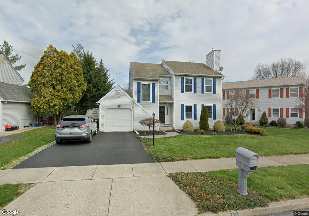
109 Bradford Ln Lansdale, PA 19446
Estimated Value: $445,000 - $525,000
3
Beds
2
Baths
1,552
Sq Ft
$306/Sq Ft
Est. Value
About This Home
This home is located at 109 Bradford Ln, Lansdale, PA 19446 and is currently estimated at $475,422, approximately $306 per square foot. 109 Bradford Ln is a home located in Montgomery County with nearby schools including Inglewood Elementary School, Penndale Middle School, and North Penn Senior High School.
Ownership History
Date
Name
Owned For
Owner Type
Purchase Details
Closed on
Jul 24, 2003
Sold by
Pu Yiyun and Wang Yigong
Bought by
Polzella Laura M and Polzella William
Current Estimated Value
Purchase Details
Closed on
Apr 15, 1996
Sold by
Henkels Mark V and Henkels Karen M
Bought by
Wang Yigong and Pu Yiyun
Purchase Details
Closed on
Sep 20, 1994
Sold by
Beardsley Harold R and Beardsley Michelle R
Bought by
Henkels Mark and Henkels Karen M
Create a Home Valuation Report for This Property
The Home Valuation Report is an in-depth analysis detailing your home's value as well as a comparison with similar homes in the area
Home Values in the Area
Average Home Value in this Area
Purchase History
| Date | Buyer | Sale Price | Title Company |
|---|---|---|---|
| Polzella Laura M | $215,900 | -- | |
| Wang Yigong | $144,000 | -- | |
| Henkels Mark | $154,950 | -- |
Source: Public Records
Tax History Compared to Growth
Tax History
| Year | Tax Paid | Tax Assessment Tax Assessment Total Assessment is a certain percentage of the fair market value that is determined by local assessors to be the total taxable value of land and additions on the property. | Land | Improvement |
|---|---|---|---|---|
| 2025 | $4,911 | $133,840 | $43,640 | $90,200 |
| 2024 | $4,911 | $133,840 | $43,640 | $90,200 |
| 2023 | $4,681 | $133,840 | $43,640 | $90,200 |
| 2022 | $4,514 | $133,840 | $43,640 | $90,200 |
| 2021 | $4,395 | $133,840 | $43,640 | $90,200 |
| 2020 | $4,281 | $133,840 | $43,640 | $90,200 |
| 2019 | $4,202 | $133,840 | $43,640 | $90,200 |
| 2018 | $4,202 | $133,840 | $43,640 | $90,200 |
| 2017 | $4,026 | $133,840 | $43,640 | $90,200 |
| 2016 | $3,973 | $133,840 | $43,640 | $90,200 |
| 2015 | $3,894 | $133,840 | $43,640 | $90,200 |
| 2014 | $3,794 | $133,840 | $43,640 | $90,200 |
Source: Public Records
Map
Nearby Homes
- 758 Brian Way
- 1120 Kingsley Hall Dr
- 197 Eric Ln
- 818 Green St
- 1059 Charter Oaks Dr
- 830 S Broad St
- 38 Hamilton St
- 10 Wheatley Walk
- 611 Green St
- 160 Church Rd
- 534 Green St
- 719 N Sumneytown Pike Unit 4
- 532 Green St
- 380 E Hancock St Unit 100A
- 380 E Hancock St Unit 104A
- 380 E Hancock St Unit 103A
- 380 E Hancock St Unit 101A
- 380 E Hancock St Unit 103B
- 380 E Hancock St Unit 102B
- 380 E Hancock St Unit 101B
- 115 Bradford Ln
- 103 Bradford Ln
- 797 Allentown Rd
- 898 Sturbridge Ln
- 896 Sturbridge Ln
- 796 Brian Way
- 894 Sturbridge Ln
- 888 Sturbridge Ln
- 794 Brian Way
- 114 Bradford Ln
- 892 Sturbridge Ln
- 118 Bradford Ln
- 890 Sturbridge Ln
- 799 Allentown Rd
- 122 Bradford Ln
- 126 Bradford Ln
- 792 Brian Way
- 130 Bradford Ln
- 886 Sturbridge Ln
- 897 Sturbridge Ln