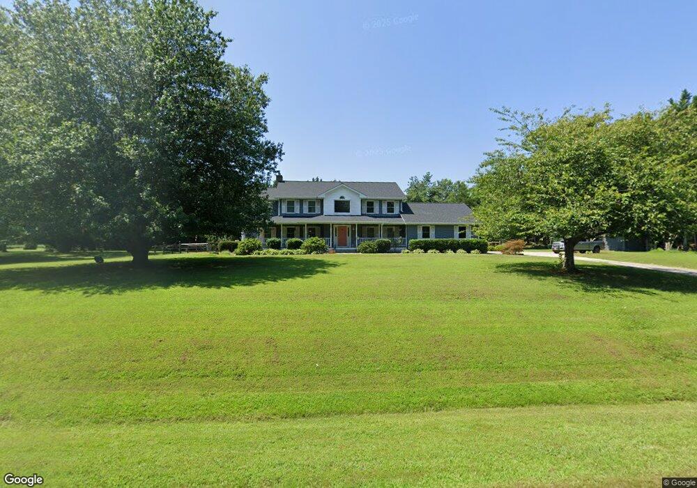
109 Bryans Channel Way Queenstown, MD 21658
Estimated Value: $765,546 - $1,371,000
--
Bed
3
Baths
2,880
Sq Ft
$327/Sq Ft
Est. Value
About This Home
This home is located at 109 Bryans Channel Way, Queenstown, MD 21658 and is currently estimated at $941,387, approximately $326 per square foot. 109 Bryans Channel Way is a home located in Queen Anne's County with nearby schools including Grasonville Elementary School, Stevensville Middle School, and Kent Island High School.
Ownership History
Date
Name
Owned For
Owner Type
Purchase Details
Closed on
Mar 16, 2022
Sold by
Julie Iii Roy E
Bought by
Roy E Julie Iii And Mary A Julie Revocable De
Current Estimated Value
Purchase Details
Closed on
May 2, 1990
Sold by
Wye Harbor Partnership
Bought by
Julie Roy E and Julie Mary A
Create a Home Valuation Report for This Property
The Home Valuation Report is an in-depth analysis detailing your home's value as well as a comparison with similar homes in the area
Home Values in the Area
Average Home Value in this Area
Purchase History
| Date | Buyer | Sale Price | Title Company |
|---|---|---|---|
| Roy E Julie Iii And Mary A Julie Revocable De | -- | Brilliant Title | |
| Julie Roy E | $62,500 | -- |
Source: Public Records
Tax History Compared to Growth
Tax History
| Year | Tax Paid | Tax Assessment Tax Assessment Total Assessment is a certain percentage of the fair market value that is determined by local assessors to be the total taxable value of land and additions on the property. | Land | Improvement |
|---|---|---|---|---|
| 2025 | $5,072 | $552,467 | $0 | $0 |
| 2024 | $4,809 | $504,100 | $186,500 | $317,600 |
| 2023 | $4,694 | $498,333 | $0 | $0 |
| 2022 | $4,700 | $492,567 | $0 | $0 |
| 2021 | $4,668 | $486,800 | $156,500 | $330,300 |
| 2020 | $4,668 | $480,400 | $0 | $0 |
| 2019 | $4,606 | $474,000 | $0 | $0 |
| 2018 | $4,545 | $467,600 | $146,500 | $321,100 |
| 2017 | $4,355 | $447,867 | $0 | $0 |
| 2016 | -- | $428,133 | $0 | $0 |
| 2015 | $2,006 | $408,400 | $0 | $0 |
| 2014 | $2,006 | $408,400 | $0 | $0 |
Source: Public Records
Map
Nearby Homes
- 213 Slippery Hill Ln
- 915 Sportsman Neck Rd
- 108 Carriage Ln
- 201 Sawmill Ln
- 149 Unit 141155 SAWMILL Lane
- 141 Sawmill Ln
- 149 Sawmill Ln
- 155 Sawmill Ln
- 149,141,155 Sawmill Ln
- 1109 Grasonville Cemetery Rd
- 0 Grasonville Cemetery Rd
- 248 Harbor Ln
- 0 Hess Frontage Rd
- 128 Aker Rd
- 0 U S 301
- 144 River Run
- 5128 Main St
- 6915 Main St
- The Chester Plan at Whitetail Crossing
- The Cordova Plan at Whitetail Crossing
- 213 Wye Harbor Dr
- 112 Bryans Channel Way
- 116 Bryans Channel Way
- 105 Bryans Channel Way
- 120 Bryans Channel Way
- 108 Bryans Channel Way
- 104 Bryans Channel Way
- 100 Bryans Channel Way
- 124 Bryans Channel Way
- 121 Bryans Channel Way
- 128 Bryans Channel Way
- 200 Wye Harbor Dr
- 305 Wye Harbor Dr
- 300 Wye Harbor Dr
- 304 Wye Harbor Dr
- 309 Wye Harbor Dr
- 308 Wye Harbor Dr
- 313 Wye Harbor Dr
- 305 Bennett Point Rd
- 312 Wye Harbor Dr