L
Seller's Agent in 2012
Leo Liatsos
Molisse Realty Group, LLC

Estimated Value: $468,000 - $612,000
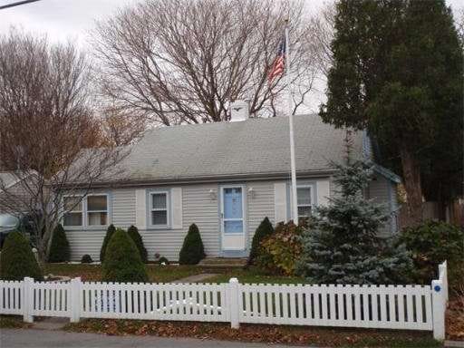
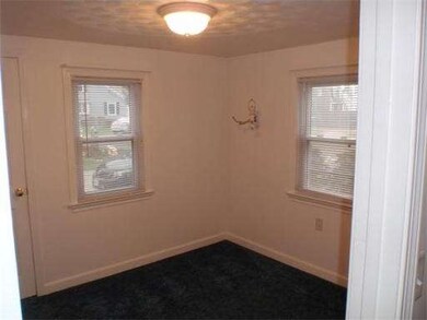
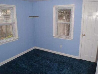
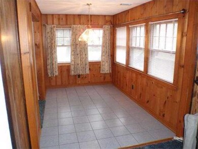
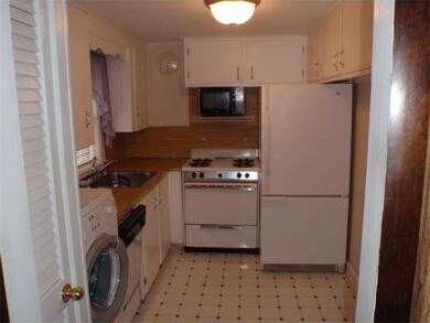
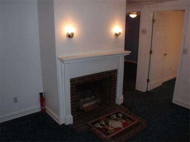
Priced to sell. Enjoy the pleasures of four season living near the shore. Excellent starter or downsized home. Well maintained neighborhood. Just moments to shopping ,restaurants , park and beach. Appreciate outdoor living features of a large deck,adjacent enclosed shower,private fenced back yard and a newer shed with electricity. Central air, gas heat, town water/ sewer and some newer windows. Refrigerator, washer, dryer stay. Very neat interior premises and exterior grounds. Don't miss out !
Last Agent to Sell the Property
Leo Liatsos
Molisse Realty Group, LLC License #455021466 Listed on: 11/27/2011
Last Buyer's Agent
Andrea McQuarrie
American Real Estate License #450001081
Home Type
Single Family
Est. Annual Taxes
$4,565
Year Built
1949
Lot Details
0
| Date | Buyer | Sale Price | Title Company |
|---|---|---|---|
| Manoli Robert F | $209,000 | -- |
| Date | Status | Borrower | Loan Amount |
|---|---|---|---|
| Previous Owner | Manoli Robert F | $50,000 | |
| Previous Owner | Manoli Robert F | $40,000 |
| Date | Event | Price | List to Sale | Price per Sq Ft |
|---|---|---|---|---|
| 01/24/2012 01/24/12 | Sold | $209,000 | -5.0% | $269 / Sq Ft |
| 01/07/2012 01/07/12 | Pending | -- | -- | -- |
| 11/27/2011 11/27/11 | For Sale | $219,900 | -- | $283 / Sq Ft |
| Year | Tax Paid | Tax Assessment Tax Assessment Total Assessment is a certain percentage of the fair market value that is determined by local assessors to be the total taxable value of land and additions on the property. | Land | Improvement |
|---|---|---|---|---|
| 2025 | $4,565 | $461,100 | $317,600 | $143,500 |
| 2024 | $4,429 | $426,300 | $297,800 | $128,500 |
| 2023 | $4,219 | $385,300 | $268,000 | $117,300 |
| 2022 | $4,219 | $325,800 | $228,300 | $97,500 |
| 2021 | $4,070 | $308,600 | $218,400 | $90,200 |
| 2020 | $3,694 | $277,100 | $188,600 | $88,500 |
| 2019 | $3,587 | $268,100 | $188,600 | $79,500 |
| 2018 | $3,552 | $265,700 | $188,600 | $77,100 |
| 2017 | $3,448 | $251,300 | $178,700 | $72,600 |
| 2016 | $3,259 | $234,800 | $168,700 | $66,100 |
| 2015 | $3,030 | $228,000 | $168,700 | $59,300 |
| 2014 | $2,997 | $225,500 | $168,700 | $56,800 |
L
Seller's Agent in 2012
Leo Liatsos
Molisse Realty Group, LLC
A
Buyer's Agent in 2012
Andrea McQuarrie
American Real Estate
Source: MLS Property Information Network (MLS PIN)
MLS Number: 71314407
APN: MARS-000008M-000023-000011
Disclaimer: Certain information contained herein is derived from information provided by parties other than Homes.com. All information provided is deemed reliable, but is not guaranteed to be accurate and should be independently verified.
![]() The property listing data and information, or the Images, set forth herein were provided to MLS Property Information Network, Inc. from third party sources, including sellers, lessors and public records, and were compiled by MLS Property Information Network, Inc. The property listing data and information, and the Images, are for the personal, non-commercial use of consumers having a good faith interest in purchasing or leasing listed properties of the type displayed to them and may not be used for any purpose other than to identify prospective properties which such consumers may have a good faith interest in purchasing or leasing. MLS Property Information Network, Inc. and its subscribers disclaim any and all representations and warranties as to the accuracy of the property listing data and information, or as to the accuracy of any of the Images, set forth herein.
The property listing data and information, or the Images, set forth herein were provided to MLS Property Information Network, Inc. from third party sources, including sellers, lessors and public records, and were compiled by MLS Property Information Network, Inc. The property listing data and information, and the Images, are for the personal, non-commercial use of consumers having a good faith interest in purchasing or leasing listed properties of the type displayed to them and may not be used for any purpose other than to identify prospective properties which such consumers may have a good faith interest in purchasing or leasing. MLS Property Information Network, Inc. and its subscribers disclaim any and all representations and warranties as to the accuracy of the property listing data and information, or as to the accuracy of any of the Images, set forth herein.