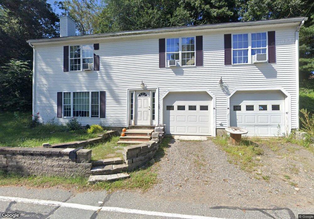
109 Burroughs Rd North Reading, MA 01864
Estimated Value: $575,000 - $1,231,000
2
Beds
1
Bath
9,999
Sq Ft
$75/Sq Ft
Est. Value
About This Home
This home is located at 109 Burroughs Rd, North Reading, MA 01864 and is currently estimated at $745,590, approximately $74 per square foot. 109 Burroughs Rd is a home located in Middlesex County with nearby schools including J Turner Hood, North Reading Middle School, and North Reading High School.
Ownership History
Date
Name
Owned For
Owner Type
Purchase Details
Closed on
Jul 3, 2003
Sold by
Roberts Darrin C
Bought by
Gallagher Theresa A and Gallagher William J
Current Estimated Value
Home Financials for this Owner
Home Financials are based on the most recent Mortgage that was taken out on this home.
Original Mortgage
$165,600
Outstanding Balance
$71,465
Interest Rate
5.46%
Mortgage Type
Purchase Money Mortgage
Estimated Equity
$674,125
Purchase Details
Closed on
Jul 11, 1996
Sold by
Bennett Lois E
Bought by
Roberts Darrin C
Home Financials for this Owner
Home Financials are based on the most recent Mortgage that was taken out on this home.
Original Mortgage
$67,500
Interest Rate
7.98%
Mortgage Type
Purchase Money Mortgage
Create a Home Valuation Report for This Property
The Home Valuation Report is an in-depth analysis detailing your home's value as well as a comparison with similar homes in the area
Home Values in the Area
Average Home Value in this Area
Purchase History
| Date | Buyer | Sale Price | Title Company |
|---|---|---|---|
| Gallagher Theresa A | $184,000 | -- | |
| Roberts Darrin C | $75,000 | -- |
Source: Public Records
Mortgage History
| Date | Status | Borrower | Loan Amount |
|---|---|---|---|
| Open | Gallagher Theresa A | $165,600 | |
| Previous Owner | Roberts Darrin C | $9,000 | |
| Previous Owner | Roberts Darrin C | $67,500 |
Source: Public Records
Tax History
| Year | Tax Paid | Tax Assessment Tax Assessment Total Assessment is a certain percentage of the fair market value that is determined by local assessors to be the total taxable value of land and additions on the property. | Land | Improvement |
|---|---|---|---|---|
| 2025 | $6,717 | $514,300 | $306,600 | $207,700 |
| 2024 | $6,425 | $486,400 | $297,600 | $188,800 |
| 2023 | $6,704 | $479,200 | $297,600 | $181,600 |
| 2022 | $6,501 | $433,400 | $270,700 | $162,700 |
| 2021 | $12,706 | $404,600 | $251,400 | $153,200 |
Source: Public Records
Map
Nearby Homes
- 12 Parkview Terrace
- 3 Pinecrest Rd
- 11 Cogswell Rd
- 250 Martins Landing Unit 402
- 300 Martins Landing Unit 505
- 280 Martins Landing Unit 312
- 260 Martins Landing Unit 508
- 230 Martins Landing Unit 209
- 200 Martins Landing Unit 102
- 220 Martins Landing Unit 411
- 220 Martins Landing Unit 410
- 220 Martins Landing Unit 309
- 320 Martins Landing Unit 401
- 320 Martins Landing Unit 310
- 320 Martins Landing Unit 211
- 320 Martins Landing Unit 2410
- 320 Martins Landing Unit 502
- 320 Martins Landing Unit 107
- 320 Martins Landing Unit 404
- 320 Martins Landing Unit 501
- 5 Old Andover Rd
- 105 Burroughs Rd
- 2 Fieldcrest Terrace
- 6 Viewcrest Rd
- 7 Old Andover Rd
- 2 Old Andover Rd
- 16 Evergreen Rd
- 4 Fieldcrest Terrace
- 9 Hawthorne Terrace
- 5 Viewcrest Rd
- 6 Old Andover Rd
- 15 Old Andover Rd
- 93 Burroughs Rd
- 12 Bellflower Rd
- 6 Bellflower Rd
- 9 Viewcrest Rd
- 11 Fieldcrest Terrace
- 12 Old Andover Rd
- 20 Evergreen Rd
- 17 Old Andover Rd
Your Personal Tour Guide
Ask me questions while you tour the home.