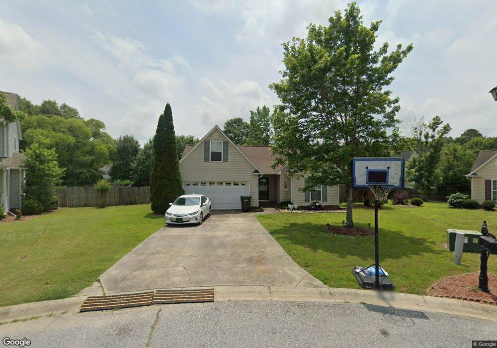
109 Canvasback Ct Easley, SC 29642
Estimated Value: $248,408 - $317,000
3
Beds
2
Baths
1,335
Sq Ft
$209/Sq Ft
Est. Value
About This Home
This home is located at 109 Canvasback Ct, Easley, SC 29642 and is currently estimated at $279,102, approximately $209 per square foot. 109 Canvasback Ct is a home located in Pickens County with nearby schools including Forest Acres Elementary School, Richard H. Gettys Middle School, and Easley High School.
Ownership History
Date
Name
Owned For
Owner Type
Purchase Details
Closed on
Aug 27, 2007
Sold by
Brown Sandra and Sitton Sandra
Bought by
Albutti Faisal
Current Estimated Value
Home Financials for this Owner
Home Financials are based on the most recent Mortgage that was taken out on this home.
Original Mortgage
$141,775
Outstanding Balance
$88,053
Interest Rate
6.65%
Estimated Equity
$191,049
Purchase Details
Closed on
Aug 10, 2005
Sold by
Fisher Nada Joye
Bought by
Brown Sandra S
Home Financials for this Owner
Home Financials are based on the most recent Mortgage that was taken out on this home.
Original Mortgage
$69,000
Interest Rate
5.48%
Mortgage Type
New Conventional
Create a Home Valuation Report for This Property
The Home Valuation Report is an in-depth analysis detailing your home's value as well as a comparison with similar homes in the area
Home Values in the Area
Average Home Value in this Area
Purchase History
| Date | Buyer | Sale Price | Title Company |
|---|---|---|---|
| Albutti Faisal | $144,000 | None Available | |
| Brown Sandra S | $123,000 | None Available |
Source: Public Records
Mortgage History
| Date | Status | Borrower | Loan Amount |
|---|---|---|---|
| Open | Albutti Faisal | $141,775 | |
| Previous Owner | Brown Sandra S | $69,000 |
Source: Public Records
Tax History
| Year | Tax Paid | Tax Assessment Tax Assessment Total Assessment is a certain percentage of the fair market value that is determined by local assessors to be the total taxable value of land and additions on the property. | Land | Improvement |
|---|---|---|---|---|
| 2025 | $2,739 | $10,850 | $1,870 | $8,980 |
| 2024 | $2,739 | $9,440 | $1,260 | $8,180 |
| 2023 | $2,476 | $9,440 | $1,260 | $8,180 |
| 2022 | $2,400 | $9,440 | $1,260 | $8,180 |
| 2021 | $2,382 | $9,440 | $1,260 | $8,180 |
| 2020 | $2,322 | $6,292 | $840 | $5,452 |
| 2019 | $2,317 | $9,440 | $1,260 | $8,180 |
| 2018 | $743 | $5,880 | $840 | $5,040 |
| 2017 | $690 | $5,880 | $840 | $5,040 |
| 2015 | $735 | $5,880 | $0 | $0 |
| 2008 | -- | $5,760 | $800 | $4,960 |
Source: Public Records
Map
Nearby Homes
- 116 Tortuga Ln
- 411 W Sundance Dr
- 521 Brighton Cir
- 104 W Sundance Dr
- 100 W Sundance Dr
- 102 Lockmere Ct
- 303 Hartley Ct
- 103 Wagner Ct
- 317 Hartley Ct
- 324 Crestgate Way
- 103 Malvern Hill
- 1703 Crestview Rd
- 0 Red Berry Ln
- 0 Red Berry Ln Unit Tract E
- 0 Red Berry Ln Unit Tract G
- 104 Forest Park Dr
- 114 Raven Ln
- 108 Raven Ln
- 110 Raven Ln
- 104 Raven Ln
- 105 Canvasback Ct
- 112 Canvasback Ct
- 304 Wild Wing Way
- 109 Wild Wing Ct
- 308 Wild Wing Way
- 105 Wild Wing Ct
- 225 Canvasback Way
- 221 Canvasback Way
- 113 Wild Wing Ct
- 229 Canvasback Way
- 108 Canvasback Ct
- 217 Canvasback Way
- 312 Wild Wing Way
- 104 Canvasback Ct
- 213 Canvasback Way
- 100 Canvasback Ct
- 305 Wild Wing Way
- 108 Wild Wing Ct
- 228 Canvasback Way
- 224 Canvasback Way
Your Personal Tour Guide
Ask me questions while you tour the home.