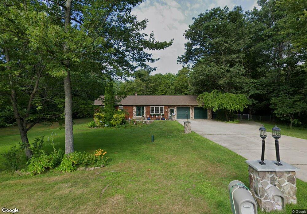
109 Cotton Rd Lewiston, ME 04240
Estimated Value: $452,897 - $498,000
4
Beds
2
Baths
1,992
Sq Ft
$238/Sq Ft
Est. Value
About This Home
This home is located at 109 Cotton Rd, Lewiston, ME 04240 and is currently estimated at $473,224, approximately $237 per square foot. 109 Cotton Rd is a home located in Androscoggin County with nearby schools including Lewiston Middle School, Lewiston High School, and Acadia Academy School.
Ownership History
Date
Name
Owned For
Owner Type
Purchase Details
Closed on
Sep 11, 2007
Sold by
Geoffroy James R and Geoffroy Brenda L
Bought by
Langlais Rachel I
Current Estimated Value
Home Financials for this Owner
Home Financials are based on the most recent Mortgage that was taken out on this home.
Original Mortgage
$176,000
Outstanding Balance
$112,398
Interest Rate
6.74%
Mortgage Type
Unknown
Estimated Equity
$360,826
Create a Home Valuation Report for This Property
The Home Valuation Report is an in-depth analysis detailing your home's value as well as a comparison with similar homes in the area
Home Values in the Area
Average Home Value in this Area
Purchase History
| Date | Buyer | Sale Price | Title Company |
|---|---|---|---|
| Langlais Rachel I | -- | -- |
Source: Public Records
Mortgage History
| Date | Status | Borrower | Loan Amount |
|---|---|---|---|
| Open | Langlais Rachel I | $118,000 | |
| Open | Langlais Rachel I | $176,000 | |
| Closed | Langlais Rachel I | $44,000 |
Source: Public Records
Tax History Compared to Growth
Tax History
| Year | Tax Paid | Tax Assessment Tax Assessment Total Assessment is a certain percentage of the fair market value that is determined by local assessors to be the total taxable value of land and additions on the property. | Land | Improvement |
|---|---|---|---|---|
| 2024 | $5,988 | $188,480 | $36,600 | $151,880 |
| 2023 | $5,654 | $188,480 | $36,600 | $151,880 |
| 2022 | $5,372 | $188,480 | $36,600 | $151,880 |
| 2021 | $5,326 | $188,480 | $36,600 | $151,880 |
| 2020 | $5,404 | $188,480 | $36,600 | $151,880 |
| 2019 | $5,449 | $188,480 | $36,600 | $151,880 |
| 2018 | $5,404 | $188,480 | $36,600 | $151,880 |
| 2017 | $5,281 | $188,480 | $36,600 | $151,880 |
| 2016 | $5,191 | $188,480 | $36,600 | $151,880 |
| 2015 | $5,159 | $188,480 | $36,600 | $151,880 |
| 2014 | $4,847 | $182,280 | $36,600 | $145,680 |
| 2013 | $4,819 | $182,280 | $36,600 | $145,680 |
Source: Public Records
Map
Nearby Homes
- 232 Dyer Rd
- 197 Dyer Rd
- 6 Macintosh Ln
- 556 River Rd
- 113 Dyer Rd
- 11 Pinewoods Rd
- 8 Hatch Rd
- 2161 Lisbon Rd Unit 27
- 20 Arrowhead Dr
- 26 Stanley Dr
- 5 Trent Dr
- 0 Riverside Dr
- 059-007 Soper's Mill Rd
- 1944 S Lisbon Rd
- 65 Wood St
- 69 Lisbon Street Lots F & G
- 48 Fairview Dr
- 33 Fairview Dr
- 44 Fairview Dr
- 20 Town And Country Dr