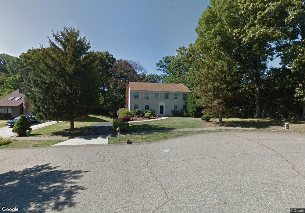
109 Cranston Dr Coraopolis, PA 15108
Estimated Value: $437,000 - $467,000
4
Beds
4
Baths
2,296
Sq Ft
$195/Sq Ft
Est. Value
About This Home
This home is located at 109 Cranston Dr, Coraopolis, PA 15108 and is currently estimated at $447,289, approximately $194 per square foot. 109 Cranston Dr is a home located in Allegheny County with nearby schools including Moon Area High School, Rhema Christian School, and Montessori Children's Community.
Ownership History
Date
Name
Owned For
Owner Type
Purchase Details
Closed on
Aug 23, 2013
Sold by
Ricketts Dennis J
Bought by
Mckay Kevin
Current Estimated Value
Home Financials for this Owner
Home Financials are based on the most recent Mortgage that was taken out on this home.
Original Mortgage
$244,649
Outstanding Balance
$179,449
Interest Rate
4.51%
Mortgage Type
VA
Estimated Equity
$267,840
Purchase Details
Closed on
Jun 20, 1989
Bought by
Ricketts Dennis J and Ricketts Debra A
Create a Home Valuation Report for This Property
The Home Valuation Report is an in-depth analysis detailing your home's value as well as a comparison with similar homes in the area
Home Values in the Area
Average Home Value in this Area
Purchase History
| Date | Buyer | Sale Price | Title Company |
|---|---|---|---|
| Mckay Kevin | $239,500 | -- | |
| Ricketts Dennis J | $143,500 | -- |
Source: Public Records
Mortgage History
| Date | Status | Borrower | Loan Amount |
|---|---|---|---|
| Open | Mckay Kevin | $244,649 |
Source: Public Records
Tax History
| Year | Tax Paid | Tax Assessment Tax Assessment Total Assessment is a certain percentage of the fair market value that is determined by local assessors to be the total taxable value of land and additions on the property. | Land | Improvement |
|---|---|---|---|---|
| 2025 | $6,157 | $197,000 | $45,100 | $151,900 |
| 2024 | $6,157 | $197,000 | $45,100 | $151,900 |
| 2023 | $5,938 | $197,000 | $45,100 | $151,900 |
| 2022 | $5,938 | $197,000 | $45,100 | $151,900 |
| 2021 | $6,236 | $197,000 | $45,100 | $151,900 |
| 2020 | $5,790 | $197,000 | $45,100 | $151,900 |
| 2019 | $5,632 | $197,000 | $45,100 | $151,900 |
| 2018 | $932 | $197,000 | $45,100 | $151,900 |
| 2017 | $5,324 | $197,000 | $45,100 | $151,900 |
| 2016 | $932 | $197,000 | $45,100 | $151,900 |
| 2015 | $932 | $215,000 | $45,100 | $169,900 |
| 2014 | $5,659 | $215,000 | $45,100 | $169,900 |
Source: Public Records
Map
Nearby Homes
- 623 Parliament Dr
- 1705 Hassam Rd
- 1751 Hassam Rd
- 203 Nottingham Dr
- 0 Spring Run Rd Unit 1735945
- 300 Corner Thorn Run Ext Commerce Dr
- 2120 Pococen Dr
- 138 Hunters Run Dr
- 372 Indian Ridge Dr
- 2204 Greystone Dr
- 221 Felician Dr
- 1089 Main St
- 469 Mccormick Rd
- 1900 Beechford Ave
- 213 Oak Highland Dr
- 1229 Mccabe Ave
- 923 Locust St
- 1523 Woodcrest Ave
- 700 Hiland Ave
- 1894 Oakbine Ave
- 107 Cranston Dr
- 111 Cranston Dr
- 105 Cranston Dr
- 104 Cranston Dr
- 108 Cranston Dr
- 103 Cranston Dr
- 110 Cranston Dr
- 106 Cranston Dr
- 102 Cranston Dr
- 700 Parliament Dr
- 622 Parliament Dr
- 624 Parliament Dr
- 620 Parliament Dr
- 1023 622 Parliament Dr
- 125 Pine Acres Ln
- 618 Parliament Dr
- 702 W Parliament Dr
- 616 Parliament Dr
- 627 Parliament Dr
- 701 Parliament Dr
Your Personal Tour Guide
Ask me questions while you tour the home.