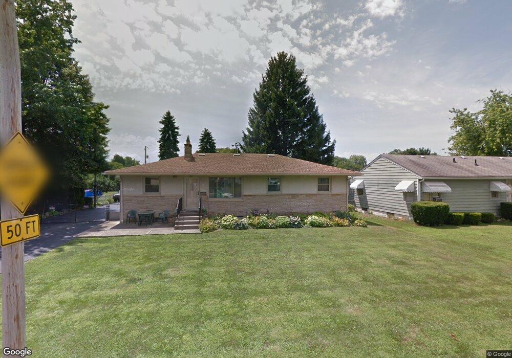
109 Cullman Rd Columbus, OH 43207
Obetz-Lockbourne NeighborhoodEstimated Value: $210,986 - $248,000
3
Beds
2
Baths
1,400
Sq Ft
$161/Sq Ft
Est. Value
About This Home
This home is located at 109 Cullman Rd, Columbus, OH 43207 and is currently estimated at $225,747, approximately $161 per square foot. 109 Cullman Rd is a home located in Franklin County with nearby schools including Parsons Elementary School, Buckeye Middle School, and Marion-Franklin High School.
Ownership History
Date
Name
Owned For
Owner Type
Purchase Details
Closed on
Jun 27, 2006
Sold by
Bowen Mary and Bowen Bryan E
Bought by
Bowen Bryan E and Bowen Mary
Current Estimated Value
Purchase Details
Closed on
Apr 14, 1994
Create a Home Valuation Report for This Property
The Home Valuation Report is an in-depth analysis detailing your home's value as well as a comparison with similar homes in the area
Home Values in the Area
Average Home Value in this Area
Purchase History
| Date | Buyer | Sale Price | Title Company |
|---|---|---|---|
| Bowen Bryan E | -- | None Available | |
| -- | -- | -- |
Source: Public Records
Tax History
| Year | Tax Paid | Tax Assessment Tax Assessment Total Assessment is a certain percentage of the fair market value that is determined by local assessors to be the total taxable value of land and additions on the property. | Land | Improvement |
|---|---|---|---|---|
| 2025 | $2,567 | $66,990 | $18,690 | $48,300 |
| 2024 | $2,567 | $66,990 | $18,690 | $48,300 |
| 2023 | $2,562 | $66,990 | $18,690 | $48,300 |
| 2022 | $1,763 | $42,740 | $13,900 | $28,840 |
| 2021 | $1,766 | $42,740 | $13,900 | $28,840 |
| 2020 | $1,768 | $42,740 | $13,900 | $28,840 |
| 2019 | $2,262 | $37,280 | $12,110 | $25,170 |
| 2018 | $2,055 | $37,280 | $12,110 | $25,170 |
| 2017 | $2,151 | $37,280 | $12,110 | $25,170 |
| 2016 | $2,041 | $30,810 | $7,670 | $23,140 |
| 2015 | $1,853 | $30,810 | $7,670 | $23,140 |
| 2014 | $1,857 | $30,810 | $7,670 | $23,140 |
| 2013 | $965 | $32,445 | $8,085 | $24,360 |
Source: Public Records
Map
Nearby Homes
- 212 E Alcott Rd
- 19 E Castle Rd
- 211 Delaney Dr
- 84 Betz Rd
- 272 Southard Dr
- 228 Currier Dr
- 162 Phelps Rd
- 2501 S 6th St
- 3127 Parsons Ave
- 253 Benfield Ave
- 3204 Lee Ellen Place
- 460 Coulter Ave
- 2382 S 6th St
- 1633-1635 E Greenway Ave
- 83 Rumsey Rd
- 3458 S 8th St
- 611 Lock Ave
- 3251 Hilock Ct
- 245 Marilla Rd
- 780 Basswood Rd
Your Personal Tour Guide
Ask me questions while you tour the home.