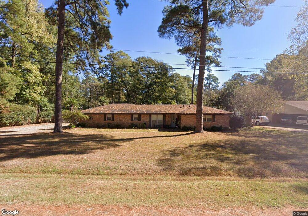
109 Don Dee St West Monroe, LA 71291
Claiborne NeighborhoodEstimated Value: $215,000 - $238,000
3
Beds
2
Baths
1,689
Sq Ft
$134/Sq Ft
Est. Value
About This Home
This home is located at 109 Don Dee St, West Monroe, LA 71291 and is currently estimated at $226,828, approximately $134 per square foot. 109 Don Dee St is a home located in Ouachita Parish with nearby schools including Claiborne School, West Ridge Middle School, and West Monroe High School.
Ownership History
Date
Name
Owned For
Owner Type
Purchase Details
Closed on
Aug 11, 2017
Sold by
Thomas Mark and Thomas Brandi
Bought by
Thomas Mark and Thomas Brandi
Current Estimated Value
Purchase Details
Closed on
Feb 14, 2007
Sold by
Logan Donald Edward and Logan Penny Wade
Bought by
Thomas Mark Bradly and Taylor Bradi Sharee
Home Financials for this Owner
Home Financials are based on the most recent Mortgage that was taken out on this home.
Original Mortgage
$153,000
Interest Rate
6.13%
Mortgage Type
New Conventional
Create a Home Valuation Report for This Property
The Home Valuation Report is an in-depth analysis detailing your home's value as well as a comparison with similar homes in the area
Home Values in the Area
Average Home Value in this Area
Purchase History
| Date | Buyer | Sale Price | Title Company |
|---|---|---|---|
| Thomas Mark | -- | None Available | |
| Thomas Mark Bradly | $153,000 | None Available |
Source: Public Records
Mortgage History
| Date | Status | Borrower | Loan Amount |
|---|---|---|---|
| Previous Owner | Thomas Mark Bradly | $153,000 |
Source: Public Records
Tax History Compared to Growth
Tax History
| Year | Tax Paid | Tax Assessment Tax Assessment Total Assessment is a certain percentage of the fair market value that is determined by local assessors to be the total taxable value of land and additions on the property. | Land | Improvement |
|---|---|---|---|---|
| 2024 | $1,113 | $18,691 | $2,950 | $15,741 |
| 2023 | $1,113 | $17,724 | $2,950 | $14,774 |
| 2022 | $1,609 | $17,299 | $2,950 | $14,349 |
| 2021 | $1,586 | $17,192 | $2,950 | $14,242 |
| 2020 | $1,600 | $17,282 | $2,950 | $14,332 |
| 2019 | $1,600 | $17,282 | $2,950 | $14,332 |
| 2018 | $918 | $17,282 | $2,950 | $14,332 |
| 2017 | $1,412 | $15,300 | $2,448 | $12,852 |
| 2016 | $1,401 | $15,300 | $2,448 | $12,852 |
| 2015 | $728 | $15,300 | $2,448 | $12,852 |
| 2014 | $728 | $15,300 | $2,448 | $12,852 |
| 2013 | $736 | $15,300 | $2,448 | $12,852 |
Source: Public Records
Map
Nearby Homes
- 439 Laird St
- 429 Laird St
- 101 Contrail Dr
- 115 Thompson Rd Unit 1.09+-acres
- 123 Belle Vue Dr
- 108 Belle Vue Dr
- 2004 Carter St
- 106 Belle Vue Dr
- 112 Willow Branch Dr
- 182 Lost Landing Rd
- 0 Highway 80 Unit 213443
- 116 Sadie Ln
- 320 Hilbert Dr
- 101 Piney Cove
- 114 Fairlane Dr
- 4450 Cypress St
- 2300 Rainbow Dr
- 104 Delane Dr
- 106 Butler Ave
- 107 Searcy Ln