Estimated Value: $171,000 - $206,000
3
Beds
2
Baths
3,286
Sq Ft
$58/Sq Ft
Est. Value
About This Home
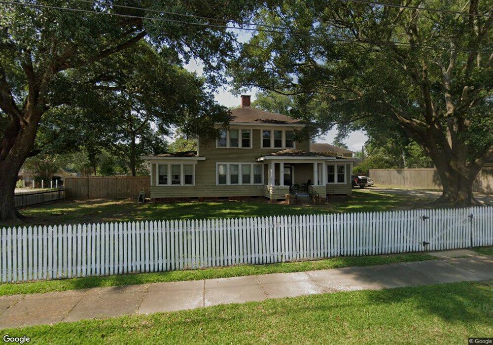
This home is located at 109 E Hudspeth St, Welsh, LA 70591 and is currently estimated at $189,051, approximately $57 per square foot. 109 E Hudspeth St is a home located in Jefferson Davis Parish with nearby schools including Welsh Elementary School, Welsh-Roanoke Junior High School, and Welsh High School.
Ownership History
Date
Name
Owned For
Owner Type
Purchase Details
Closed on
Sep 2, 2014
Sold by
Richard Kyle Cannon Trust
Bought by
Moore Richard G and Moore Donna C
Current Estimated Value
Home Financials for this Owner
Home Financials are based on the most recent Mortgage that was taken out on this home.
Original Mortgage
$85,000
Outstanding Balance
$63,984
Interest Rate
4.16%
Mortgage Type
New Conventional
Estimated Equity
$125,067
Purchase Details
Closed on
Sep 25, 2012
Sold by
Trahan Robbie D and Trahan Teresa G
Bought by
Midwest Management and Us Bank Na
Purchase Details
Closed on
Jul 25, 2012
Sold by
Trahan Robbie D and Trahan Teresa G
Bought by
Co Midwest Management and Ak Us Bank
Create a Home Valuation Report for This Property
The Home Valuation Report is an in-depth analysis detailing your home's value as well as a comparison with similar homes in the area
Home Values in the Area
Average Home Value in this Area
Purchase History
| Date | Buyer | Sale Price | Title Company |
|---|---|---|---|
| Moore Richard G | $107,000 | -- | |
| Midwest Management | $821 | None Available | |
| Co Midwest Management | $684 | None Available |
Source: Public Records
Mortgage History
| Date | Status | Borrower | Loan Amount |
|---|---|---|---|
| Open | Moore Richard G | $85,000 |
Source: Public Records
Tax History
| Year | Tax Paid | Tax Assessment Tax Assessment Total Assessment is a certain percentage of the fair market value that is determined by local assessors to be the total taxable value of land and additions on the property. | Land | Improvement |
|---|---|---|---|---|
| 2025 | $1,300 | $15,200 | $1,400 | $13,800 |
| 2023 | $1,002 | $13,400 | $1,400 | $12,000 |
| 2022 | $492 | $13,400 | $1,400 | $12,000 |
| 2021 | $1,002 | $13,400 | $1,400 | $12,000 |
| 2020 | $1,001 | $13,400 | $1,400 | $12,000 |
| 2019 | $990 | $13,000 | $1,200 | $11,800 |
| 2018 | $1,135 | $13,000 | $1,200 | $11,800 |
| 2017 | $1,136 | $13,000 | $1,200 | $11,800 |
| 2015 | $1,035 | $11,900 | $1,200 | $10,700 |
| 2014 | $1,037 | $11,900 | $1,200 | $10,700 |
| 2013 | $1,060 | $11,900 | $1,200 | $10,700 |
Source: Public Records
Map
Nearby Homes
- 207 Powers St
- 501 S Polk St
- 406 W Hudspeth St
- 17188 Highway 90 Unit Suite B
- 17180 Highway 90
- 0 Highway 90
- 507 Beaufort St
- 619 S Sarah St
- 409 Pine St
- 0 Dautel St Unit SWL25101889
- 560 Bowers St
- 311 Bourgeois St
- 0 Grove St Unit SWL25002212
- 0 Grove St Unit SWL25002213
- 0 Grove St Unit SWL25002211
- 0 Grove St Unit SWL25002210
- 303 Elizabeth St
- 0 S Simmons St Unit SWL25002203
- 0 S Simmons St Unit SWL25002209
- 0 S Simmons St Unit SWL25002206
- 311 Crowley St
- 201 E Hudspeth St
- 107 E Hudspeth St
- 207 Crowley St
- 0 99 Hwy Unit 185284
- 0 99 Hwy Unit 185285
- 0 99 Hwy Unit 166706
- 0 99 Hwy Unit tbd 167706
- 202 E Nichols St
- tbd Louisiana 99
- 0 Louisiana 99
- 109 E South St
- 207 Crowley St
- 105 E South St
- 210 E Nichols St
- 202 S Adams St
- 210 E Hudspeth St
- 104 W Nichols St
- 203 E Nichols St
- 207 E Nichols St
Your Personal Tour Guide
Ask me questions while you tour the home.