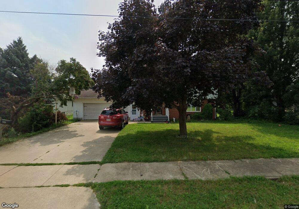
109 E Logan St New Hampton, IA 50659
Estimated Value: $204,000 - $266,000
4
Beds
3
Baths
1,617
Sq Ft
$149/Sq Ft
Est. Value
About This Home
This home is located at 109 E Logan St, New Hampton, IA 50659 and is currently estimated at $241,346, approximately $149 per square foot. 109 E Logan St is a home located in Chickasaw County with nearby schools including New Hampton Elementary School, New Hampton Middle School, and New Hampton High School.
Ownership History
Date
Name
Owned For
Owner Type
Purchase Details
Closed on
Jun 12, 2020
Sold by
Epperly John R and Epperly Chasity S
Bought by
Scott Richard and Scott Stephanie
Current Estimated Value
Home Financials for this Owner
Home Financials are based on the most recent Mortgage that was taken out on this home.
Original Mortgage
$154,156
Outstanding Balance
$135,162
Interest Rate
3.1%
Mortgage Type
FHA
Estimated Equity
$106,184
Create a Home Valuation Report for This Property
The Home Valuation Report is an in-depth analysis detailing your home's value as well as a comparison with similar homes in the area
Home Values in the Area
Average Home Value in this Area
Purchase History
| Date | Buyer | Sale Price | Title Company |
|---|---|---|---|
| Scott Richard | $157,000 | None Available |
Source: Public Records
Mortgage History
| Date | Status | Borrower | Loan Amount |
|---|---|---|---|
| Open | Scott Richard | $154,156 |
Source: Public Records
Tax History
| Year | Tax Paid | Tax Assessment Tax Assessment Total Assessment is a certain percentage of the fair market value that is determined by local assessors to be the total taxable value of land and additions on the property. | Land | Improvement |
|---|---|---|---|---|
| 2025 | $3,148 | $226,200 | $31,200 | $195,000 |
| 2024 | $3,148 | $209,500 | $31,200 | $178,300 |
| 2023 | $3,024 | $209,500 | $31,200 | $178,300 |
| 2022 | $2,370 | $154,300 | $20,800 | $133,500 |
| 2021 | $2,370 | $154,300 | $20,800 | $133,500 |
| 2020 | $1,860 | $112,600 | $20,800 | $91,800 |
| 2019 | $1,830 | $107,300 | $0 | $0 |
| 2018 | $1,830 | $107,300 | $0 | $0 |
| 2017 | $1,776 | $106,800 | $0 | $0 |
| 2016 | $1,796 | $106,800 | $0 | $0 |
| 2015 | $1,650 | $106,800 | $0 | $0 |
| 2014 | $1,636 | $105,000 | $0 | $0 |
Source: Public Records
Map
Nearby Homes
- 103 E Logan St
- 506 S Linn Ave
- 236 S Chestnut Ave
- 520 S 1st Ave Unit 104
- 122 S Walnut Ave
- 2 E Main St
- 105 2nd Ave
- 332 Fleur Dr
- 422 S 5th Ave
- 306 E Prospect St
- 520 W Wilson St
- 423 W Spring St
- 115 N Linn Ave
- 712 E Main St
- 215 N Chestnut Ave
- 318 S Western Ave
- 228 N Pleasant Hill Ave
- 505 W Prospect St
- 515 N Hartwell Ave
- 2057 Newell Ave
- 414 S Locust Ave
- 201 E Logan St
- 416 S Locust Ave
- 335 S Water Ave
- 17 E Logan St
- 418 S Locust Ave
- 407 S Locust Ave
- 336 S Locust Ave
- 342 S Water Ave
- 343 S Locust Ave
- 207 E Logan St
- 411 S Locust Ave
- 339 S Locust Ave
- 428 S Locust Ave
- 336 S Water Ave
- 325 S Water Ave
- 421 S Locust Ave
- 11 E Logan St
- 330 S Locust Ave
- 333 S Locust Ave
Your Personal Tour Guide
Ask me questions while you tour the home.