Estimated Value: $85,375 - $111,000
Studio
1
Bath
1,020
Sq Ft
$101/Sq Ft
Est. Value
About This Home
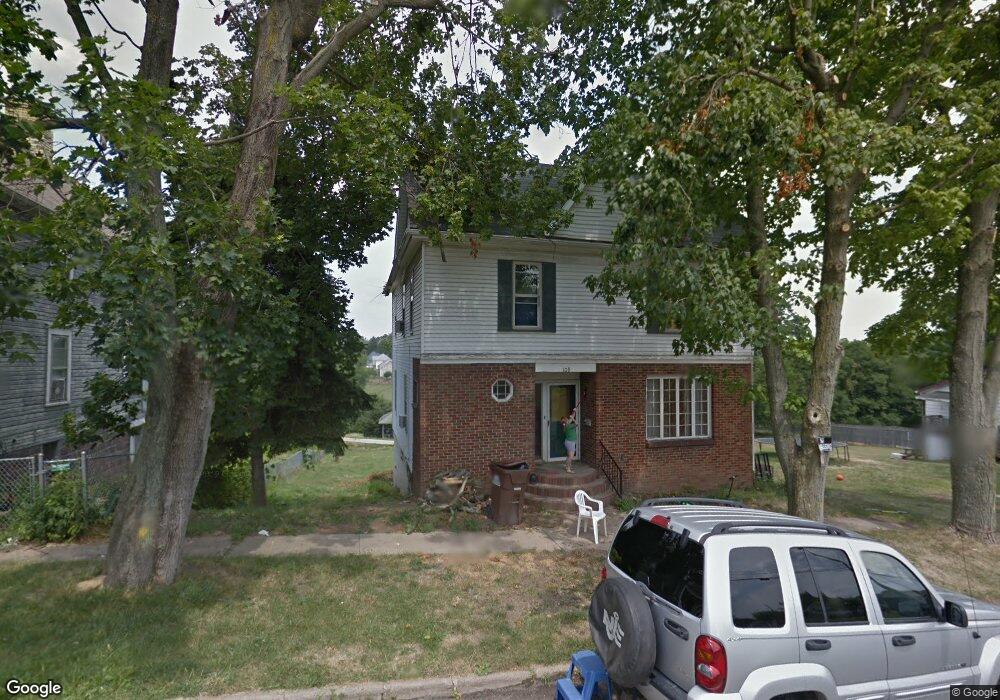
This home is located at 109 E North St, Cadiz, OH 43907 and is currently estimated at $103,344, approximately $101 per square foot. 109 E North St is a home located in Harrison County with nearby schools including Harrison Central Elementary School and Harrison Central Junior/Senior High School.
Ownership History
Date
Name
Owned For
Owner Type
Purchase Details
Closed on
Mar 24, 2008
Sold by
Habc Bank Usa Na
Bought by
Griffin Kristie
Current Estimated Value
Home Financials for this Owner
Home Financials are based on the most recent Mortgage that was taken out on this home.
Original Mortgage
$21,000
Interest Rate
5.93%
Mortgage Type
New Conventional
Purchase Details
Closed on
Aug 28, 2002
Purchase Details
Closed on
Jun 20, 1994
Purchase Details
Closed on
Nov 5, 1993
Purchase Details
Closed on
Sep 7, 1988
Create a Home Valuation Report for This Property
The Home Valuation Report is an in-depth analysis detailing your home's value as well as a comparison with similar homes in the area
Home Values in the Area
Average Home Value in this Area
Purchase History
| Date | Buyer | Sale Price | Title Company |
|---|---|---|---|
| Griffin Kristie | -- | None Available | |
| Hsbc Bank Usa Na | -- | None Available | |
| -- | $60,000 | -- | |
| -- | -- | -- | |
| -- | $32,000 | -- | |
| -- | -- | -- | |
| -- | -- | -- |
Source: Public Records
Mortgage History
| Date | Status | Borrower | Loan Amount |
|---|---|---|---|
| Previous Owner | Hsbc Bank Usa Na | $21,000 |
Source: Public Records
Tax History
| Year | Tax Paid | Tax Assessment Tax Assessment Total Assessment is a certain percentage of the fair market value that is determined by local assessors to be the total taxable value of land and additions on the property. | Land | Improvement |
|---|---|---|---|---|
| 2025 | $873 | $21,950 | $4,620 | $17,330 |
| 2024 | $873 | $21,950 | $4,620 | $17,330 |
| 2023 | $872 | $21,950 | $4,620 | $17,330 |
| 2022 | $718 | $17,270 | $2,070 | $15,200 |
| 2021 | $694 | $17,270 | $2,070 | $15,200 |
| 2020 | $691 | $17,270 | $2,070 | $15,200 |
| 2019 | $592 | $14,630 | $1,750 | $12,880 |
| 2018 | $592 | $14,630 | $1,750 | $12,880 |
| 2017 | $611 | $14,630 | $1,750 | $12,880 |
| 2016 | $623 | $14,190 | $1,540 | $12,650 |
| 2015 | $623 | $14,190 | $1,540 | $12,650 |
| 2014 | $506 | $13,690 | $1,400 | $12,290 |
| 2013 | $506 | $13,690 | $1,400 | $12,290 |
Source: Public Records
Map
Nearby Homes
- 151 S Buffalo St
- 593 Dewey Ave
- 333 Saint Clair Ave
- 413 Oakwood Dr
- 545 E Market St
- 419 Saint Clair Ave
- 158 Martin Ave
- 44208 Meadowlark Ln
- 0 E Market St
- 83478 Monzula Dr
- 0 Monzula Dr
- 44501 Hanover Ridge Rd
- 39000 Lees Run Rd
- 77900 Slater Rd
- 85200 Merryman Rd
- 200 Cross St
- 324 Central St
- 103 Lake St
- Brough Rd
- 90850 Jewett Germano Rd
Your Personal Tour Guide
Ask me questions while you tour the home.