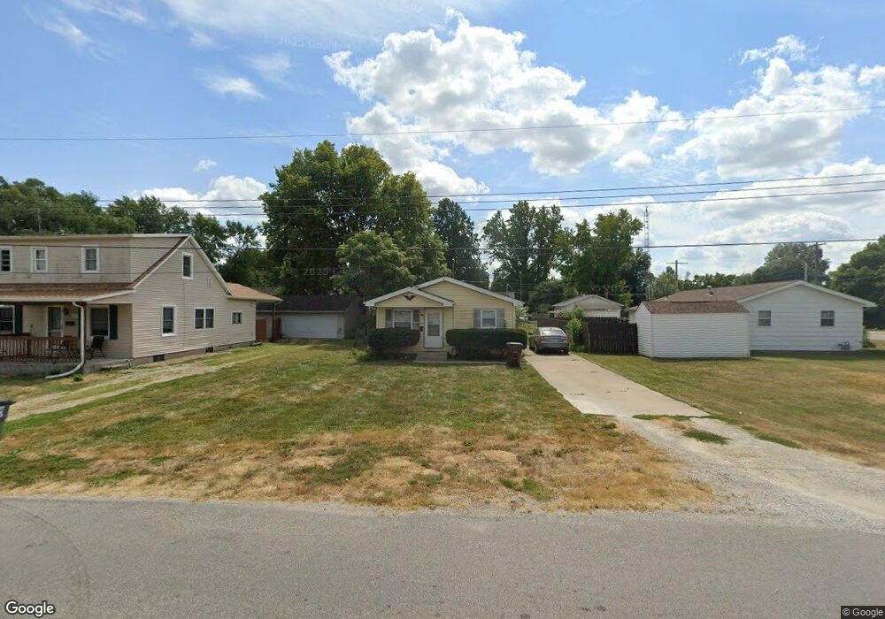
109 E Washington St Unit 1 Auburn, IL 62615
Estimated Value: $78,000 - $171,000
Studio
--
Bath
--
Sq Ft
7,187
Sq Ft Lot
About This Home
This home is located at 109 E Washington St Unit 1, Auburn, IL 62615 and is currently estimated at $128,333. 109 E Washington St Unit 1 is a home located in Sangamon County with nearby schools including Auburn Elementary School, Auburn Middle School, and Auburn Junior High School.
Ownership History
Date
Name
Owned For
Owner Type
Purchase Details
Closed on
May 20, 2024
Sold by
Central Il Realty Company
Bought by
Rbs Invs Inc
Current Estimated Value
Home Financials for this Owner
Home Financials are based on the most recent Mortgage that was taken out on this home.
Original Mortgage
$686,541
Outstanding Balance
$398,774
Interest Rate
6.88%
Mortgage Type
New Conventional
Estimated Equity
-$270,441
Purchase Details
Closed on
Jul 26, 2013
Purchase Details
Closed on
Apr 6, 1998
Create a Home Valuation Report for This Property
The Home Valuation Report is an in-depth analysis detailing your home's value as well as a comparison with similar homes in the area
Home Values in the Area
Average Home Value in this Area
Purchase History
| Date | Buyer | Sale Price | Title Company |
|---|---|---|---|
| Rbs Invs Inc | $685,000 | None Listed On Document | |
| -- | -- | -- | |
| -- | -- | -- |
Source: Public Records
Mortgage History
| Date | Status | Borrower | Loan Amount |
|---|---|---|---|
| Open | Rbs Invs Inc | $686,541 |
Source: Public Records
Tax History
| Year | Tax Paid | Tax Assessment Tax Assessment Total Assessment is a certain percentage of the fair market value that is determined by local assessors to be the total taxable value of land and additions on the property. | Land | Improvement |
|---|---|---|---|---|
| 2024 | $1,002 | $17,276 | $5,814 | $11,462 |
| 2023 | $970 | $15,799 | $5,317 | $10,482 |
| 2022 | $909 | $14,958 | $5,034 | $9,924 |
| 2021 | $886 | $14,364 | $4,834 | $9,530 |
| 2020 | $886 | $14,314 | $4,817 | $9,497 |
| 2019 | $495 | $13,960 | $4,698 | $9,262 |
| 2018 | $853 | $13,672 | $4,601 | $9,071 |
| 2017 | $855 | $13,165 | $4,430 | $8,735 |
| 2016 | $448 | $13,082 | $4,402 | $8,680 |
| 2015 | $461 | $12,930 | $4,351 | $8,579 |
| 2014 | $453 | $13,131 | $4,419 | $8,712 |
| 2013 | $427 | $12,700 | $4,274 | $8,426 |
Source: Public Records
Map
Nearby Homes
- 111 W Jefferson St
- 410 E Washington St
- 608 W Van Buren St Unit 1
- 442 S 6th St Unit 1
- 13560 Gilmore Rd
- 5938 Snell Rd
- 3550 Hudson Rd
- 9 Edgewood Dr Unit 1
- 201 S 3rd St Unit 1
- 18880 Perry Dr
- 809 S 1st St
- 521 S Lincoln St
- 5 Churchill Dr Unit 1
- 1536 N Springfield St
- 26 Circle
- 231 E Stoddard Ave
- 412 Manor Hill Dr
- 617 E Chestnut St Unit 1
- 607 E Mulberry St Unit 1
- 537 Richmond Dr
- 119 E Washington St Unit 1
- 307 N 1st St
- 121 E Washington St
- 106 E Adams St Unit 1
- 114 E Adams St Unit 1
- 104 E Adams St Unit 1
- 118 E Washington St
- 120 E Adams St Unit 1
- 108 E Washington St Unit 1
- 101 W Washington St Unit 1
- 122 E Washington St Unit 1
- 400 N 1st St
- 102 W Washington St Unit 1
- 128 E Adams St Unit 1
- 111 W Washington St Unit 1
- 106 W Adams St
- 110 W Washington St
- 413 N 1st St Unit 1
- 401 N Auburn St
- 207 N 1st St
Your Personal Tour Guide
Ask me questions while you tour the home.