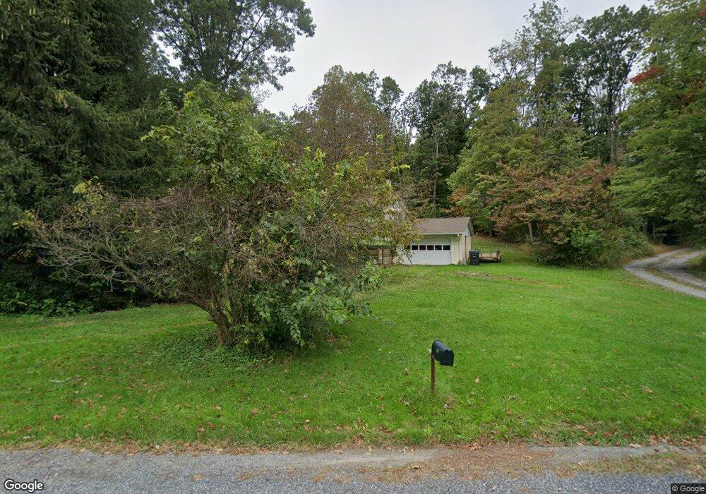
109 Fieldstone Rd Honey Brook, PA 19344
Estimated Value: $294,910 - $311,000
3
Beds
1
Bath
1,050
Sq Ft
$288/Sq Ft
Est. Value
About This Home
This home is located at 109 Fieldstone Rd, Honey Brook, PA 19344 and is currently estimated at $302,228, approximately $287 per square foot. 109 Fieldstone Rd is a home located in Chester County with nearby schools including Honey Brook Elementary Center, Twin Valley Middle School, and Twin Valley High School.
Ownership History
Date
Name
Owned For
Owner Type
Purchase Details
Closed on
Jul 8, 2022
Sold by
Thomas Evans
Bought by
Mcdonnell Eric J
Current Estimated Value
Home Financials for this Owner
Home Financials are based on the most recent Mortgage that was taken out on this home.
Original Mortgage
$175,000
Outstanding Balance
$157,666
Interest Rate
5.09%
Mortgage Type
Balloon
Estimated Equity
$144,562
Purchase Details
Closed on
Aug 16, 2021
Sold by
Spencer Evelyn L
Bought by
Evans Christopher N
Home Financials for this Owner
Home Financials are based on the most recent Mortgage that was taken out on this home.
Original Mortgage
$193,800
Interest Rate
2.9%
Mortgage Type
New Conventional
Purchase Details
Closed on
Nov 1, 1978
Bought by
Spencer Evelyn I and Spencer Myles A
Create a Home Valuation Report for This Property
The Home Valuation Report is an in-depth analysis detailing your home's value as well as a comparison with similar homes in the area
Home Values in the Area
Average Home Value in this Area
Purchase History
| Date | Buyer | Sale Price | Title Company |
|---|---|---|---|
| Mcdonnell Eric J | $225,000 | -- | |
| Evans Christopher N | $225,000 | Regal Abstract Lp | |
| Spencer Evelyn I | $6,300 | -- |
Source: Public Records
Mortgage History
| Date | Status | Borrower | Loan Amount |
|---|---|---|---|
| Open | Mcdonnell Eric J | $175,000 | |
| Previous Owner | Evans Christopher N | $193,800 |
Source: Public Records
Tax History Compared to Growth
Tax History
| Year | Tax Paid | Tax Assessment Tax Assessment Total Assessment is a certain percentage of the fair market value that is determined by local assessors to be the total taxable value of land and additions on the property. | Land | Improvement |
|---|---|---|---|---|
| 2025 | $3,515 | $91,550 | $24,150 | $67,400 |
| 2024 | $3,515 | $91,550 | $24,150 | $67,400 |
| 2023 | $3,435 | $91,550 | $24,150 | $67,400 |
| 2022 | $3,397 | $91,550 | $24,150 | $67,400 |
| 2021 | $3,298 | $91,550 | $24,150 | $67,400 |
| 2020 | $3,281 | $91,550 | $24,150 | $67,400 |
| 2019 | $3,184 | $91,550 | $24,150 | $67,400 |
| 2018 | $3,184 | $91,550 | $24,150 | $67,400 |
| 2017 | $3,108 | $91,550 | $24,150 | $67,400 |
| 2016 | $2,406 | $91,550 | $24,150 | $67,400 |
| 2015 | $2,406 | $91,550 | $24,150 | $67,400 |
| 2014 | $2,406 | $91,550 | $24,150 | $67,400 |
Source: Public Records
Map
Nearby Homes
- 0 Westbrook Dr
- 0 Westbrook Dr
- 0 Westbrook Dr
- 0 Westbrook Dr
- 112 Maxwell Hill Rd
- 110 Petrelia Dr
- 407 Cahill Cir Unit 4
- 1 Senn Ln
- 1520 Lexington Way
- 24 Wexford Ct
- 44 Wexford Ct
- 3511 Main St
- 102 Country Ln
- 2085 Main St
- 1022 Elwood St
- 1250 Chestnut Tree Rd
- 650 Broad St
- 0 Heritage Dr Unit 4A PABK2058798
- 10 Woods Rd
- 241 Dove Dr