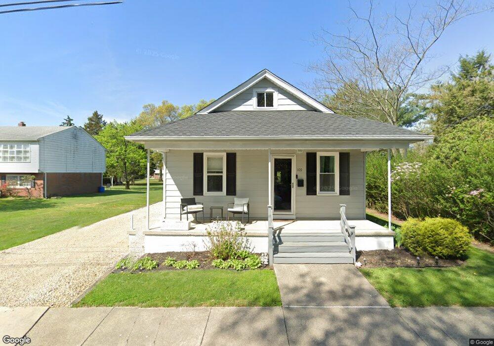
109 Forrest St Gibbstown, NJ 08027
Greenwich Township NeighborhoodEstimated Value: $226,106 - $263,000
2
Beds
1
Bath
864
Sq Ft
$283/Sq Ft
Est. Value
About This Home
This home is located at 109 Forrest St, Gibbstown, NJ 08027 and is currently estimated at $244,777, approximately $283 per square foot. 109 Forrest St is a home located in Gloucester County with nearby schools including Nehaunsey Middle School and Guardian Angels Regional School.
Ownership History
Date
Name
Owned For
Owner Type
Purchase Details
Closed on
Jul 30, 2020
Sold by
Brown Marielena and Chiavoroli James
Bought by
Brown Chelsea M
Current Estimated Value
Home Financials for this Owner
Home Financials are based on the most recent Mortgage that was taken out on this home.
Original Mortgage
$126,262
Interest Rate
2.9%
Mortgage Type
New Conventional
Purchase Details
Closed on
Mar 22, 2011
Sold by
Chiavoroli Melfino and Chiavoroli Helen
Bought by
Brown Marielena and Chiavoroli James
Create a Home Valuation Report for This Property
The Home Valuation Report is an in-depth analysis detailing your home's value as well as a comparison with similar homes in the area
Home Values in the Area
Average Home Value in this Area
Purchase History
| Date | Buyer | Sale Price | Title Company |
|---|---|---|---|
| Brown Chelsea M | $125,000 | Fidelity National Ttl Ins Co | |
| Brown Marielena | -- | None Available |
Source: Public Records
Mortgage History
| Date | Status | Borrower | Loan Amount |
|---|---|---|---|
| Previous Owner | Brown Chelsea M | $126,262 |
Source: Public Records
Tax History Compared to Growth
Tax History
| Year | Tax Paid | Tax Assessment Tax Assessment Total Assessment is a certain percentage of the fair market value that is determined by local assessors to be the total taxable value of land and additions on the property. | Land | Improvement |
|---|---|---|---|---|
| 2025 | $4,028 | $117,000 | $31,900 | $85,100 |
| 2024 | $3,817 | $117,000 | $31,900 | $85,100 |
| 2023 | $3,817 | $117,000 | $31,900 | $85,100 |
| 2022 | $3,819 | $117,000 | $31,900 | $85,100 |
| 2021 | $3,779 | $117,000 | $31,900 | $85,100 |
| 2020 | $3,776 | $115,300 | $31,900 | $83,400 |
| 2019 | $3,778 | $115,300 | $31,900 | $83,400 |
| 2018 | $3,671 | $115,300 | $31,900 | $83,400 |
| 2017 | $3,582 | $115,300 | $31,900 | $83,400 |
| 2016 | $3,543 | $115,300 | $31,900 | $83,400 |
| 2015 | $3,429 | $115,300 | $31,900 | $83,400 |
| 2014 | $3,281 | $115,300 | $31,900 | $83,400 |
Source: Public Records
Map
Nearby Homes
- 268 Memorial Ave
- W Broad St
- 157 S Poplar St
- 431 Washington St
- 433 Jefferson St
- 132 Tomlin Station Rd
- 752 Duncan Ave
- 0 S Democrat Rd Unit NJGL2065008
- 456 Freund Ave
- 0 Swedesboro Ave Unit NJGL2061592
- 330 Croce Ave
- 219 Vanneman Blvd
- 344 W Washington St
- L18 20 W Broad St
- 43 45 Repaupo Station Rd
- 255 Elizabeth Ave
- 126 Repaupo Station Rd
- 0 Rd Unit NJGL2061600
- 269 W Broad St
- 792 Paulsboro Rd
- 117 Forrest St
- 76 Adalisa Ave
- 84 Adalisa Ave
- 67 Forrest St
- 67 Forrest St
- 120 Forrest St
- 60 Adalisa Ave
- 0 Route 295 Unit 1005742104
- 0 Route 295 Unit 5331198
- 128 Adalisa Ave
- 130 Forrest St
- 265 Memorial Ave
- 275 Memorial Ave
- 50 Adalisa Ave
- 251 Memorial Ave
- 45 Forrest St
- 281 Memorial Ave
- 44 Forrest St
- 117 S Orchard St
- 44 Adalisa Ave