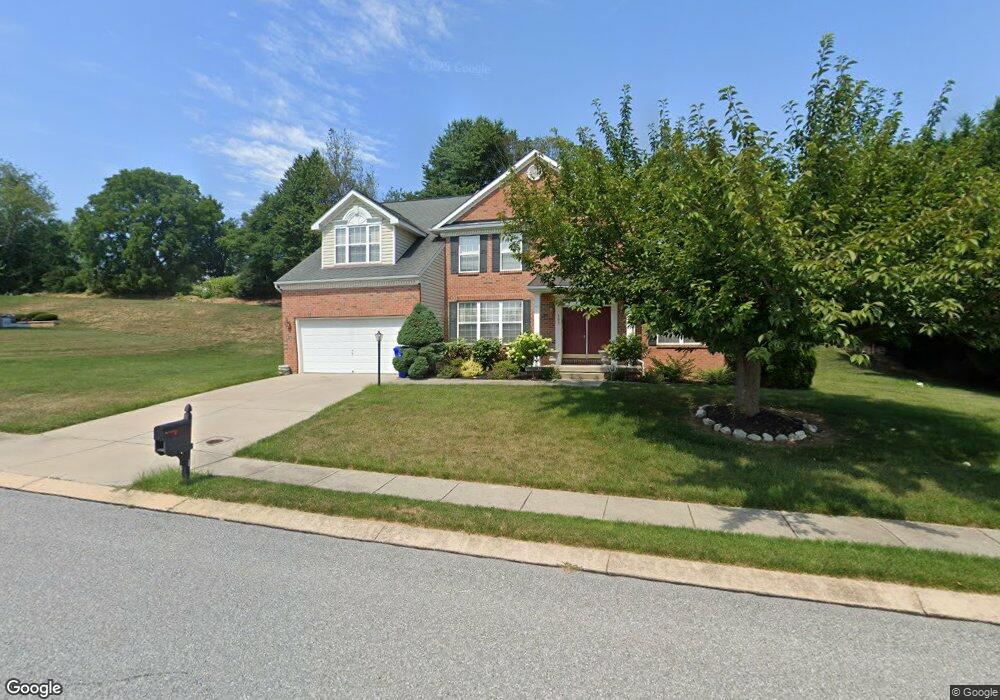
109 Glenray Ct New Freedom, PA 17349
Estimated Value: $589,262 - $700,000
4
Beds
3
Baths
3,802
Sq Ft
$170/Sq Ft
Est. Value
About This Home
This home is located at 109 Glenray Ct, New Freedom, PA 17349 and is currently estimated at $647,566, approximately $170 per square foot. 109 Glenray Ct is a home located in York County with nearby schools including Susquehannock High School, St John The Baptist Catholic School, and Shrewsbury Christian Academy.
Ownership History
Date
Name
Owned For
Owner Type
Purchase Details
Closed on
Jun 29, 2005
Sold by
Sg One Llc
Bought by
Walker Horace and Walker Marcia
Current Estimated Value
Home Financials for this Owner
Home Financials are based on the most recent Mortgage that was taken out on this home.
Original Mortgage
$397,500
Interest Rate
5.87%
Mortgage Type
Fannie Mae Freddie Mac
Create a Home Valuation Report for This Property
The Home Valuation Report is an in-depth analysis detailing your home's value as well as a comparison with similar homes in the area
Home Values in the Area
Average Home Value in this Area
Purchase History
| Date | Buyer | Sale Price | Title Company |
|---|---|---|---|
| Walker Horace | $496,887 | None Available |
Source: Public Records
Mortgage History
| Date | Status | Borrower | Loan Amount |
|---|---|---|---|
| Previous Owner | Walker Horace | $397,500 |
Source: Public Records
Tax History Compared to Growth
Tax History
| Year | Tax Paid | Tax Assessment Tax Assessment Total Assessment is a certain percentage of the fair market value that is determined by local assessors to be the total taxable value of land and additions on the property. | Land | Improvement |
|---|---|---|---|---|
| 2025 | $11,519 | $389,270 | $78,520 | $310,750 |
| 2024 | $11,332 | $389,270 | $78,520 | $310,750 |
| 2023 | $11,215 | $389,270 | $78,520 | $310,750 |
| 2022 | $11,156 | $389,270 | $78,520 | $310,750 |
| 2021 | $10,674 | $389,270 | $78,520 | $310,750 |
| 2020 | $10,604 | $389,270 | $78,520 | $310,750 |
| 2019 | $10,604 | $389,270 | $78,520 | $310,750 |
| 2018 | $10,382 | $389,270 | $78,520 | $310,750 |
| 2017 | $10,105 | $389,270 | $78,520 | $310,750 |
| 2016 | $0 | $389,270 | $78,520 | $310,750 |
| 2015 | -- | $389,270 | $78,520 | $310,750 |
| 2014 | -- | $389,270 | $78,520 | $310,750 |
Source: Public Records
Map
Nearby Homes
- 1402 Oakland Rd
- 101 Freedom Ave
- 677 Keller Rd
- 48 E Franklin St
- 1605 Oakland Rd
- 411 Peggy Ln
- 21315 Ridge Rd
- 318 Eliza Rd
- 41 Logan Dr
- 452 Hilltop Ct
- 111 Penny Ln
- 606 Freeland Rd
- 35 Independence Dr
- 32 Washington Rd
- 521 Windy Hill Rd
- 21618 York Rd
- 17453 Reddale Dr
- Lot #1 Norland Way Unit COVINGTON
- 21525 York Rd
- 21521 York Rd