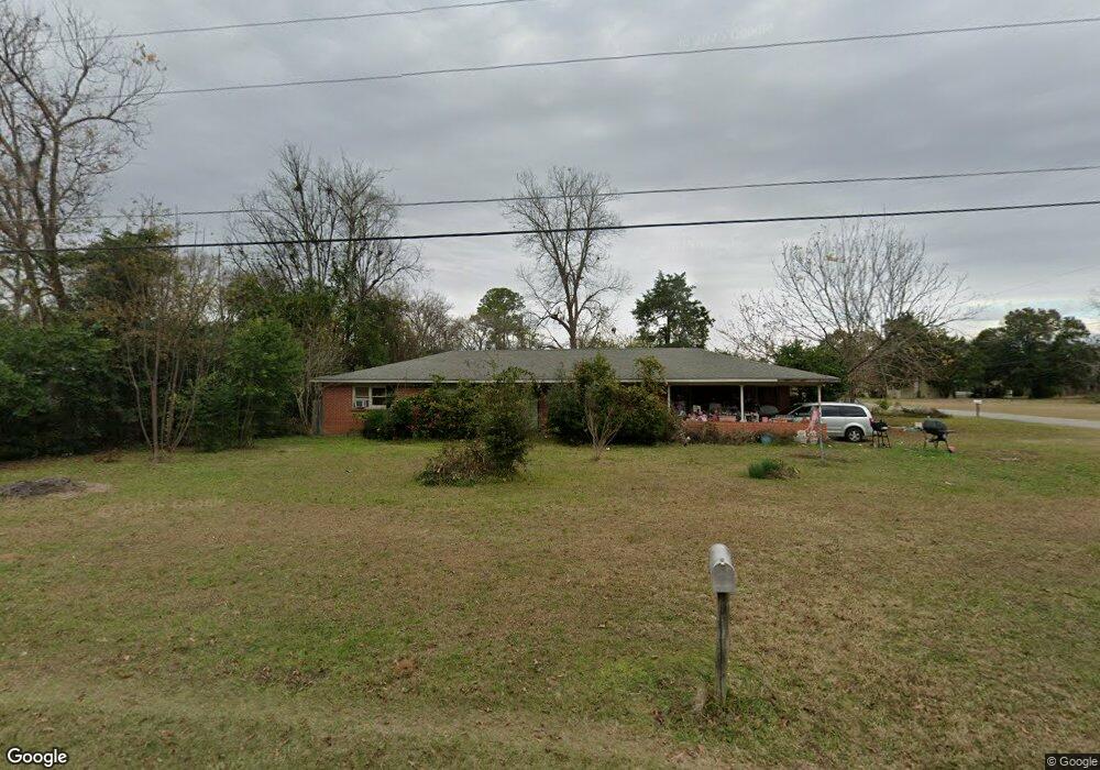
109 High St Georgetown, GA 39854
Estimated Value: $95,166 - $134,000
3
Beds
2
Baths
1,620
Sq Ft
$69/Sq Ft
Est. Value
About This Home
This home is located at 109 High St, Georgetown, GA 39854 and is currently estimated at $111,792, approximately $69 per square foot. 109 High St is a home located in Quitman County with nearby schools including Quitman County Elementary School, Quitman County High School, and Parkview Christian School.
Ownership History
Date
Name
Owned For
Owner Type
Purchase Details
Closed on
Jul 9, 1992
Sold by
Gary Walter B and Gary Gayl
Bought by
Morton Carolyn B
Current Estimated Value
Purchase Details
Closed on
Mar 16, 1984
Sold by
Eufaula Bank & Trust
Bought by
Gary Walter B and Gary Gayl
Purchase Details
Closed on
Sep 6, 1983
Sold by
Borders Robert and Borders Sue
Bought by
Eufaula Bank & Trust
Purchase Details
Closed on
Oct 16, 1972
Sold by
Borders Robert and Borders Sue
Bought by
Borders Robert and Borders Sue
Purchase Details
Closed on
Aug 15, 1972
Bought by
Borders Robert and Borders Sue
Create a Home Valuation Report for This Property
The Home Valuation Report is an in-depth analysis detailing your home's value as well as a comparison with similar homes in the area
Purchase History
| Date | Buyer | Sale Price | Title Company |
|---|---|---|---|
| Morton Carolyn B | $37,800 | -- | |
| Gary Walter B | $25,000 | -- | |
| Eufaula Bank & Trust | $18,000 | -- | |
| Borders Robert | -- | -- | |
| Borders Robert | -- | -- |
Source: Public Records
Tax History
| Year | Tax Paid | Tax Assessment Tax Assessment Total Assessment is a certain percentage of the fair market value that is determined by local assessors to be the total taxable value of land and additions on the property. | Land | Improvement |
|---|---|---|---|---|
| 2025 | $872 | $36,168 | $4,515 | $31,653 |
| 2024 | $720 | $36,168 | $4,515 | $31,653 |
| 2023 | $755 | $36,168 | $4,515 | $31,653 |
| 2022 | $732 | $36,168 | $4,515 | $31,653 |
| 2021 | $544 | $31,711 | $4,587 | $27,124 |
| 2020 | $544 | $31,711 | $4,587 | $27,124 |
| 2019 | $538 | $31,359 | $4,587 | $26,772 |
| 2018 | $917 | $31,359 | $4,587 | $26,772 |
| 2017 | $468 | $32,135 | $4,587 | $27,548 |
| 2016 | $479 | $32,135 | $4,587 | $27,548 |
| 2015 | -- | $32,135 | $4,587 | $27,548 |
| 2014 | -- | $32,135 | $4,587 | $27,548 |
| 2013 | -- | $32,135 | $4,587 | $27,548 |
Source: Public Records
Map
Nearby Homes
- 11 Church St
- 32 Whispering Pines Blvd
- 197 Whispering Pines Blvd
- 000 Joy St
- 110 Whispering Pines Blvd
- 111 Whispering Pines Blvd
- 189 190 Whispering Pines
- 185 Lakeview Dr
- 83 Whispering Pines Blvd
- 123 Lakeview Dr
- 97 Sandy Ln
- 82 Whispering Pines Blvd
- 166 Lakeview Dr
- 0 Point Dr Unit 22643
- 0 Point Dr Unit LOT 2, 3, 4
- 7 Point Way
- 94 Ridgeview St
- 1194 U S Hwy 82-Parcel B
- 0 Sandra Dr Unit 10544581
- 9 Shirley Dr
Your Personal Tour Guide
Ask me questions while you tour the home.