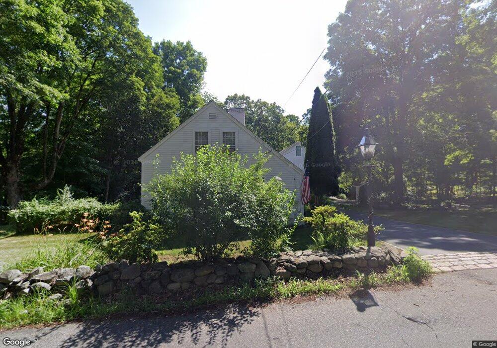
109 Hines Rd Cumberland, RI 02864
Arnold Mills NeighborhoodEstimated Value: $559,000 - $753,000
4
Beds
2
Baths
1,850
Sq Ft
$348/Sq Ft
Est. Value
About This Home
This home is located at 109 Hines Rd, Cumberland, RI 02864 and is currently estimated at $644,256, approximately $348 per square foot. 109 Hines Rd is a home located in Providence County with nearby schools including Garvin Memorial School, Joseph L. McCourt Middle School, and Cumberland High School.
Ownership History
Date
Name
Owned For
Owner Type
Purchase Details
Closed on
Mar 4, 2021
Sold by
Goss Sandra F
Bought by
Sandra F Gross Lt
Current Estimated Value
Purchase Details
Closed on
Apr 17, 2006
Sold by
Durgin Sarah
Bought by
Gross Sandra
Home Financials for this Owner
Home Financials are based on the most recent Mortgage that was taken out on this home.
Original Mortgage
$320,000
Interest Rate
6.28%
Mortgage Type
Purchase Money Mortgage
Create a Home Valuation Report for This Property
The Home Valuation Report is an in-depth analysis detailing your home's value as well as a comparison with similar homes in the area
Home Values in the Area
Average Home Value in this Area
Purchase History
We collect this data history from publicly available records. To have your information removed, we recommend requesting removal directly through your county’s website.
| Date | Buyer | Sale Price | Title Company |
|---|---|---|---|
| Sandra F Gross Lt | -- | None Available | |
| Gross Sandra | $400,000 | -- |
Source: Public Records
Mortgage History
We collect this data history from publicly available records. To have your information removed, we recommend requesting removal directly through your county’s website.
| Date | Status | Borrower | Loan Amount |
|---|---|---|---|
| Previous Owner | Gross Sandra | $370,000 | |
| Previous Owner | Gross Sandra | $312,100 | |
| Previous Owner | Gross Sandra | $320,000 | |
| Previous Owner | Gross Sandra | $60,000 |
Source: Public Records
Tax History
| Year | Tax Paid | Tax Assessment Tax Assessment Total Assessment is a certain percentage of the fair market value that is determined by local assessors to be the total taxable value of land and additions on the property. | Land | Improvement |
|---|---|---|---|---|
| 2025 | $5,964 | $486,100 | $190,300 | $295,800 |
| 2024 | $5,809 | $486,100 | $190,300 | $295,800 |
| 2023 | $5,648 | $486,100 | $190,300 | $295,800 |
| 2022 | $5,743 | $383,100 | $149,300 | $233,800 |
| 2021 | $5,647 | $383,100 | $149,300 | $233,800 |
| 2020 | $5,486 | $383,100 | $149,300 | $233,800 |
| 2019 | $5,113 | $322,000 | $128,500 | $193,500 |
| 2018 | $1,279 | $322,000 | $128,500 | $193,500 |
| 2017 | $4,898 | $322,000 | $128,500 | $193,500 |
| 2016 | $4,934 | $288,900 | $129,400 | $159,500 |
| 2015 | $4,934 | $288,900 | $129,400 | $159,500 |
| 2014 | $4,934 | $288,900 | $129,400 | $159,500 |
| 2013 | $5,133 | $325,300 | $130,700 | $194,600 |
Source: Public Records
Map
Nearby Homes
- 84 Phillip Ave
- 34 Massachusetts Ave
- 43 Massachusetts Ave
- 159 Iroquois Rd
- 18 Narragansett Ave
- 24 Narragansett Ave
- 0 Narragansett Rd
- 182 Hines Rd
- 1551 Diamond Hill Rd
- 19 Susan Dr
- 30 Bear Hill Rd
- 101 Shirley Dr
- 00 Mendon Rd
- 250 Mendon Rd
- 164 Bear Hill Rd Unit 35
- 164 Bear Hill Rd Unit 19
- 24 Hamilton St
- 34 Chestnut St
- 136 Roland St
- 221 Curran Rd
Your Personal Tour Guide
Ask me questions while you tour the home.