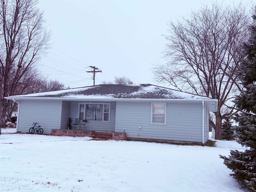
109 Jay St Bloomfield, NE 68718
Estimated payment $457/month
Highlights
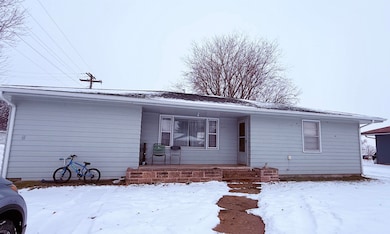
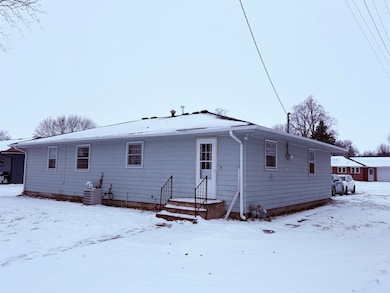
- Ranch Style House
- Wood Flooring
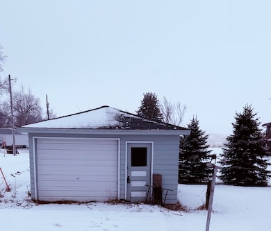
- Converted Garage
- Bloomfield Elementary School Rated A-
- Covered Patio or Porch
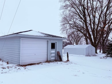
- 1 Car Detached Garage
About This Home
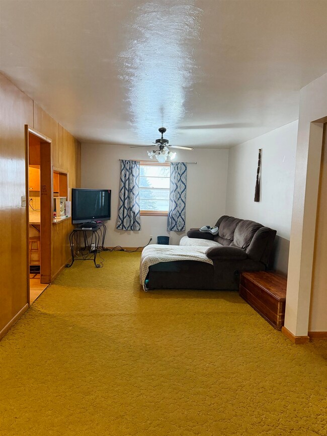
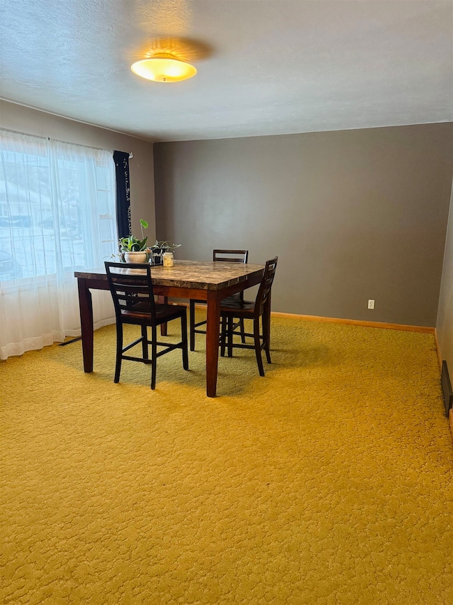
Welcome to this 3-bedroom, 1-bath home offering 1,448 sq ft of living space in a peaceful small-town setting. The open-concept living and dining area creates a welcoming space for gatherings and everyday living. The kitchen features a unique vintage cooktop and oven that add character you won’t find in newer homes. Outside, you’ll find a large backyard with room to relax or entertain, along with a detached one-car garage and an additional storage shed for extra space. This property is being sold as-is and offers a great opportunity for buyers looking to update and add value. With some vision and TLC, this home has strong potential to be transformed into something truly special.
Listing Agent
Berkshire Hathaway Home Services Amb RE Norfolk License #20220732 Listed on: 12/06/2025

Home Details
Home Type
- Single Family
Est. Annual Taxes
- $800
Year Built
- Built in 1960
Lot Details
- 0.26 Acre Lot
Home Design
- Ranch Style House
- Slab Foundation
- Frame Construction
- Asphalt Roof
Interior Spaces
- 1,448 Sq Ft Home
- Combination Dining and Living Room
- Crawl Space
- Attic Fan
Kitchen
- Electric Range
- Range Hood
- Dishwasher
Flooring
- Wood
- Carpet
- Vinyl
Bedrooms and Bathrooms
- 3 Main Level Bedrooms
- 1 Bathroom
Laundry
- Laundry on main level
- Dryer
- Washer
Home Security
- Carbon Monoxide Detectors
- Fire and Smoke Detector
Parking
- 1 Car Detached Garage
- Converted Garage
Outdoor Features
- Covered Patio or Porch
- Storage Shed
Utilities
- Central Air
- Gas Water Heater
- Water Softener is Owned
- Phone Available
Listing and Financial Details
- Assessor Parcel Number 540001123
Map
Tax History
| Year | Tax Paid | Tax Assessment Tax Assessment Total Assessment is a certain percentage of the fair market value that is determined by local assessors to be the total taxable value of land and additions on the property. | Land | Improvement |
|---|---|---|---|---|
| 2025 | $800 | $68,815 | $11,945 | $56,870 |
| 2024 | $817 | $63,035 | $10,410 | $52,625 |
| 2023 | $817 | $56,820 | $10,410 | $46,410 |
| 2022 | $782 | $52,195 | $5,785 | $46,410 |
| 2021 | $746 | $49,205 | $5,040 | $44,165 |
| 2020 | $750 | $49,205 | $5,040 | $44,165 |
| 2019 | $751 | $47,710 | $5,040 | $42,670 |
| 2018 | $676 | $43,570 | $5,040 | $38,530 |
| 2017 | $684 | $43,110 | $4,580 | $38,530 |
| 2016 | $619 | $43,110 | $4,580 | $38,530 |
| 2015 | $591 | $39,210 | $3,150 | $36,060 |
| 2014 | $657 | $39,555 | $3,150 | $36,405 |
| 2013 | $624 | $35,770 | $3,150 | $32,620 |
Property History
| Date | Event | Price | List to Sale | Price per Sq Ft |
|---|---|---|---|---|
| 03/09/2026 03/09/26 | Pending | -- | -- | -- |
| 02/13/2026 02/13/26 | Price Changed | $75,000 | -6.3% | $52 / Sq Ft |
| 12/06/2025 12/06/25 | For Sale | $80,000 | -- | $55 / Sq Ft |
Purchase History
| Date | Type | Sale Price | Title Company |
|---|---|---|---|
| Warranty Deed | $58,000 | Cedar Title & Escrow | |
| Warranty Deed | $30,000 | -- |
Mortgage History
| Date | Status | Loan Amount | Loan Type |
|---|---|---|---|
| Open | $52,200 | New Conventional |
Source: Norfolk Board of REALTORS®
MLS Number: 250874
APN: 540001123
Disclaimer: Certain information contained herein is derived from information provided by parties other than Homes.com. All information provided is deemed reliable, but is not guaranteed to be accurate and should be independently verified.
![]() IDX information is provided exclusively for personal, non-commercial use, and may not be used for any purpose other than to identify prospective properties consumers may be interested in purchasing. Information is deemed reliable but not guaranteed.
IDX information is provided exclusively for personal, non-commercial use, and may not be used for any purpose other than to identify prospective properties consumers may be interested in purchasing. Information is deemed reliable but not guaranteed.
- 502 W Main St
- 208 E Elm St
- 206 E Elm St
- 405 E Main St
- 200 E Roosevelt St
- 703 E Clark St
- 702 E Norris St
- 502 S Sherman St
- 708 E Grant St
- 88922 550th Ave
- 88952 550 Ave
- 312 Bazille St
- 609 W Omaha St
- 55310 Nebraska 121
- 1207 W 4th St
- 903 W 2nd St
- 315 W Colorado St
- 886 Rd Unit 532 Ave
- See Legal Lot 303
- See Legal Lot 302
Ask me questions while you tour the home.