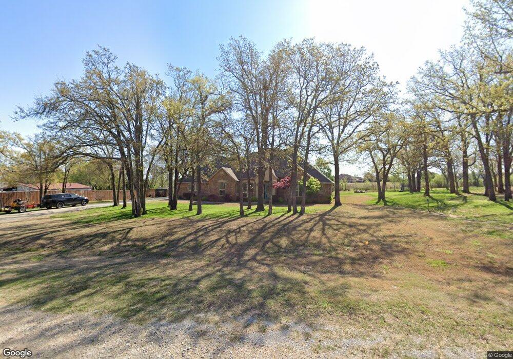
109 Kale Ln McLoud, OK 74851
Estimated Value: $315,000 - $351,534
3
Beds
2
Baths
2,195
Sq Ft
$151/Sq Ft
Est. Value
About This Home
This home is located at 109 Kale Ln, McLoud, OK 74851 and is currently estimated at $330,634, approximately $150 per square foot. 109 Kale Ln is a home with nearby schools including Dale Elementary School, Dale Middle School, and Dale High School.
Ownership History
Date
Name
Owned For
Owner Type
Purchase Details
Closed on
Jan 6, 2010
Sold by
Flewallen Troy and Flewallen Michaela Rhea
Bought by
Stephens Johnny and Stephens Debra
Current Estimated Value
Home Financials for this Owner
Home Financials are based on the most recent Mortgage that was taken out on this home.
Original Mortgage
$189,000
Interest Rate
4.76%
Mortgage Type
Construction
Purchase Details
Closed on
Mar 4, 2002
Sold by
Flewallen Troy
Bought by
Stephens Johnny and Stephens Debra
Create a Home Valuation Report for This Property
The Home Valuation Report is an in-depth analysis detailing your home's value as well as a comparison with similar homes in the area
Home Values in the Area
Average Home Value in this Area
Purchase History
| Date | Buyer | Sale Price | Title Company |
|---|---|---|---|
| Stephens Johnny | -- | None Available | |
| Stephens Johnny | $7,500 | -- |
Source: Public Records
Mortgage History
| Date | Status | Borrower | Loan Amount |
|---|---|---|---|
| Closed | Stephens Johnny | $189,000 |
Source: Public Records
Tax History
| Year | Tax Paid | Tax Assessment Tax Assessment Total Assessment is a certain percentage of the fair market value that is determined by local assessors to be the total taxable value of land and additions on the property. | Land | Improvement |
|---|---|---|---|---|
| 2025 | $3,238 | $31,555 | $2,073 | $29,482 |
| 2024 | $3,257 | $30,635 | $2,012 | $28,623 |
| 2023 | $3,257 | $29,743 | $1,920 | $27,823 |
| 2022 | $2,952 | $29,743 | $1,920 | $27,823 |
| 2021 | $3,239 | $29,743 | $1,920 | $27,823 |
| 2020 | $3,162 | $29,060 | $1,920 | $27,140 |
| 2019 | $3,219 | $28,514 | $1,865 | $26,649 |
| 2018 | $3,090 | $27,684 | $1,824 | $25,860 |
| 2017 | $2,891 | $26,878 | $1,754 | $25,124 |
| 2016 | $2,455 | $26,094 | $1,686 | $24,408 |
| 2015 | $2,329 | $25,335 | $1,778 | $23,557 |
| 2014 | $2,329 | $24,597 | $1,754 | $22,843 |
Source: Public Records
Map
Nearby Homes
- 0 May Addition Rd Unit 1195332
- 32903 Tincup Dr
- 31097 Elderberry Dr
- 33205 Amy Ave
- 13411 Huckleberry Ln
- 5668 Bent Creek Rd
- 5636 Bent Creek Rd
- 5610 Bent Creek Rd
- 13446 Dewberry Rd
- 5592 Bent Creek Rd
- 31065 Elderberry Dr
- TBD Elderberry Dr
- 31049 Elderberry Dr
- 13437 Juneberry Dr
- 13420 Juneberry Dr
- 13445 Juneberry Dr
- 13438 Juneberry Dr
- 13446 Juneberry Dr
- 31041 Elderberry Dr
- 0 SE 74th St
Your Personal Tour Guide
Ask me questions while you tour the home.