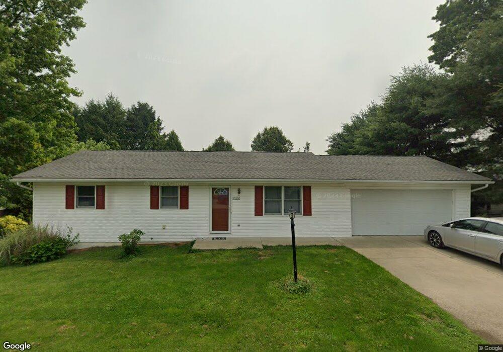
109 Locust Dr Barnesville, OH 43713
Estimated Value: $143,000 - $266,000
3
Beds
1
Bath
1,092
Sq Ft
$176/Sq Ft
Est. Value
About This Home
This home is located at 109 Locust Dr, Barnesville, OH 43713 and is currently estimated at $191,972, approximately $175 per square foot. 109 Locust Dr is a home located in Belmont County with nearby schools including Barnesville Elementary School, Barnesville Middle School, and Barnesville High School.
Ownership History
Date
Name
Owned For
Owner Type
Purchase Details
Closed on
Jan 6, 2022
Sold by
Schuerle Wayne M and Schuerle Aureola A
Bought by
Schrum Scott A
Current Estimated Value
Home Financials for this Owner
Home Financials are based on the most recent Mortgage that was taken out on this home.
Original Mortgage
$145,960
Interest Rate
3.11%
Mortgage Type
New Conventional
Purchase Details
Closed on
May 21, 2021
Sold by
Mcdonald Jamie S and Mcdonald Steve
Bought by
Schuerle Wayne M and Schuerle Aureola A
Purchase Details
Closed on
Mar 4, 1999
Sold by
Workman Floyd L and Workman Barbara
Bought by
Workman Floyd L and Workman Barbara
Purchase Details
Closed on
Mar 26, 1998
Sold by
Mayberry Gerald F
Bought by
Mayberry Gerald F
Purchase Details
Closed on
Jan 1, 1986
Sold by
Smith Alton I
Bought by
Smith Alton I
Create a Home Valuation Report for This Property
The Home Valuation Report is an in-depth analysis detailing your home's value as well as a comparison with similar homes in the area
Home Values in the Area
Average Home Value in this Area
Purchase History
| Date | Buyer | Sale Price | Title Company |
|---|---|---|---|
| Schrum Scott A | $164,000 | Schramm Eric A | |
| Schuerle Wayne M | $100,000 | None Available | |
| Workman Floyd L | $91,000 | -- | |
| Mayberry Gerald F | $20,000 | -- | |
| Smith Alton I | -- | -- |
Source: Public Records
Mortgage History
| Date | Status | Borrower | Loan Amount |
|---|---|---|---|
| Previous Owner | Schrum Scott A | $145,960 |
Source: Public Records
Tax History
| Year | Tax Paid | Tax Assessment Tax Assessment Total Assessment is a certain percentage of the fair market value that is determined by local assessors to be the total taxable value of land and additions on the property. | Land | Improvement |
|---|---|---|---|---|
| 2025 | $1,978 | $58,840 | $5,100 | $53,740 |
| 2024 | $1,949 | $58,840 | $5,100 | $53,740 |
| 2023 | $1,879 | $54,410 | $4,180 | $50,230 |
| 2022 | $1,878 | $54,411 | $4,179 | $50,232 |
| 2021 | $1,883 | $54,411 | $4,179 | $50,232 |
| 2020 | $1,292 | $45,340 | $3,480 | $41,860 |
| 2019 | $1,294 | $45,340 | $3,480 | $41,860 |
| 2018 | $1,225 | $45,340 | $3,480 | $41,860 |
| 2017 | $1,164 | $41,100 | $3,810 | $37,290 |
| 2016 | $1,089 | $41,100 | $3,810 | $37,290 |
| 2015 | $1,241 | $45,760 | $3,810 | $41,950 |
| 2014 | $987 | $37,850 | $3,470 | $34,380 |
| 2013 | $992 | $37,850 | $3,470 | $34,380 |
Source: Public Records
Map
Nearby Homes
- 613 E Main St
- 724 E Main St
- 118 Pine Ln
- 164 Pine Ln
- 0 Fairmont Ave Unit 5163774
- 0 Fairmont Ave Unit 5163784
- 136 E Walnut St
- 152 E Main St
- 438 N Lincoln Ave
- 0 Tract 17 Brown Peavine Rd Rd
- 202 Walton Ave
- 617 Park St
- 618 Park St
- 62239 Hillcrest Rd
- TBD W Main St
- 0 County Road 114
- 57128 Somerton Hwy
- Lot 1 Cattle Dr
- 0 Nevada Rd
- 63054 & 63060 S 26 Rd
Your Personal Tour Guide
Ask me questions while you tour the home.