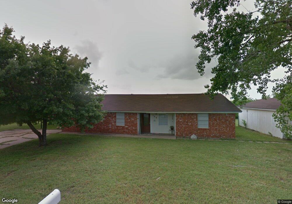
109 Lora Ln Weatherford, TX 76088
Estimated Value: $250,249 - $359,000
--
Bed
--
Bath
1,803
Sq Ft
$174/Sq Ft
Est. Value
About This Home
This home is located at 109 Lora Ln, Weatherford, TX 76088 and is currently estimated at $313,562, approximately $173 per square foot. 109 Lora Ln is a home located in Parker County with nearby schools including Peaster Elementary School, Peaster Middle School, and Peaster High School.
Ownership History
Date
Name
Owned For
Owner Type
Purchase Details
Closed on
Mar 24, 2020
Sold by
Hamilton Brad and Hamilton Kristen
Bought by
Derington Crystal and Holt David
Current Estimated Value
Purchase Details
Closed on
Nov 26, 2008
Sold by
Stephens Carl and Stephen Marietta
Bought by
Hamilton Brad
Purchase Details
Closed on
Nov 25, 2003
Sold by
Killingsworth David
Bought by
Hamilton Bradley W and Hamilton Kristen
Purchase Details
Closed on
Mar 22, 2001
Sold by
Oldham Betsy
Bought by
Hamilton Bradley W and Hamilton Kristen
Purchase Details
Closed on
Aug 21, 1985
Bought by
Hamilton Bradley W and Hamilton Kristen
Create a Home Valuation Report for This Property
The Home Valuation Report is an in-depth analysis detailing your home's value as well as a comparison with similar homes in the area
Home Values in the Area
Average Home Value in this Area
Purchase History
| Date | Buyer | Sale Price | Title Company |
|---|---|---|---|
| Derington Crystal | -- | None Available | |
| Hamilton Brad | $49,802 | Lsi Title Agency | |
| Hamilton Bradley W | -- | -- | |
| Hamilton Bradley W | -- | -- | |
| Hamilton Bradley W | -- | -- |
Source: Public Records
Tax History Compared to Growth
Tax History
| Year | Tax Paid | Tax Assessment Tax Assessment Total Assessment is a certain percentage of the fair market value that is determined by local assessors to be the total taxable value of land and additions on the property. | Land | Improvement |
|---|---|---|---|---|
| 2025 | $3,476 | $250,074 | -- | -- |
| 2024 | $3,476 | $227,340 | $20,000 | $207,340 |
| 2023 | $3,476 | $213,340 | $0 | $0 |
| 2022 | $4,559 | $193,950 | $20,000 | $173,950 |
| 2021 | $4,634 | $193,650 | $20,000 | $173,650 |
| 2020 | $2,846 | $116,700 | $20,000 | $96,700 |
| 2019 | $2,970 | $116,700 | $20,000 | $96,700 |
| 2018 | $2,635 | $103,280 | $15,000 | $88,280 |
| 2017 | $2,646 | $103,280 | $15,000 | $88,280 |
| 2016 | $2,376 | $92,750 | $13,800 | $78,950 |
| 2015 | $2,326 | $92,750 | $13,800 | $78,950 |
| 2014 | $2,400 | $94,830 | $11,960 | $82,870 |
Source: Public Records
Map
Nearby Homes
- 107 Hall St
- 905 Zion Hill Rd
- 105 Oxford Ct
- 104 Lagrange Ct
- 2016 Vanderbilt Dr
- 2020 Vanderbilt Dr
- 2117 Pepperdine Dr
- Lot 11 Pepperdine Dr
- Lot 12 Pepperdine Dr
- Lot 10 Pepperdine Dr
- 2124 Pepperdine Dr
- 2000 Vanderbilt Dr
- TBD Hwy 920 Hwy
- 3004 Greg Allen Dr
- 1425 N Bowie Dr
- 125 Odel Dr
- 522 W 7th St
- Hillside Plan at Woodland Lakes Estates
- Haven Plan at Woodland Lakes Estates
- 109 Odel Dr