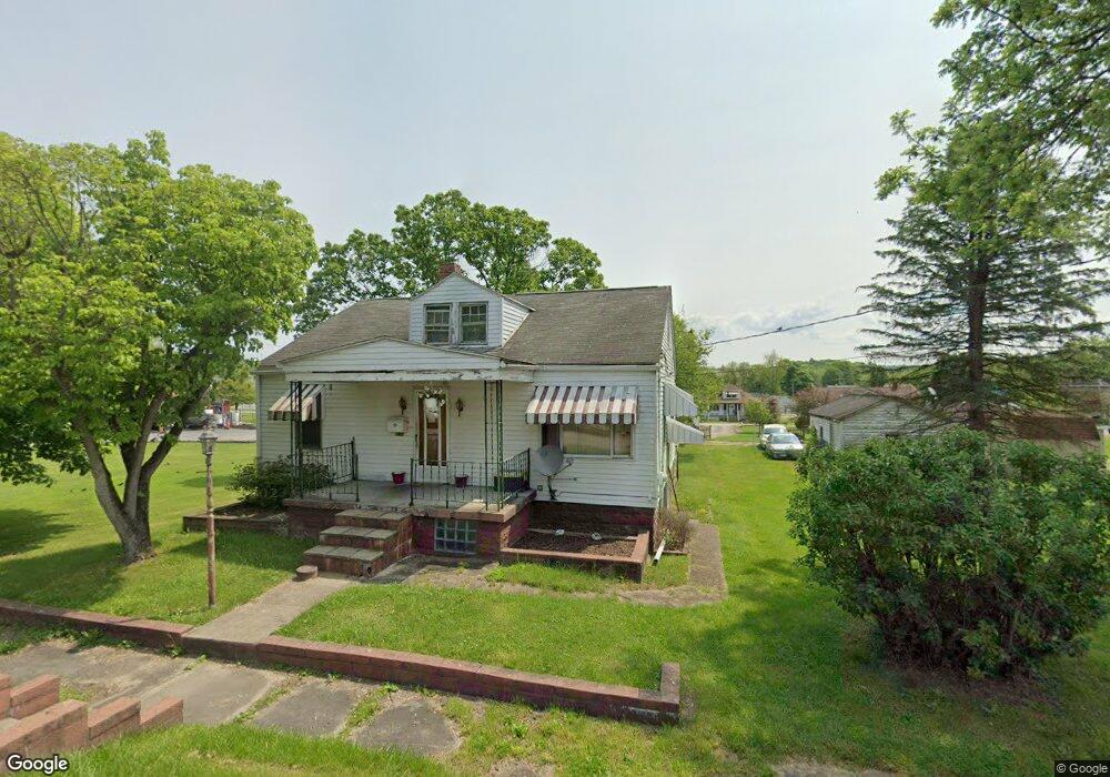
109 Maple St Masontown, PA 15461
Estimated Value: $105,770 - $151,000
3
Beds
1
Bath
1,176
Sq Ft
$104/Sq Ft
Est. Value
About This Home
This home is located at 109 Maple St, Masontown, PA 15461 and is currently estimated at $121,943, approximately $103 per square foot. 109 Maple St is a home located in Fayette County with nearby schools including Albert Gallatin Area Senior High School and All Saints Regional School.
Ownership History
Date
Name
Owned For
Owner Type
Purchase Details
Closed on
Jan 24, 2025
Sold by
Fayette County Tax Claim Bureau
Bought by
Belinger Justin
Current Estimated Value
Purchase Details
Closed on
Dec 4, 2006
Sold by
Vargo George and Vargo Micheline
Bought by
Gibson Ii Roy E and Gibson Brenda J
Create a Home Valuation Report for This Property
The Home Valuation Report is an in-depth analysis detailing your home's value as well as a comparison with similar homes in the area
Home Values in the Area
Average Home Value in this Area
Purchase History
| Date | Buyer | Sale Price | Title Company |
|---|---|---|---|
| Belinger Justin | $11,000 | None Listed On Document | |
| Belinger Justin | $11,000 | None Listed On Document | |
| Gibson Ii Roy E | $50,000 | None Available |
Source: Public Records
Tax History Compared to Growth
Tax History
| Year | Tax Paid | Tax Assessment Tax Assessment Total Assessment is a certain percentage of the fair market value that is determined by local assessors to be the total taxable value of land and additions on the property. | Land | Improvement |
|---|---|---|---|---|
| 2025 | $779 | $27,560 | $6,100 | $21,460 |
| 2024 | $779 | $27,560 | $6,100 | $21,460 |
| 2023 | $1,559 | $27,560 | $6,100 | $21,460 |
| 2022 | $1,559 | $27,560 | $6,100 | $21,460 |
| 2021 | $1,523 | $27,560 | $6,100 | $21,460 |
| 2020 | $1,523 | $27,560 | $6,100 | $21,460 |
| 2019 | $1,454 | $27,560 | $6,100 | $21,460 |
| 2018 | $1,316 | $27,560 | $6,100 | $21,460 |
| 2017 | $1,316 | $27,560 | $6,100 | $21,460 |
| 2016 | -- | $27,560 | $6,100 | $21,460 |
| 2015 | -- | $27,560 | $6,100 | $21,460 |
| 2014 | -- | $55,120 | $12,200 | $42,920 |
Source: Public Records
Map
Nearby Homes