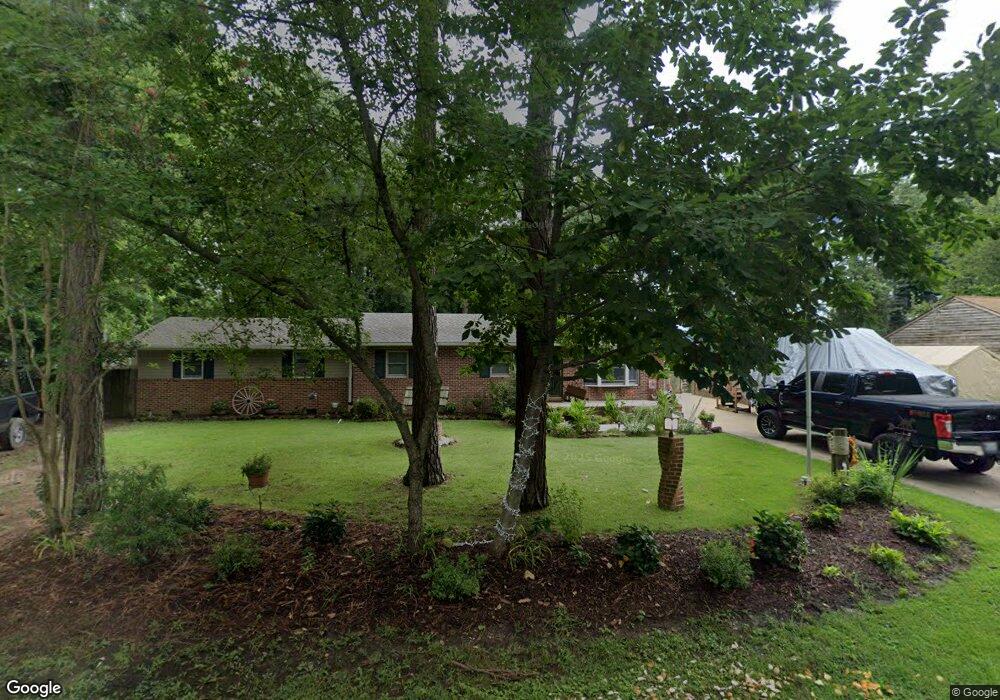
109 Monoponsan Rd Stevensville, MD 21666
Estimated Value: $320,000 - $524,000
--
Bed
1
Bath
1,718
Sq Ft
$245/Sq Ft
Est. Value
About This Home
This home is located at 109 Monoponsan Rd, Stevensville, MD 21666 and is currently estimated at $421,111, approximately $245 per square foot. 109 Monoponsan Rd is a home located in Queen Anne's County with nearby schools including Matapeake Elementary School, Matapeake Middle School, and Kent Island High School.
Ownership History
Date
Name
Owned For
Owner Type
Purchase Details
Closed on
Jul 24, 2024
Sold by
Hoover Curtis C and Hoover Sharon Kay
Bought by
Curtis And Sharon Hoover Living Trust and Hoover
Current Estimated Value
Purchase Details
Closed on
Aug 7, 2023
Sold by
Hoover Curtis C and Hoover Sharon Kay
Bought by
Hoover Curtis C and Hoover Sharon Kay
Purchase Details
Closed on
Aug 17, 1987
Sold by
Tolliver Roger B And
Bought by
Hoover Curtis C and Sharon Kay
Home Financials for this Owner
Home Financials are based on the most recent Mortgage that was taken out on this home.
Original Mortgage
$74,700
Interest Rate
10.34%
Create a Home Valuation Report for This Property
The Home Valuation Report is an in-depth analysis detailing your home's value as well as a comparison with similar homes in the area
Home Values in the Area
Average Home Value in this Area
Purchase History
| Date | Buyer | Sale Price | Title Company |
|---|---|---|---|
| Curtis And Sharon Hoover Living Trust | -- | None Listed On Document | |
| Curtis And Sharon Hoover Living Trust | -- | None Listed On Document | |
| Hoover Curtis C | -- | None Listed On Document | |
| Hoover Curtis C | -- | None Listed On Document | |
| Hoover Curtis C | -- | None Listed On Document | |
| Hoover Curtis C | $73,000 | -- |
Source: Public Records
Mortgage History
| Date | Status | Borrower | Loan Amount |
|---|---|---|---|
| Previous Owner | Hoover Curtis C | $74,700 |
Source: Public Records
Tax History Compared to Growth
Tax History
| Year | Tax Paid | Tax Assessment Tax Assessment Total Assessment is a certain percentage of the fair market value that is determined by local assessors to be the total taxable value of land and additions on the property. | Land | Improvement |
|---|---|---|---|---|
| 2025 | $2,719 | $332,800 | $0 | $0 |
| 2024 | $2,585 | $310,700 | $0 | $0 |
| 2023 | $2,455 | $288,600 | $151,000 | $137,600 |
| 2022 | $2,327 | $264,333 | $0 | $0 |
| 2021 | $2,130 | $240,067 | $0 | $0 |
| 2020 | $2,130 | $215,800 | $92,000 | $123,800 |
| 2019 | $2,073 | $209,900 | $0 | $0 |
| 2018 | $2,017 | $204,000 | $0 | $0 |
| 2017 | $1,960 | $198,100 | $0 | $0 |
| 2016 | -- | $198,100 | $0 | $0 |
| 2015 | $2,023 | $198,100 | $0 | $0 |
| 2014 | $2,023 | $210,300 | $0 | $0 |
Source: Public Records
Map
Nearby Homes
- 109 Chesapeake Bay Dr
- 100 Kent Point Rd
- 116 Kent Point Rd
- 216 Lighthouse View Dr
- 205 Lighthouse View Dr
- 231 Lighthouse View Dr
- 200 Mallard Cove Ln
- 312 S Lake Dr
- 201 Beachside Dr
- 208 Tower Dr
- 101 Beachside Dr
- 145 N Lake Dr
- 114 N Lake Dr
- 118 N Lake Dr
- 102 Golf Ct
- 0 Ackerman Dr
- Lot 8 Ackerman Dr
- 214 Pennick Dr
- 210 Pennick Dr
- 213 Pennick Dr
- 107 Monoponsan Rd
- 111 Monoponsan Rd
- 108 Kent Point Rd
- 108 Monoponsan Rd
- 106 Kent Point Rd
- 110 Kent Point Rd
- 105 Monoponsan Rd
- 113 Monoponsan Rd
- 104 Kent Point Rd
- 112 Kent Point Rd
- 104 Monoponsan Rd
- 103 Monoponsan Rd
- 115 Monoponsan Rd
- 111 Chesapeake Bay Dr
- 114 Monoponsan Rd
- 107 Chesapeake Bay Dr
- 102 Kent Point Rd
- 114 Kent Point Rd
- 113 Chesapeake Bay Dr
- 102 Monoponsan Rd