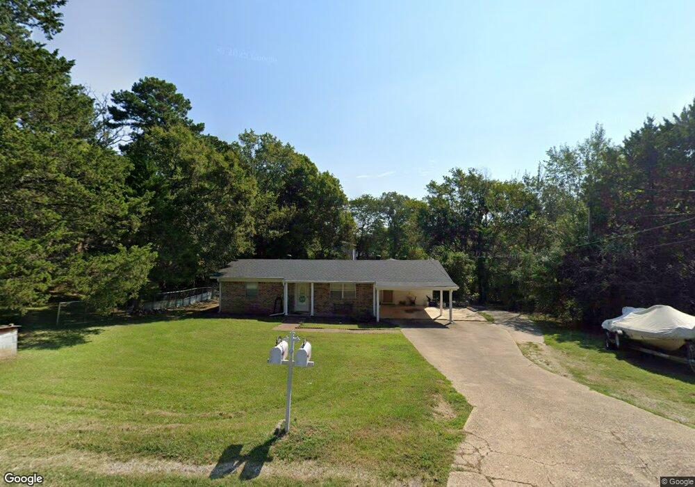
109 Mossyrock St Hot Springs National Park, AR 71913
Estimated Value: $194,000 - $236,000
2
Beds
1
Bath
1,016
Sq Ft
$208/Sq Ft
Est. Value
About This Home
This home is located at 109 Mossyrock St, Hot Springs National Park, AR 71913 and is currently estimated at $211,511, approximately $208 per square foot. 109 Mossyrock St is a home located in Garland County with nearby schools including Lake Hamilton Primary School, Lake Hamilton Elementary School, and Lake Hamilton Interm. School.
Ownership History
Date
Name
Owned For
Owner Type
Purchase Details
Closed on
May 25, 2011
Sold by
Thornburg Tina
Bought by
Bransetter Carolyn S
Current Estimated Value
Purchase Details
Closed on
Apr 20, 2009
Sold by
Branstetter Carolyn
Bought by
Branstetter Carolyn and Thornburg Tina
Purchase Details
Closed on
Aug 26, 2008
Sold by
Branstetter Carolyn and Branstetter Tina
Bought by
Branstetter Carolyn
Purchase Details
Closed on
Aug 10, 2000
Sold by
Not Provided
Bought by
Branstetter Carolyn S and Thornburg Tina
Purchase Details
Closed on
Sep 8, 1995
Sold by
Not Provided
Bought by
Branstetter Carolyn S
Create a Home Valuation Report for This Property
The Home Valuation Report is an in-depth analysis detailing your home's value as well as a comparison with similar homes in the area
Home Values in the Area
Average Home Value in this Area
Purchase History
| Date | Buyer | Sale Price | Title Company |
|---|---|---|---|
| Bransetter Carolyn S | -- | None Available | |
| Branstetter Carolyn | -- | None Available | |
| Branstetter Carolyn | -- | None Available | |
| Branstetter Carolyn S | -- | -- | |
| Branstetter Carolyn S | -- | -- |
Source: Public Records
Tax History Compared to Growth
Tax History
| Year | Tax Paid | Tax Assessment Tax Assessment Total Assessment is a certain percentage of the fair market value that is determined by local assessors to be the total taxable value of land and additions on the property. | Land | Improvement |
|---|---|---|---|---|
| 2025 | $1,530 | $36,780 | $4,000 | $32,780 |
| 2024 | $1,401 | $36,780 | $4,000 | $32,780 |
| 2023 | $1,294 | $36,780 | $4,000 | $32,780 |
| 2022 | $1,261 | $36,780 | $4,000 | $32,780 |
| 2021 | $1,148 | $24,610 | $2,500 | $22,110 |
| 2020 | $1,148 | $24,610 | $2,500 | $22,110 |
| 2019 | $1,088 | $24,610 | $2,500 | $22,110 |
| 2018 | $1,063 | $24,610 | $2,500 | $22,110 |
| 2017 | $618 | $24,610 | $2,500 | $22,110 |
| 2016 | $603 | $22,810 | $2,900 | $19,910 |
| 2015 | $603 | $22,810 | $2,900 | $19,910 |
| 2014 | $602 | $21,550 | $2,900 | $18,650 |
Source: Public Records
Map
Nearby Homes
- 328 S Danna Dr
- 105 Briarcroft Dr
- 12 Stonegate Ct
- Lot 27 Hunterscove Terrace
- 146 Kaufman Rd
- 7 Stonegate Ln
- 58 Stonegate Terrace
- 112 Pine Shore Ln
- Lot 2 Stonegate Heights
- 70 Stonegate Terrace
- 1412 Airport Rd
- 1412 Airport Rd Unit A13
- 1412 Airport Rd Unit B16
- 109 Copper Mountain Loop
- 205 Kleinshore Rd
- 1369 Airport Rd
- 111 Fishing Ln
- 1347,1349,1369 Airport Unit 108 Lancaster
- 207 Kleinshore Rd
- 131 Kleinshore Rd Unit 1,4,7
- 113 Mossyrock St
- 163 Enterprise Dr
- 111 Mossyrock St
- 115 Mossyrock St
- 110 Mossyrock St
- 108 Mossyrock St
- 112 Mossyrock St
- 168 Enterprise Dr
- 164 Enterprise Dr
- 102 Grissom Trail
- 106 Mossyrock St
- 155 Enterprise Dr
- 104 Grissom Trail
- 114 Mossyrock St
- 117 Mossyrock St
- 116 Mossyrock St
- 160 Enterprise Dr
- 104 Mossyrock St
- 156 Enterprise Dr
- 119 Mossyrock St