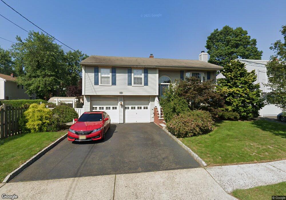
109 N Grant Ave Colonia, NJ 07067
Estimated Value: $430,941 - $686,000
3
Beds
3
Baths
1,450
Sq Ft
$416/Sq Ft
Est. Value
About This Home
This home is located at 109 N Grant Ave, Colonia, NJ 07067 and is currently estimated at $602,735, approximately $415 per square foot. 109 N Grant Ave is a home located in Middlesex County with nearby schools including Pennsylvania Ave School, Colonia Middle School, and Colonia High School.
Ownership History
Date
Name
Owned For
Owner Type
Purchase Details
Closed on
May 16, 2013
Sold by
Belibasakis Nick and Yanusz Susanne
Bought by
Oneal Dana R
Current Estimated Value
Home Financials for this Owner
Home Financials are based on the most recent Mortgage that was taken out on this home.
Original Mortgage
$358,388
Outstanding Balance
$254,184
Interest Rate
3.5%
Mortgage Type
FHA
Estimated Equity
$348,551
Purchase Details
Closed on
Jun 24, 2004
Sold by
Stellmach William J
Bought by
Belibasakis Nick J and Yanusz Susanne
Home Financials for this Owner
Home Financials are based on the most recent Mortgage that was taken out on this home.
Original Mortgage
$265,000
Interest Rate
6.25%
Purchase Details
Closed on
Dec 11, 1998
Sold by
Estate Of Helen Chabak
Bought by
Stellmach William
Home Financials for this Owner
Home Financials are based on the most recent Mortgage that was taken out on this home.
Original Mortgage
$129,600
Interest Rate
6.89%
Create a Home Valuation Report for This Property
The Home Valuation Report is an in-depth analysis detailing your home's value as well as a comparison with similar homes in the area
Home Values in the Area
Average Home Value in this Area
Purchase History
| Date | Buyer | Sale Price | Title Company |
|---|---|---|---|
| Oneal Dana R | $365,000 | Westcor Land Title Ins Co | |
| Belibasakis Nick J | $385,000 | -- | |
| Stellmach William | $162,000 | -- |
Source: Public Records
Mortgage History
| Date | Status | Borrower | Loan Amount |
|---|---|---|---|
| Open | Oneal Dana R | $358,388 | |
| Previous Owner | Belibasakis Nick J | $265,000 | |
| Previous Owner | Stellmach William | $129,600 |
Source: Public Records
Tax History Compared to Growth
Tax History
| Year | Tax Paid | Tax Assessment Tax Assessment Total Assessment is a certain percentage of the fair market value that is determined by local assessors to be the total taxable value of land and additions on the property. | Land | Improvement |
|---|---|---|---|---|
| 2025 | $12,451 | $102,900 | $24,400 | $78,500 |
| 2024 | $12,181 | $102,900 | $24,400 | $78,500 |
| 2023 | $12,181 | $102,900 | $24,400 | $78,500 |
| 2022 | $11,879 | $102,900 | $24,400 | $78,500 |
| 2021 | $11,781 | $102,900 | $24,400 | $78,500 |
| 2020 | $11,426 | $102,900 | $24,400 | $78,500 |
| 2019 | $11,155 | $102,900 | $24,400 | $78,500 |
| 2018 | $10,943 | $102,900 | $24,400 | $78,500 |
| 2017 | $10,751 | $102,900 | $24,400 | $78,500 |
| 2016 | $10,668 | $102,900 | $24,400 | $78,500 |
| 2015 | $10,480 | $102,900 | $24,400 | $78,500 |
| 2014 | $9,808 | $102,900 | $24,400 | $78,500 |
Source: Public Records
Map
Nearby Homes
- 42 Roosevelt Ave
- 92 Mckinley Ave
- 49 Cleveland Ave
- 21 Windsor Ln
- 15 Mckinley Ave
- 54 Montrose Ave
- 25 N Lincoln Ave
- 36 Amherst Ave
- 14 Parson Place
- 91 Amherst Ave
- 150 Carolyn Ave
- 205 Patricia Ave
- 42 Harrow Dr
- 77 Conduit Way
- 31 Jordan Rd
- 11 Dufoe Place
- 47 Marlboro Ln
- 24 Savoy St
- 251 Amherst Ave
- 16 Stafford Rd
- 105 N Grant Ave
- 26 N High St
- 108 Garfield Ave
- 108 Garfield Ave Unit 2
- 108 Garfield Ave Unit 1
- 22 N High St
- 104 Garfield Ave
- 99 N Grant Ave
- 110 N Grant Ave
- 36 N High St
- 16 N High St
- 106 N Grant Ave
- 98 Garfield Ave
- 98 Garfield Ave
- 98 Garfield Ave Unit 2
- 98 Garfield Ave Unit 1
- 98 Garfield Ave Unit 98
- 98 Garfield Ave Unit 2ND
- 95 N Grant Ave
- 94 Garfield Ave