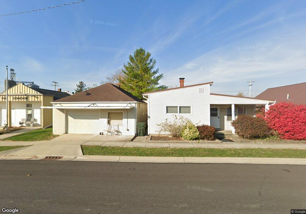
109 N Main St Buckland, OH 45819
Estimated Value: $150,686 - $164,000
2
Beds
1
Bath
1,288
Sq Ft
$122/Sq Ft
Est. Value
About This Home
This home is located at 109 N Main St, Buckland, OH 45819 and is currently estimated at $156,922, approximately $121 per square foot. 109 N Main St is a home located in Auglaize County with nearby schools including Wapakoneta Elementary School, Wapakoneta High School, and Wapakoneta Middle School.
Ownership History
Date
Name
Owned For
Owner Type
Purchase Details
Closed on
May 4, 1999
Sold by
Guagenti John M
Bought by
Guagenti John M and Guagenti Tondar L
Current Estimated Value
Purchase Details
Closed on
Apr 1, 1996
Sold by
Pleiman Mathew A
Bought by
Guagenti John M
Purchase Details
Closed on
Nov 16, 1994
Sold by
Vorhees Theodore
Bought by
Pleiman Mathew A
Purchase Details
Closed on
May 1, 1987
Purchase Details
Closed on
Sep 1, 1985
Create a Home Valuation Report for This Property
The Home Valuation Report is an in-depth analysis detailing your home's value as well as a comparison with similar homes in the area
Home Values in the Area
Average Home Value in this Area
Purchase History
| Date | Buyer | Sale Price | Title Company |
|---|---|---|---|
| Guagenti John M | -- | -- | |
| Guagenti John M | $60,000 | -- | |
| Pleiman Mathew A | $54,000 | -- | |
| -- | $55,000 | -- | |
| -- | $55,000 | -- |
Source: Public Records
Tax History Compared to Growth
Tax History
| Year | Tax Paid | Tax Assessment Tax Assessment Total Assessment is a certain percentage of the fair market value that is determined by local assessors to be the total taxable value of land and additions on the property. | Land | Improvement |
|---|---|---|---|---|
| 2024 | $1,660 | $32,710 | $3,230 | $29,480 |
| 2023 | $1,123 | $32,710 | $3,230 | $29,480 |
| 2022 | $933 | $24,510 | $3,830 | $20,680 |
| 2021 | $913 | $24,510 | $3,830 | $20,680 |
| 2020 | $467 | $24,504 | $3,826 | $20,678 |
| 2019 | $846 | $21,707 | $3,388 | $18,319 |
| 2018 | $849 | $21,707 | $3,388 | $18,319 |
| 2017 | $843 | $21,707 | $3,388 | $18,319 |
| 2016 | $772 | $19,947 | $3,231 | $16,716 |
| 2015 | $1,251 | $19,947 | $3,231 | $16,716 |
| 2014 | $1,019 | $19,947 | $3,231 | $16,716 |
| 2013 | $732 | $19,947 | $3,231 | $16,716 |
Source: Public Records
Map
Nearby Homes
- 17054 State Route 198
- 15644 Bay Rd
- 22284 Ohio 198
- 1020 Timber Trail
- 1028 Stonegate Ct
- 920 Primrose Dr
- 601 Warren St
- 808 Aster Dr
- 8304 Kruse Rd
- 322 Cole Dr
- 106 Valleyview Dr
- 7470 Fort Amanda Rd
- 1100 W Auglaize St
- 814 W Benton St
- 0 Wapakoneta Cridersville Rd
- 307 W Auglaize St
- 608 W Benton St
- 9 E Silver St
- 510 North St
- 17092 Hauss Rd