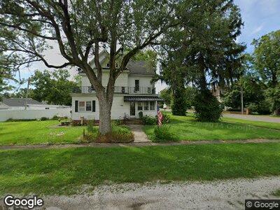
Estimated Value: $179,865 - $237,000
4
Beds
3
Baths
3,414
Sq Ft
$60/Sq Ft
Est. Value
About This Home
This home is located at 109 N Maple St, Maroa, IL 61756 and is currently estimated at $203,216, approximately $59 per square foot. 109 N Maple St is a home located in Macon County with nearby schools including Maroa-Forsyth Grade School, Maroa-Forsyth Middle School, and Maroa-Forsyth Senior High School.
Ownership History
Date
Name
Owned For
Owner Type
Purchase Details
Closed on
Nov 1, 2018
Sold by
Newton Jeffrey S
Bought by
Newton Audra S
Current Estimated Value
Purchase Details
Closed on
Jun 2, 2008
Sold by
Clem Barbara L and Clem Chesley D
Bought by
Newton Jeffrey S and Newton Audra S
Home Financials for this Owner
Home Financials are based on the most recent Mortgage that was taken out on this home.
Original Mortgage
$162,701
Interest Rate
6.1%
Mortgage Type
FHA
Purchase Details
Closed on
Aug 1, 1995
Create a Home Valuation Report for This Property
The Home Valuation Report is an in-depth analysis detailing your home's value as well as a comparison with similar homes in the area
Home Values in the Area
Average Home Value in this Area
Purchase History
| Date | Buyer | Sale Price | Title Company |
|---|---|---|---|
| Newton Audra S | -- | None Available | |
| Newton Jeffrey S | $165,000 | None Available | |
| -- | $110,000 | -- |
Source: Public Records
Mortgage History
| Date | Status | Borrower | Loan Amount |
|---|---|---|---|
| Open | Newton Audra Sue | $32,500 | |
| Open | Newton Audra Sue | $127,000 | |
| Closed | Newton Jefrey S | $148,164 | |
| Closed | Newton Jeffrey S | $162,701 |
Source: Public Records
Tax History Compared to Growth
Tax History
| Year | Tax Paid | Tax Assessment Tax Assessment Total Assessment is a certain percentage of the fair market value that is determined by local assessors to be the total taxable value of land and additions on the property. | Land | Improvement |
|---|---|---|---|---|
| 2023 | $5,744 | $61,944 | $7,906 | $54,038 |
| 2022 | $5,443 | $58,432 | $7,458 | $50,974 |
| 2021 | $5,272 | $55,502 | $7,084 | $48,418 |
| 2020 | $4,832 | $52,303 | $6,676 | $45,627 |
| 2019 | $4,832 | $52,303 | $6,676 | $45,627 |
| 2018 | $4,620 | $51,063 | $6,518 | $44,545 |
| 2017 | $4,833 | $51,278 | $6,545 | $44,733 |
| 2016 | $4,823 | $51,216 | $6,537 | $44,679 |
| 2015 | $4,559 | $49,725 | $6,347 | $43,378 |
| 2014 | $4,414 | $49,233 | $6,284 | $42,949 |
| 2013 | $4,457 | $49,233 | $6,284 | $42,949 |
Source: Public Records
Map
Nearby Homes
- 212 W Washington St
- 218 S Oak St
- 410 E Kennedy St
- 1076 U S 51
- 8527 Sawyer Rd
- 1650 Schellabarger Rd
- 0 Betty Ln Unit 10514801
- 164 Shadow Ridge Blvd
- 157 Shadow Ridge Blvd
- 120 Shadow Ridge Blvd
- 130 S Grant St
- 6080 Stagecoach Rd
- 6150 Stagecoach Rd
- 72 Edgelea Dr
- 450 Phillip Cir
- 4877 Tunbridge Hill Rd
- 342 E Cox St
- 1029 Jemima St
- 1026 State Route 10 E
- 701 S Cain St
