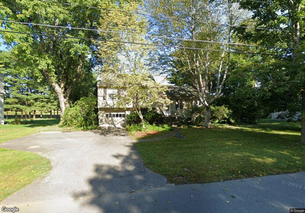
109 Nimrod Dr Concord, MA 01742
Estimated Value: $887,000 - $1,551,000
3
Beds
2
Baths
1,400
Sq Ft
$898/Sq Ft
Est. Value
About This Home
This home is located at 109 Nimrod Dr, Concord, MA 01742 and is currently estimated at $1,256,525, approximately $897 per square foot. 109 Nimrod Dr is a home located in Middlesex County with nearby schools including Willard School, Concord Middle School, and Concord Carlisle High School.
Ownership History
Date
Name
Owned For
Owner Type
Purchase Details
Closed on
Sep 5, 2012
Sold by
Davies Susan R and Davies Christopher M
Bought by
109 Nimrod Drive Rt
Current Estimated Value
Purchase Details
Closed on
May 2, 1996
Sold by
Intervale Farm Rt
Bought by
Davies Susan R
Create a Home Valuation Report for This Property
The Home Valuation Report is an in-depth analysis detailing your home's value as well as a comparison with similar homes in the area
Home Values in the Area
Average Home Value in this Area
Purchase History
| Date | Buyer | Sale Price | Title Company |
|---|---|---|---|
| 109 Nimrod Drive Rt | -- | -- | |
| Davies Susan R | $350,000 | -- |
Source: Public Records
Mortgage History
| Date | Status | Borrower | Loan Amount |
|---|---|---|---|
| Previous Owner | Davies Susan R | $50,000 | |
| Previous Owner | Davies Susan R | $60,000 |
Source: Public Records
Tax History Compared to Growth
Tax History
| Year | Tax Paid | Tax Assessment Tax Assessment Total Assessment is a certain percentage of the fair market value that is determined by local assessors to be the total taxable value of land and additions on the property. | Land | Improvement |
|---|---|---|---|---|
| 2025 | $136 | $1,028,400 | $699,300 | $329,100 |
| 2024 | $13,144 | $1,001,100 | $699,300 | $301,800 |
| 2023 | $12,431 | $959,200 | $635,700 | $323,500 |
| 2022 | $11,415 | $773,400 | $508,400 | $265,000 |
| 2021 | $11,305 | $768,000 | $508,400 | $259,600 |
| 2020 | $10,678 | $750,400 | $508,400 | $242,000 |
| 2019 | $10,437 | $735,500 | $493,500 | $242,000 |
| 2018 | $10,049 | $703,200 | $469,900 | $233,300 |
| 2017 | $9,459 | $672,300 | $447,500 | $224,800 |
| 2016 | $9,381 | $673,900 | $447,500 | $226,400 |
| 2015 | $8,821 | $617,300 | $414,300 | $203,000 |
Source: Public Records
Map
Nearby Homes
- 488 Elm St
- 295 Musterfield Rd
- 138 Baker Ave
- 79-81 Assabet Ave
- 244 Musterfield Rd
- 855 Barretts Mill Rd
- 213 Nashoba Rd
- 29 Concord Greene Unit 2
- 16 Concord Greene Unit 5
- 24 Concord Greene Unit 7
- 23 Concord Greene Unit 4
- 38 McCallar Ln
- 1053 Main St
- 46 Wood St
- 602 Main St
- 343 Nashawtuc Rd
- 29 Willard Common
- 49 Willard Common
- 106 Elm St
- 168 Nashawtuc Rd