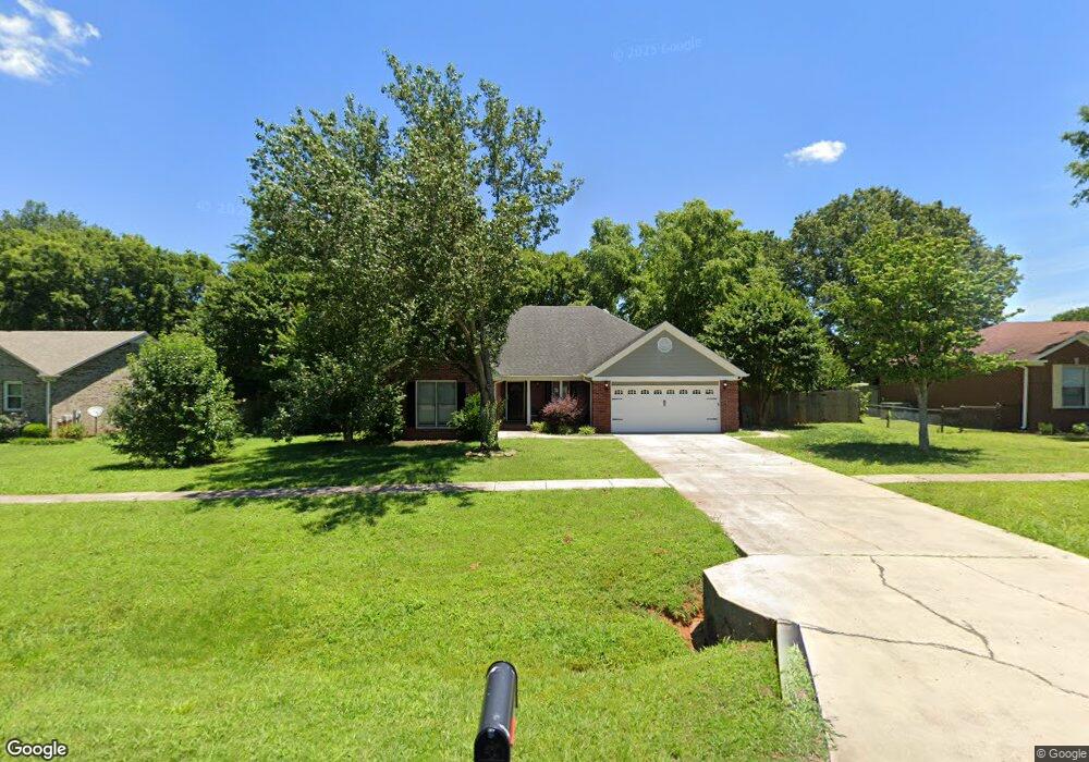
109 Oletimers Rd Huntsville, AL 35811
Ryland NeighborhoodEstimated Value: $282,000 - $296,000
3
Beds
2
Baths
1,654
Sq Ft
$177/Sq Ft
Est. Value
About This Home
This home is located at 109 Oletimers Rd, Huntsville, AL 35811 and is currently estimated at $292,334, approximately $176 per square foot. 109 Oletimers Rd is a home located in Madison County with nearby schools including Mt Carmel Elementary School, Riverton Intermediate School, and Buckhorn Middle School.
Ownership History
Date
Name
Owned For
Owner Type
Purchase Details
Closed on
Jan 28, 2022
Sold by
Alavest Llc
Bought by
Resicap Alabama Owner Llc
Current Estimated Value
Purchase Details
Closed on
Nov 4, 2021
Sold by
Shellpoint Mortgage Servicing
Bought by
Alavest Llc and Maxwell
Purchase Details
Closed on
Oct 24, 2016
Sold by
Maxwell Andrew Robert
Bought by
Grisham C Howard
Purchase Details
Closed on
Jun 27, 2008
Sold by
East Jimmy B and East Stephanie M
Bought by
Maxwell Andrew Robert and Maxwell Shannon L
Home Financials for this Owner
Home Financials are based on the most recent Mortgage that was taken out on this home.
Original Mortgage
$168,956
Interest Rate
5.97%
Mortgage Type
VA
Create a Home Valuation Report for This Property
The Home Valuation Report is an in-depth analysis detailing your home's value as well as a comparison with similar homes in the area
Home Values in the Area
Average Home Value in this Area
Purchase History
| Date | Buyer | Sale Price | Title Company |
|---|---|---|---|
| Resicap Alabama Owner Llc | $232,500 | Smith Closing Title | |
| Alavest Llc | $185,000 | None Listed On Document | |
| Grisham C Howard | $1,500 | None Available | |
| Maxwell Andrew Robert | -- | -- |
Source: Public Records
Mortgage History
| Date | Status | Borrower | Loan Amount |
|---|---|---|---|
| Previous Owner | Maxwell Andrew Robert | $168,956 | |
| Closed | Grisham C Howard | $0 |
Source: Public Records
Tax History Compared to Growth
Tax History
| Year | Tax Paid | Tax Assessment Tax Assessment Total Assessment is a certain percentage of the fair market value that is determined by local assessors to be the total taxable value of land and additions on the property. | Land | Improvement |
|---|---|---|---|---|
| 2024 | $1,925 | $53,640 | $11,000 | $42,640 |
| 2023 | $1,836 | $51,040 | $9,000 | $42,040 |
| 2022 | $614 | $21,440 | $2,500 | $18,940 |
| 2021 | $0 | $19,420 | $2,500 | $16,920 |
| 2020 | $0 | $17,490 | $2,500 | $14,990 |
| 2019 | $0 | $16,810 | $2,500 | $14,310 |
| 2018 | $0 | $15,860 | $0 | $0 |
| 2017 | $0 | $15,460 | $0 | $0 |
| 2016 | -- | $15,460 | $0 | $0 |
| 2015 | -- | $15,460 | $0 | $0 |
| 2014 | $504 | $15,340 | $0 | $0 |
Source: Public Records
Map
Nearby Homes
- 197 Sawmill Rd
- 1761 Winchester Rd NE
- 130 Blackburn Trace
- 319 Jackson Point Cir
- 135 Lanwood Dr
- 217 Idle Creek Dr
- 103 Trackside Trail
- 157 Lanwood Dr
- 215 Idle Creek Dr
- 136 Ranna Dr
- 134 Ranna Dr
- 130 Ranna Dr
- The Shelburne Plan at Blue Ridge at Mount Carmel - Signature Series
- The Lincoln Plan at Blue Ridge at Mount Carmel - Signature Series
- The Jamestown Plan at Blue Ridge at Mount Carmel - Founders Series
- The Winston Plan at Blue Ridge at Mount Carmel - Signature Series
- The Raleigh Plan at Blue Ridge at Mount Carmel - Signature Series
- The Cambridge Plan at Blue Ridge at Mount Carmel - Signature Series
- The Savannah Plan at Blue Ridge at Mount Carmel - Signature Series
- The Potomac Plan at Blue Ridge at Mount Carmel - Founders Series