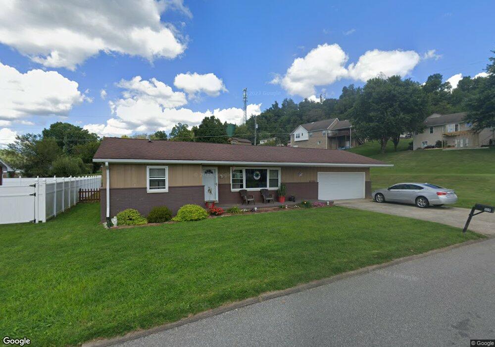
109 Orchard Dr South Point, OH 45680
Estimated Value: $242,000 - $288,000
3
Beds
3
Baths
2,216
Sq Ft
$116/Sq Ft
Est. Value
About This Home
This home is located at 109 Orchard Dr, South Point, OH 45680 and is currently estimated at $256,836, approximately $115 per square foot. 109 Orchard Dr is a home located in Lawrence County with nearby schools including South Point High School.
Ownership History
Date
Name
Owned For
Owner Type
Purchase Details
Closed on
Aug 20, 2010
Sold by
Torlone Richard L and Torlone Karen L
Bought by
Torlone Richard L and Torlone Karen L
Current Estimated Value
Purchase Details
Closed on
Sep 20, 2001
Sold by
Barnett Sheila
Bought by
Barnett Sheila
Purchase Details
Closed on
Apr 17, 2001
Sold by
Barnett James E and Barnett She
Bought by
Barnett Sheila
Purchase Details
Closed on
Feb 19, 1997
Sold by
Moren John and Whitf Susan
Bought by
Barnett James E and Barnett She
Purchase Details
Closed on
Oct 25, 1996
Bought by
Moren John and Susan Whitf
Purchase Details
Closed on
Nov 28, 1995
Sold by
Moren Myrtle
Bought by
Moren, Myrtle W Life Est
Create a Home Valuation Report for This Property
The Home Valuation Report is an in-depth analysis detailing your home's value as well as a comparison with similar homes in the area
Home Values in the Area
Average Home Value in this Area
Purchase History
| Date | Buyer | Sale Price | Title Company |
|---|---|---|---|
| Torlone Richard L | -- | Attorney | |
| Barnett Sheila | $104,500 | -- | |
| Barnett Sheila | -- | -- | |
| Barnett James E | $67,000 | -- | |
| Moren John | -- | -- | |
| Moren, Myrtle W Life Est | -- | -- |
Source: Public Records
Tax History Compared to Growth
Tax History
| Year | Tax Paid | Tax Assessment Tax Assessment Total Assessment is a certain percentage of the fair market value that is determined by local assessors to be the total taxable value of land and additions on the property. | Land | Improvement |
|---|---|---|---|---|
| 2024 | -- | $62,420 | $7,060 | $55,360 |
| 2023 | $2,137 | $62,420 | $7,060 | $55,360 |
| 2022 | $2,132 | $62,420 | $7,060 | $55,360 |
| 2021 | $2,065 | $56,680 | $5,270 | $51,410 |
| 2020 | $2,077 | $56,680 | $5,270 | $51,410 |
| 2019 | $2,066 | $56,680 | $5,270 | $51,410 |
| 2018 | $1,915 | $51,530 | $4,790 | $46,740 |
| 2017 | $1,911 | $51,530 | $4,790 | $46,740 |
| 2016 | $1,793 | $51,530 | $4,790 | $46,740 |
| 2015 | $1,151 | $30,900 | $4,790 | $26,110 |
| 2014 | $1,149 | $30,900 | $4,790 | $26,110 |
| 2013 | $1,039 | $30,900 | $4,790 | $26,110 |
Source: Public Records
Map
Nearby Homes
- 105 Orchard Dr
- 119 Meadow Ln
- 205 Michael St
- 408 Brubaker Dr
- 0 Twp R 135
- 404 Township Road 135
- 0 Township Road 135
- 609 4th St E
- 101 Henray Dr
- 00 County Road 1
- 102 Park Ave
- 110 Kitts Ln
- 1184 County Road 18
- 1524 Beech St
- 217 17th St
- 304 15th St
- 1104 Beech St
- 0 Township Road 161 Unit 182331
- 312 13th St
- 1715 Poplar St
- 113 Orchard Dr
- 107 Orchard Dr
- 114 Orchard Dr
- 105 Orchard Dr Unit KO-6
- 112 Orchard Dr
- 116 Orchard Dr
- 220 Westview St
- 110 Orchard Dr
- 118 Orchard Dr
- 113 Meadow Ln
- 103 Orchard Dr
- 218 Westview St
- 111 Meadow Ln
- 115 Meadow Ln
- 101 Orchard Dr
- 101 Orchard Dr
- 120 Orchard Dr
- 108 Orchard Dr
- 229 Westview St
- 117 Meadow Ln