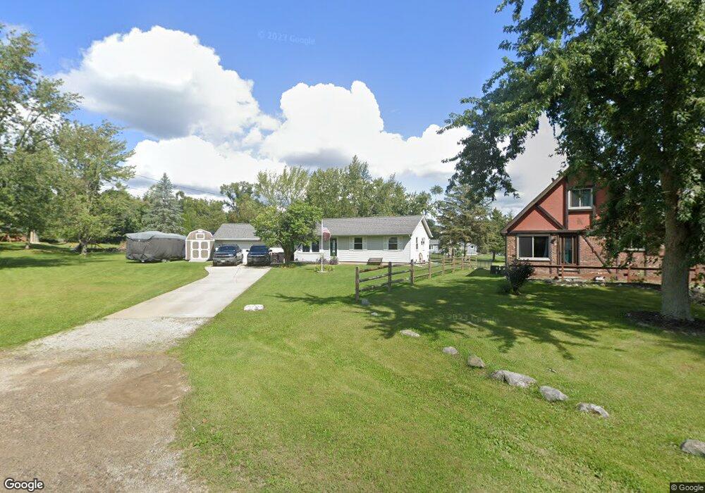
109 Orourke Ct Brooklyn, MI 49230
Estimated Value: $217,833 - $409,000
3
Beds
1
Bath
1,040
Sq Ft
$277/Sq Ft
Est. Value
About This Home
This home is located at 109 Orourke Ct, Brooklyn, MI 49230 and is currently estimated at $288,458, approximately $277 per square foot. 109 Orourke Ct is a home located in Jackson County with nearby schools including Columbia Lower Elementary School, Columbia Upper Elementary School, and Columbia Central Jr./Sr. High School.
Ownership History
Date
Name
Owned For
Owner Type
Purchase Details
Closed on
Jul 17, 2001
Sold by
Barnhouse Annie E and Barnhouse William E
Bought by
Doman Scott A and Hennells Doman Susan R
Current Estimated Value
Home Financials for this Owner
Home Financials are based on the most recent Mortgage that was taken out on this home.
Original Mortgage
$91,200
Outstanding Balance
$35,350
Interest Rate
7.22%
Mortgage Type
Purchase Money Mortgage
Estimated Equity
$253,108
Purchase Details
Closed on
Aug 26, 1994
Sold by
Bjorklund David and Bjorklund Denise
Bought by
Barnhouse William and Barnhouse Annie
Create a Home Valuation Report for This Property
The Home Valuation Report is an in-depth analysis detailing your home's value as well as a comparison with similar homes in the area
Purchase History
| Date | Buyer | Sale Price | Title Company |
|---|---|---|---|
| Doman Scott A | $114,000 | -- | |
| Barnhouse William | $77,500 | -- |
Source: Public Records
Mortgage History
| Date | Status | Borrower | Loan Amount |
|---|---|---|---|
| Open | Doman Scott A | $91,200 |
Source: Public Records
Tax History Compared to Growth
Tax History
| Year | Tax Paid | Tax Assessment Tax Assessment Total Assessment is a certain percentage of the fair market value that is determined by local assessors to be the total taxable value of land and additions on the property. | Land | Improvement |
|---|---|---|---|---|
| 2025 | $1,843 | $81,200 | $0 | $0 |
| 2024 | $9 | $77,800 | $0 | $0 |
| 2023 | $881 | $70,000 | $0 | $0 |
| 2022 | $1,756 | $61,200 | $0 | $0 |
| 2021 | $1,756 | $58,900 | $0 | $0 |
| 2020 | $1,758 | $58,200 | $0 | $0 |
| 2019 | $1,743 | $47,600 | $0 | $0 |
| 2018 | $1,732 | $45,800 | $0 | $0 |
| 2017 | $1,686 | $44,600 | $0 | $0 |
| 2016 | $764 | $44,100 | $44,100 | $0 |
| 2015 | $2,260 | $41,000 | $41,000 | $0 |
| 2014 | $2,260 | $39,300 | $0 | $0 |
| 2013 | -- | $39,300 | $39,300 | $0 |
Source: Public Records
Map
Nearby Homes
- 112 Abbott Ln
- 154 Golfview Dr
- VL Carlysle Dr
- 000 Hewitt Rd
- 207 Ambler Dr
- 224 Ambler Dr
- 110 Littlefield Ln
- VL Kirkley Dr
- 200 Barbara Dr
- 2217 Shady Ln
- 227 Riviera Dr
- 0 Lot 44 & 45 Wilkshire Dr Unit 25044305
- 119 Nottingham Dr
- 1756 Eagle Point Rd
- 6416 Kelley Rd
- 99 Nottingham Dr
- 0 Cement City Rd Unit 50195056
- 12938 Kelley Rd
- 261 Somerset Dr
- 12975 Hayes Rd
- 107 Orourke Ct
- 172 Claremont Cir
- 108 Orourke Ct
- 215 Claremont Cir
- 219 Claremont Cir
- 213 Claremont Cir
- 174 Claremont Cir
- 106 Orourke Ct
- 176 Claremont Cir
- 223 Claremont Cir
- 223 Claremont Cir Unit 223 Claremont Cir
- V/L Claremont Cir
- 209 Claremont Cir
- 166 Claremont Cir
- 178 Claremont Cir
- 142 Claremont Cir
- 207 Claremont Cir
- 136 Claremont Cir
- 162 Claremont Cir
- 167 Claremont Cir