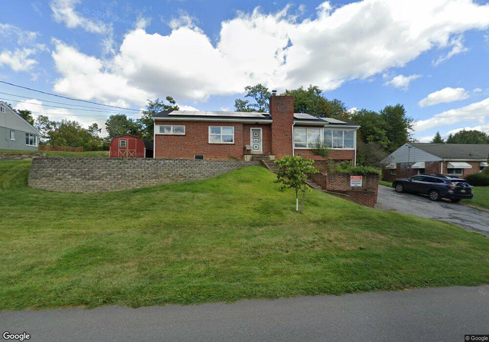
109 Poplar Rd New Cumberland, PA 17070
Estimated Value: $143,000 - $271,000
2
Beds
2
Baths
1,220
Sq Ft
$188/Sq Ft
Est. Value
About This Home
This home is located at 109 Poplar Rd, New Cumberland, PA 17070 and is currently estimated at $229,878, approximately $188 per square foot. 109 Poplar Rd is a home located in York County with nearby schools including Fairview Elementary School, New Cumberland Middle School, and Cedar Cliff High School.
Ownership History
Date
Name
Owned For
Owner Type
Purchase Details
Closed on
Sep 25, 1998
Sold by
Watson Bradley L and Watson Catherine M
Bought by
Watson Bradley L
Current Estimated Value
Home Financials for this Owner
Home Financials are based on the most recent Mortgage that was taken out on this home.
Original Mortgage
$82,500
Outstanding Balance
$18,047
Interest Rate
6.89%
Estimated Equity
$211,831
Purchase Details
Closed on
Apr 29, 1988
Bought by
Watson Bradley L and Watson Catherine M
Create a Home Valuation Report for This Property
The Home Valuation Report is an in-depth analysis detailing your home's value as well as a comparison with similar homes in the area
Home Values in the Area
Average Home Value in this Area
Purchase History
| Date | Buyer | Sale Price | Title Company |
|---|---|---|---|
| Watson Bradley L | -- | -- | |
| Watson Bradley L | $63,900 | -- |
Source: Public Records
Mortgage History
| Date | Status | Borrower | Loan Amount |
|---|---|---|---|
| Open | Watson Bradley L | $82,500 |
Source: Public Records
Tax History Compared to Growth
Tax History
| Year | Tax Paid | Tax Assessment Tax Assessment Total Assessment is a certain percentage of the fair market value that is determined by local assessors to be the total taxable value of land and additions on the property. | Land | Improvement |
|---|---|---|---|---|
| 2025 | $3,405 | $130,060 | $36,120 | $93,940 |
| 2024 | $3,225 | $130,060 | $36,120 | $93,940 |
| 2023 | $3,136 | $130,060 | $36,120 | $93,940 |
| 2022 | $3,126 | $130,060 | $36,120 | $93,940 |
| 2021 | $2,941 | $130,060 | $36,120 | $93,940 |
| 2020 | $2,906 | $130,060 | $36,120 | $93,940 |
| 2019 | $2,855 | $130,060 | $36,120 | $93,940 |
| 2018 | $2,799 | $130,060 | $36,120 | $93,940 |
| 2017 | $2,705 | $130,060 | $36,120 | $93,940 |
| 2016 | $0 | $130,060 | $36,120 | $93,940 |
| 2015 | -- | $130,060 | $36,120 | $93,940 |
| 2014 | -- | $130,060 | $36,120 | $93,940 |
Source: Public Records
Map
Nearby Homes
- 82 Springers Ln
- 355 Weatherstone Dr
- 309 Stoneridge Ct Unit 80
- 280 Fieldstone Ct Unit 99
- 118 Old York Rd Unit 1
- 0 Old York Rd Unit 253 PAYK2089868
- 1240 Summitview Ct
- 1248 Summitview Ct
- 400 Woodland Ave
- 1740 Creek Vista Dr
- 1601 Cobble Ct
- 110 Ross Ave Unit 2
- 8 Umberto Ave
- 134 S Market St
- 414 5th St
- 1726 Josiah Chowning Way
- 211 Market St
- 1764 Peyton Randolph Ct
- 409 1/2 Market St
- 115 Parkview Rd
- 107 Poplar Rd
- 110 Poplar Rd
- 111 Poplar Rd
- 105 Poplar Rd
- 108 Poplar Rd
- 112 Poplar Rd
- 113 Poplar Rd
- 101 Poplar Rd
- 103 Poplar Rd
- 205 Lewisberry Rd
- 203 Lewisberry Rd
- 301 Lewisberry Rd
- 200 Fairview Rd
- 104 Fairview Rd
- Lot Poplar Ridge
- 202 Fairview Rd
- 303 Lewisberry Rd
- 116 Poplar Rd
- 314 Lewisberry Rd
- 65 Springers Ln