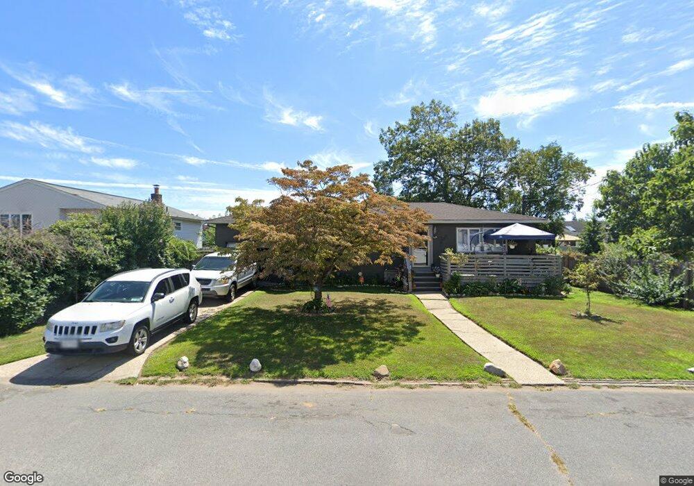
109 Robbins St Lindenhurst, NY 11757
Estimated Value: $580,005 - $708,000
--
Bed
--
Bath
1,100
Sq Ft
$592/Sq Ft
Est. Value
About This Home
This home is located at 109 Robbins St, Lindenhurst, NY 11757 and is currently estimated at $651,251, approximately $592 per square foot. 109 Robbins St is a home located in Suffolk County with nearby schools including William Rall School, Lindenhurst Middle School, and Lindenhurst Senior High School.
Ownership History
Date
Name
Owned For
Owner Type
Purchase Details
Closed on
Feb 12, 2002
Sold by
Akyerli Hatice
Bought by
Aydin Emin
Current Estimated Value
Home Financials for this Owner
Home Financials are based on the most recent Mortgage that was taken out on this home.
Original Mortgage
$122,000
Interest Rate
6.33%
Purchase Details
Closed on
Feb 22, 1999
Sold by
Demieri Anthony
Bought by
Akyerli Hatice and Aydin Emin
Home Financials for this Owner
Home Financials are based on the most recent Mortgage that was taken out on this home.
Original Mortgage
$121,250
Interest Rate
6.76%
Purchase Details
Closed on
Jun 26, 1996
Sold by
Brusso Roger W and Brusso Gertrude J
Bought by
Demieri Anthony
Create a Home Valuation Report for This Property
The Home Valuation Report is an in-depth analysis detailing your home's value as well as a comparison with similar homes in the area
Home Values in the Area
Average Home Value in this Area
Purchase History
| Date | Buyer | Sale Price | Title Company |
|---|---|---|---|
| Aydin Emin | -- | Fidelity National Title Ins | |
| Akyerli Hatice | $125,000 | Commonwealth Land Title Ins | |
| Demieri Anthony | $128,000 | First American Title Ins Co |
Source: Public Records
Mortgage History
| Date | Status | Borrower | Loan Amount |
|---|---|---|---|
| Closed | Aydin Emin | $122,000 | |
| Previous Owner | Akyerli Hatice | $121,250 |
Source: Public Records
Tax History Compared to Growth
Tax History
| Year | Tax Paid | Tax Assessment Tax Assessment Total Assessment is a certain percentage of the fair market value that is determined by local assessors to be the total taxable value of land and additions on the property. | Land | Improvement |
|---|---|---|---|---|
| 2024 | $10,736 | $3,070 | $330 | $2,740 |
| 2023 | $10,736 | $3,070 | $330 | $2,740 |
| 2022 | $9,141 | $3,070 | $330 | $2,740 |
| 2021 | $9,141 | $3,070 | $330 | $2,740 |
| 2020 | $9,629 | $3,070 | $330 | $2,740 |
| 2019 | $9,629 | $0 | $0 | $0 |
| 2018 | $9,072 | $3,070 | $330 | $2,740 |
| 2017 | $9,072 | $3,070 | $330 | $2,740 |
| 2016 | $9,089 | $3,070 | $330 | $2,740 |
| 2015 | -- | $3,070 | $330 | $2,740 |
| 2014 | -- | $3,070 | $330 | $2,740 |
Source: Public Records
Map
Nearby Homes
- 10 Paine St
- 10 Winchester Dr
- 0 Tenety Ave Unit 3461459
- 65 Marie St
- 165 Tremont Rd
- 45 Feustal St
- 436 Herzel Blvd
- 1221 Jackson Ave
- 89 Marie St
- 170 11th St
- 111 Berry St
- 210 11th St
- 61 Kellum St Unit A and B
- 61 Kellum St Unit 61A
- 430 Heathcote Rd
- 156 Farmers Ave
- 48 Farmers Ave
- 16 Burton Place
- 456 Heathcote Rd
- 350 52nd St