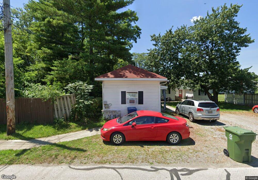
109 S Vine St Marysville, OH 43040
Estimated Value: $204,802 - $291,000
2
Beds
1
Bath
2,113
Sq Ft
$112/Sq Ft
Est. Value
About This Home
This home is located at 109 S Vine St, Marysville, OH 43040 and is currently estimated at $237,701, approximately $112 per square foot. 109 S Vine St is a home located in Union County with nearby schools including Northwood Elementary School, Creekview Intermediate Elementary School, and Bunsold Middle School.
Ownership History
Date
Name
Owned For
Owner Type
Purchase Details
Closed on
Oct 24, 2024
Sold by
Michel Margaret Jean and Michel Meg
Bought by
Otter Revocable Trust and Michel
Current Estimated Value
Purchase Details
Closed on
Aug 1, 2011
Sold by
Detweiler Max and Detweiler Erica
Bought by
Michel Margaret
Purchase Details
Closed on
Jan 6, 1998
Sold by
Smucker Ralph E
Bought by
Detweiler Max
Home Financials for this Owner
Home Financials are based on the most recent Mortgage that was taken out on this home.
Original Mortgage
$96,000
Interest Rate
7.28%
Mortgage Type
New Conventional
Purchase Details
Closed on
Aug 17, 1995
Sold by
Adkins George H
Bought by
Smucker Ralph E
Create a Home Valuation Report for This Property
The Home Valuation Report is an in-depth analysis detailing your home's value as well as a comparison with similar homes in the area
Home Values in the Area
Average Home Value in this Area
Purchase History
| Date | Buyer | Sale Price | Title Company |
|---|---|---|---|
| Otter Revocable Trust | -- | None Listed On Document | |
| Otter Revocable Trust | -- | None Listed On Document | |
| Michel Margaret | $120,000 | None Available | |
| Detweiler Max | $120,000 | -- | |
| Smucker Ralph E | $40,000 | -- |
Source: Public Records
Mortgage History
| Date | Status | Borrower | Loan Amount |
|---|---|---|---|
| Previous Owner | Detweiler Max | $96,000 |
Source: Public Records
Tax History Compared to Growth
Tax History
| Year | Tax Paid | Tax Assessment Tax Assessment Total Assessment is a certain percentage of the fair market value that is determined by local assessors to be the total taxable value of land and additions on the property. | Land | Improvement |
|---|---|---|---|---|
| 2024 | $2,560 | $59,860 | $8,170 | $51,690 |
| 2023 | $2,560 | $59,860 | $8,170 | $51,690 |
| 2022 | $2,515 | $59,860 | $8,170 | $51,690 |
| 2021 | $2,462 | $51,200 | $6,300 | $44,900 |
| 2020 | $2,458 | $51,200 | $6,300 | $44,900 |
| 2019 | $2,488 | $51,200 | $6,300 | $44,900 |
| 2018 | $1,829 | $35,050 | $6,300 | $28,750 |
| 2017 | $1,791 | $35,050 | $6,300 | $28,750 |
| 2016 | $1,785 | $35,050 | $6,300 | $28,750 |
| 2015 | $1,736 | $31,870 | $6,300 | $25,570 |
| 2014 | $1,736 | $31,870 | $6,300 | $25,570 |
| 2013 | $1,635 | $31,870 | $6,300 | $25,570 |
Source: Public Records
Map
Nearby Homes
- 627 E 6th St
- 125 S Oak St
- 226 S Plum St
- 203 W 3rd St
- 569 E 10th St Unit 1A
- 158C Tulip Dr
- 260 W 4th St
- 256 W 3rd St
- 448 Professional Pkwy
- 78 Aspen Dr
- 0 Columbus Ave
- 525 Ash St
- 718 N Main St
- 226 Elwood Ave
- 0 Square Dr
- 651 Millcrest Dr Unit 651A
- 733 N Maple St
- 1145 Coventry Way Unit D
- 1055 Greenfield Dr
- Wesley Plan at Adena Pointe - Maple Street Collection