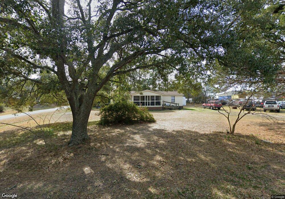
109 Sanders St Holly Ridge, NC 28445
Estimated Value: $79,835 - $247,000
--
Bed
--
Bath
--
Sq Ft
0.35
Acres
About This Home
This home is located at 109 Sanders St, Holly Ridge, NC 28445 and is currently estimated at $159,459. 109 Sanders St is a home with nearby schools including Coastal Elementary, Dixon Elementary School, and Dixon High School.
Ownership History
Date
Name
Owned For
Owner Type
Purchase Details
Closed on
Mar 7, 2024
Sold by
Sholar Belinda F and Sholar Belinda
Bought by
Mrs Property Holdings Llc
Current Estimated Value
Purchase Details
Closed on
Oct 5, 2017
Sold by
Bailey Mary A and Bailey Lonnie Ray
Bought by
Sholar Maxton R and Sholar Belinda
Purchase Details
Closed on
Aug 9, 2012
Sold by
Ottaway Jesse
Bought by
Bailey Mary A
Purchase Details
Closed on
Dec 29, 1993
Bought by
Ottaway Jesse
Create a Home Valuation Report for This Property
The Home Valuation Report is an in-depth analysis detailing your home's value as well as a comparison with similar homes in the area
Home Values in the Area
Average Home Value in this Area
Purchase History
| Date | Buyer | Sale Price | Title Company |
|---|---|---|---|
| Mrs Property Holdings Llc | -- | None Listed On Document | |
| Mrs Property Holdings Llc | -- | None Listed On Document | |
| Sholar Maxton R | $60,000 | None Available | |
| Bailey Mary A | -- | None Available | |
| Ottaway Jesse | -- | -- |
Source: Public Records
Tax History Compared to Growth
Tax History
| Year | Tax Paid | Tax Assessment Tax Assessment Total Assessment is a certain percentage of the fair market value that is determined by local assessors to be the total taxable value of land and additions on the property. | Land | Improvement |
|---|---|---|---|---|
| 2025 | $293 | $29,455 | $27,560 | $1,895 |
| 2024 | $293 | $29,455 | $27,560 | $1,895 |
| 2023 | $293 | $29,455 | $27,560 | $1,895 |
| 2022 | $296 | $29,455 | $27,560 | $1,895 |
| 2021 | $314 | $28,640 | $27,560 | $1,080 |
| 2020 | $314 | $28,640 | $27,560 | $1,080 |
| 2019 | $315 | $28,640 | $27,560 | $1,080 |
| 2018 | $318 | $28,640 | $27,560 | $1,080 |
| 2017 | $312 | $28,640 | $27,560 | $1,080 |
| 2016 | $312 | $28,640 | $0 | $0 |
| 2015 | $205 | $18,832 | $0 | $0 |
| 2014 | $205 | $28,640 | $0 | $0 |
Source: Public Records
Map
Nearby Homes
- 1001 Mabel Rawlinson Dr
- 321 N Dyson St
- 301 Kraft St
- 250 Bream St
- 739 Duneridge Ct
- 767 E Ocean Rd
- 133 Buckhorn Ave
- 435 Belvedere Dr
- 437 Belvedere Dr
- 202 Bungalow Rd
- 1213 Daisy Ct
- 301 Log Cabin Way
- 807 Wildflower Dr
- 359 Belvedere Dr
- 8 Hwy 50
- 110 Hampton Dr
- 229 Red Carnation Dr
- 204 Red Carnation Dr
- 423 Morris Landing
- 425 Morris Landing
- 106 Sanders St
- 204 U S 17
- 206 S Green St
- 203 Sanders St
- 200 Sanders St
- 118 U S 17 Unit 17
- 677 U S 17
- Lot 4 S Green St
- Lot 2 S Green St
- Lot 5 S Green St
- 0 S Green St
- 113 S Green St
- 205 S Dyson St
- 207 S Dyson St
- 209 S Dyson St
- 300 S Green St
- 211 S Dyson St
- 117 S Dyson St
- 301 S Dyson St
- 108 Us Highway 17 S