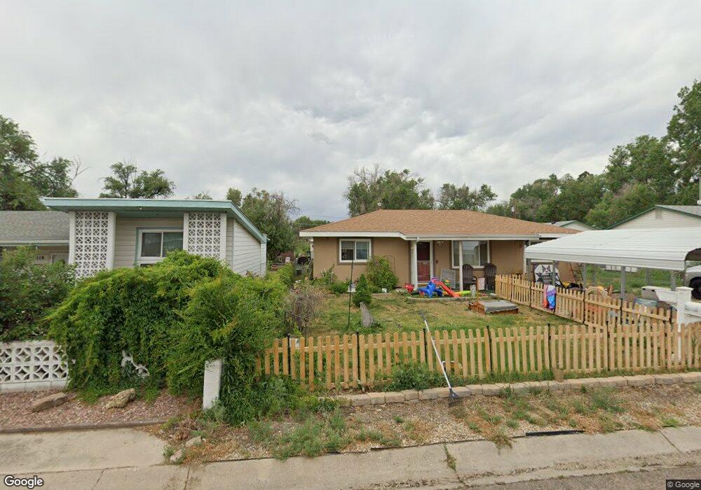
109 Security Blvd Colorado Springs, CO 80911
Fountain Valley Ranch NeighborhoodEstimated Value: $254,800 - $285,000
1
Bed
1
Bath
720
Sq Ft
$372/Sq Ft
Est. Value
About This Home
This home is located at 109 Security Blvd, Colorado Springs, CO 80911 and is currently estimated at $267,700, approximately $371 per square foot. 109 Security Blvd is a home located in El Paso County with nearby schools including Venetucci Elementary School, Watson Junior High School, and Widefield High School.
Ownership History
Date
Name
Owned For
Owner Type
Purchase Details
Closed on
May 2, 2024
Sold by
Bryan George Dean
Bought by
Bryan George Dean
Current Estimated Value
Purchase Details
Closed on
Dec 11, 2020
Sold by
Mccall Steven Lee
Bought by
Bryan George Dean and Johnson Lori Lee
Purchase Details
Closed on
Aug 3, 2018
Sold by
Davis Ruth I
Bought by
Mccall Steven Lee
Home Financials for this Owner
Home Financials are based on the most recent Mortgage that was taken out on this home.
Original Mortgage
$146,418
Interest Rate
5.62%
Mortgage Type
FHA
Purchase Details
Closed on
Jul 26, 2002
Sold by
Mealman Alice J
Bought by
Davis Thomas G and Davis Ruth I
Home Financials for this Owner
Home Financials are based on the most recent Mortgage that was taken out on this home.
Original Mortgage
$80,000
Interest Rate
6.53%
Mortgage Type
VA
Create a Home Valuation Report for This Property
The Home Valuation Report is an in-depth analysis detailing your home's value as well as a comparison with similar homes in the area
Home Values in the Area
Average Home Value in this Area
Purchase History
| Date | Buyer | Sale Price | Title Company |
|---|---|---|---|
| Bryan George Dean | -- | None Listed On Document | |
| Bryan George Dean | $175,000 | Unified Title Co | |
| Bryan George Dean | -- | None Available | |
| Mccall Steven Lee | $161,000 | None Available | |
| Davis Thomas G | $80,000 | Land Title Guarantee Company |
Source: Public Records
Mortgage History
| Date | Status | Borrower | Loan Amount |
|---|---|---|---|
| Previous Owner | Mccall Steven Lee | $146,418 | |
| Previous Owner | Davis Thomas G | $80,000 |
Source: Public Records
Tax History Compared to Growth
Tax History
| Year | Tax Paid | Tax Assessment Tax Assessment Total Assessment is a certain percentage of the fair market value that is determined by local assessors to be the total taxable value of land and additions on the property. | Land | Improvement |
|---|---|---|---|---|
| 2025 | $1,122 | $18,980 | -- | -- |
| 2024 | $1,052 | $18,980 | $3,220 | $15,760 |
| 2023 | $1,052 | $18,980 | $3,220 | $15,760 |
| 2022 | $934 | $12,510 | $2,220 | $10,290 |
| 2021 | $1,008 | $12,880 | $2,290 | $10,590 |
| 2020 | $731 | $9,070 | $2,000 | $7,070 |
| 2019 | $726 | $9,070 | $2,000 | $7,070 |
| 2018 | $637 | $7,420 | $1,500 | $5,920 |
| 2017 | $644 | $7,420 | $1,500 | $5,920 |
| 2016 | $520 | $7,320 | $1,590 | $5,730 |
| 2015 | $533 | $7,320 | $1,590 | $5,730 |
| 2014 | $460 | $6,340 | $1,430 | $4,910 |
Source: Public Records
Map
Nearby Homes
- 101 Security Blvd
- 99 Security Blvd
- 102 Security Blvd
- 141 Hayes Dr
- 89 Security Blvd
- 6380 Southmoor Dr
- 345 Libby Ct
- 80 Landoe Ln
- 490 Dix Cir
- 335 Dix Cir
- 576 Lindstrom Dr
- 817 Grand Blvd
- 95 Landoe Ln
- 102 Landoe Ln
- 402 Grand Blvd
- 409 Kiva Rd
- 422 Hackberry Dr
- 5795 Southmoor Dr Unit 17
- 5795 Southmoor Dr Unit 39
- 5795 Southmoor Dr Unit 35
- 111 Security Blvd
- 107 Security Blvd
- 113 Security Blvd
- 105 Security Blvd
- 115 Security Blvd
- 122 Easy St
- 120 Easy St
- 103 Security Blvd
- 124 Easy St
- 118 Easy St
- 128 Security Blvd
- 126 Easy St
- 116 Easy St
- 130 Security Blvd
- 124 Security Blvd
- 132 Security Blvd
- 128 Easy St
- 114 Easy St
- 110 Security Blvd
- 134 Security Blvd