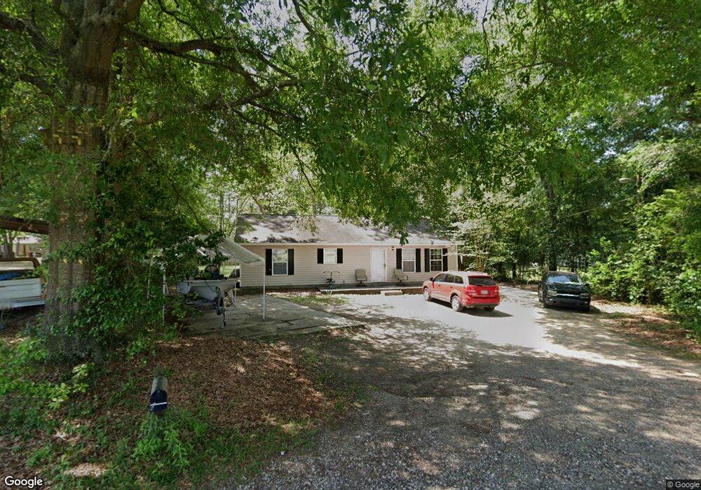
109 Starr St Tifton, GA 31794
Estimated Value: $123,000 - $236,000
2
Beds
1
Bath
888
Sq Ft
$174/Sq Ft
Est. Value
About This Home
This home is located at 109 Starr St, Tifton, GA 31794 and is currently estimated at $154,954, approximately $174 per square foot. 109 Starr St is a home located in Tift County with nearby schools including Len Lastinger Primary School, Charles Spencer Elementary School, and J.T. Reddick School.
Ownership History
Date
Name
Owned For
Owner Type
Purchase Details
Closed on
Dec 3, 2002
Sold by
Moore Paul R and Moore Gill,Hubert A
Bought by
Rmag Properties Llc
Current Estimated Value
Purchase Details
Closed on
Dec 10, 1998
Bought by
Moore Paul R
Purchase Details
Closed on
May 20, 1997
Bought by
Cook Debra Ann Neal
Purchase Details
Closed on
Jun 1, 1994
Bought by
Neal Edwena Y
Create a Home Valuation Report for This Property
The Home Valuation Report is an in-depth analysis detailing your home's value as well as a comparison with similar homes in the area
Home Values in the Area
Average Home Value in this Area
Purchase History
| Date | Buyer | Sale Price | Title Company |
|---|---|---|---|
| Rmag Properties Llc | -- | -- | |
| Moore Paul R | $44,000 | -- | |
| Cook Debra Ann Neal | -- | -- | |
| Neal Edwena Y | -- | -- |
Source: Public Records
Tax History Compared to Growth
Tax History
| Year | Tax Paid | Tax Assessment Tax Assessment Total Assessment is a certain percentage of the fair market value that is determined by local assessors to be the total taxable value of land and additions on the property. | Land | Improvement |
|---|---|---|---|---|
| 2024 | $1,308 | $48,518 | $12,000 | $36,518 |
| 2023 | $1,391 | $49,282 | $4,400 | $44,882 |
| 2022 | $1,855 | $49,282 | $4,400 | $44,882 |
| 2021 | $1,867 | $49,282 | $4,400 | $44,882 |
| 2020 | $1,913 | $49,282 | $4,400 | $44,882 |
| 2019 | $1,914 | $49,282 | $4,400 | $44,882 |
| 2018 | $1,915 | $49,282 | $4,400 | $44,882 |
| 2017 | $1,964 | $49,282 | $4,400 | $44,882 |
| 2016 | $1,967 | $49,282 | $4,400 | $44,882 |
| 2015 | $1,969 | $49,282 | $4,400 | $44,882 |
| 2014 | $1,972 | $49,282 | $4,400 | $44,882 |
| 2013 | -- | $49,282 | $4,400 | $44,882 |
Source: Public Records
Map
Nearby Homes
- 0 N U S Hwy 41
- 307 Fulwood Blvd
- 2202 Emory Dr
- 523 Alabama Dr Unit 15 & PT 16
- 523 Alabama Dr
- 2021 Emory Dr
- 225 Alabama Dr
- 2609 Emmett Dr
- 0 US Highway 41 Unit 137727
- 711 10th St W
- 0 Penn Place
- 1601 Murray Ave
- 0 Lee Ball Rd
- 803 Forest Ave
- 803 Forrest Ave
- 1617 Wilson Ave N
- 821 Murray Ave
- 1607 Mallard Ln
- 1610 Mallard Ln
- 416 6th St W