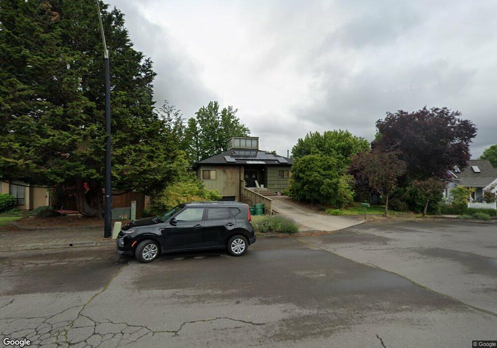
109 SW 6th Ct Gresham, OR 97080
Gresham Butte NeighborhoodEstimated Value: $613,418 - $666,000
3
Beds
3
Baths
2,656
Sq Ft
$241/Sq Ft
Est. Value
About This Home
This home is located at 109 SW 6th Ct, Gresham, OR 97080 and is currently estimated at $641,355, approximately $241 per square foot. 109 SW 6th Ct is a home located in Multnomah County with nearby schools including Dexter McCarty Middle School, Gresham High School, and Gresham Arthur Academy.
Ownership History
Date
Name
Owned For
Owner Type
Purchase Details
Closed on
Aug 9, 2021
Sold by
Mcdonald Lisa A
Bought by
Mcdonald Lisa A and Mcdonald Travis
Current Estimated Value
Home Financials for this Owner
Home Financials are based on the most recent Mortgage that was taken out on this home.
Original Mortgage
$331,500
Outstanding Balance
$300,785
Interest Rate
2.9%
Mortgage Type
New Conventional
Estimated Equity
$340,570
Purchase Details
Closed on
Oct 3, 2014
Sold by
Gannett Brainard J
Bought by
Mcdonald Lisa A
Home Financials for this Owner
Home Financials are based on the most recent Mortgage that was taken out on this home.
Original Mortgage
$320,003
Interest Rate
4.08%
Mortgage Type
FHA
Create a Home Valuation Report for This Property
The Home Valuation Report is an in-depth analysis detailing your home's value as well as a comparison with similar homes in the area
Home Values in the Area
Average Home Value in this Area
Purchase History
| Date | Buyer | Sale Price | Title Company |
|---|---|---|---|
| Mcdonald Lisa A | -- | First American | |
| Mcdonald Lisa A | $329,000 | First American |
Source: Public Records
Mortgage History
| Date | Status | Borrower | Loan Amount |
|---|---|---|---|
| Open | Mcdonald Lisa A | $331,500 | |
| Closed | Mcdonald Lisa A | $320,003 |
Source: Public Records
Tax History
| Year | Tax Paid | Tax Assessment Tax Assessment Total Assessment is a certain percentage of the fair market value that is determined by local assessors to be the total taxable value of land and additions on the property. | Land | Improvement |
|---|---|---|---|---|
| 2025 | $7,670 | $376,910 | -- | -- |
| 2024 | $7,342 | $365,940 | -- | -- |
| 2023 | $7,342 | $355,290 | -- | -- |
| 2022 | $6,502 | $344,950 | $0 | $0 |
| 2021 | $6,339 | $334,910 | $0 | $0 |
| 2020 | $5,964 | $325,160 | $0 | $0 |
| 2019 | $5,808 | $315,690 | $0 | $0 |
| 2018 | $5,538 | $306,500 | $0 | $0 |
| 2017 | $5,313 | $297,580 | $0 | $0 |
| 2016 | $4,685 | $288,920 | $0 | $0 |
| 2015 | $4,557 | $280,510 | $0 | $0 |
| 2014 | $4,365 | $272,340 | $0 | $0 |
Source: Public Records
Map
Nearby Homes
- 625 SW Miller Ct
- 417 SE Roberts Ave
- 638 SW 7th St
- 55 SW Lovhar Dr
- 419 SW Day Ct
- 645 W Powell Blvd
- 420 SE Linden Ave
- 0 SW Miller Ct Unit 470855683
- 200 SW Florence Ave Unit C6
- 200 SW Florence Ave
- 318 NE Roberts Ave Unit 308
- 1407 SE Beech Place
- 159 SW Florence Ave Unit 64
- 159 SW Florence Ave
- 0 NE 5th St
- 511 SE 15th St
- 512 SW Eastman Pkwy Unit 13
- 1113 W Powell Blvd
- 1333 SW 5th Place
- 491 NE Elliott Ave
- 117 SW 6th Ct
- 65 SW 6th Ct
- 102 SW 5th St
- 110 SW 5th St
- 41 SW 6th Ct
- 56 SW 5th St
- 56 SW 5th St-Call Then Sho
- 123 SW 6th Ct
- 605 SW Miller Ct
- 610 SW Miller Ct
- 135 SW 6th Ct
- 222 SW 5th St
- 130 SW 6th Ct
- 201 SW 6th Ct
- 635 SW Miller Ct
- 638 SW Miller Ct
- 520 SW Walters Dr
- 510 SW Walters Dr
- 211 SW 6th Ct
- 639 SW Miller Ct
Your Personal Tour Guide
Ask me questions while you tour the home.