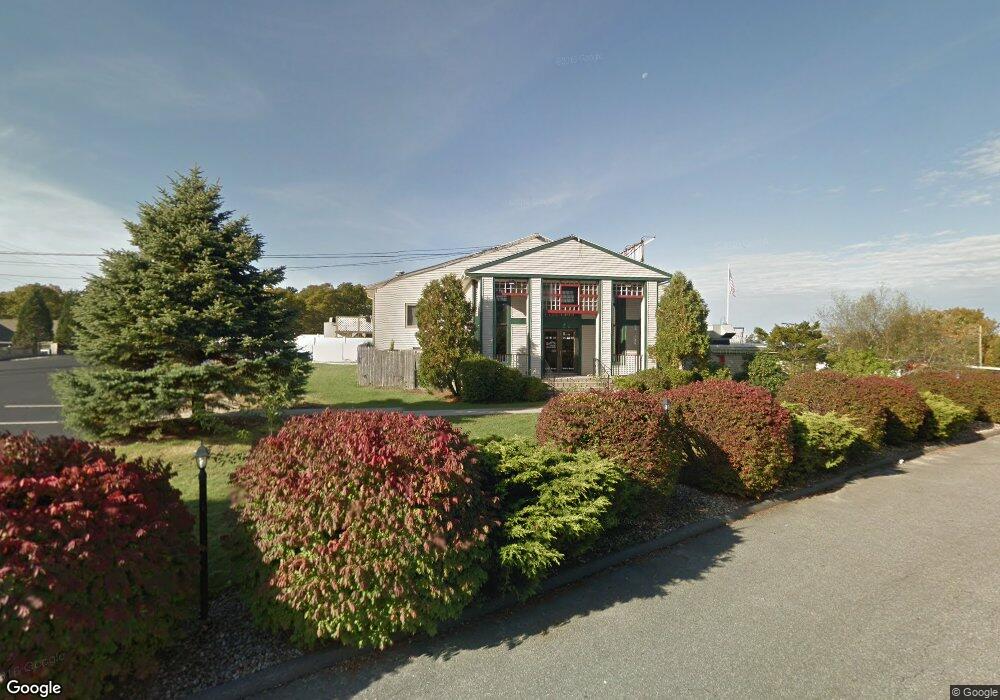
109 Trowbridge Rd Bourne, MA 2532
--
Bed
--
Bath
34,721
Sq Ft
5.76
Acres
About This Home
This home is located at 109 Trowbridge Rd, Bourne, MA 2532. 109 Trowbridge Rd is a home located in Barnstable County with nearby schools including Bourne High School, St Margaret Regional School, and Cadence Academy Preschool - Bourne.
Ownership History
Date
Name
Owned For
Owner Type
Purchase Details
Closed on
Apr 9, 1993
Sold by
Fdic
Bought by
Corey Steven S
Home Financials for this Owner
Home Financials are based on the most recent Mortgage that was taken out on this home.
Original Mortgage
$500,000
Interest Rate
7.48%
Mortgage Type
Purchase Money Mortgage
Create a Home Valuation Report for This Property
The Home Valuation Report is an in-depth analysis detailing your home's value as well as a comparison with similar homes in the area
Home Values in the Area
Average Home Value in this Area
Purchase History
| Date | Buyer | Sale Price | Title Company |
|---|---|---|---|
| Corey Steven S | $315,000 | -- |
Source: Public Records
Mortgage History
| Date | Status | Borrower | Loan Amount |
|---|---|---|---|
| Open | Corey Steven S | $200,000 | |
| Closed | Corey Steven S | $500,000 |
Source: Public Records
Tax History Compared to Growth
Tax History
| Year | Tax Paid | Tax Assessment Tax Assessment Total Assessment is a certain percentage of the fair market value that is determined by local assessors to be the total taxable value of land and additions on the property. | Land | Improvement |
|---|---|---|---|---|
| 2025 | $26,288 | $3,366,000 | $2,072,100 | $1,293,900 |
| 2024 | $25,690 | $3,203,300 | $1,973,200 | $1,230,100 |
| 2023 | $27,740 | $3,148,700 | $1,897,500 | $1,251,200 |
| 2022 | $31,622 | $3,134,000 | $1,783,900 | $1,350,100 |
| 2021 | $32,726 | $3,038,600 | $1,731,900 | $1,306,700 |
| 2020 | $32,247 | $3,002,500 | $1,698,300 | $1,304,200 |
| 2019 | $30,773 | $2,928,000 | $1,664,900 | $1,263,100 |
| 2018 | $29,755 | $2,823,100 | $1,600,700 | $1,222,400 |
| 2017 | $32,625 | $3,167,500 | $1,584,700 | $1,582,800 |
| 2016 | $32,766 | $3,225,000 | $1,584,700 | $1,640,300 |
| 2015 | $32,448 | $3,222,200 | $1,584,700 | $1,637,500 |
Source: Public Records
Map
Nearby Homes
- 90-92 Sandwich Rd Unit 2
- 60 Sandwich Rd
- 90-92 Sandwich Rd Unit 9C
- 44 Cotuit Rd
- 38 Old Bridge Rd
- 14 Great Rock Rd
- 85 Waterhouse Rd
- 85 Waterhouse Rd
- 304 Main St
- 405 Village Dr
- 405 Village Dr Unit 405
- 5 Sea Knoll Ct
- 24 Ships View Terrace
- 27 Ships View Terrace
- 13 Laurel Hill Ct
- 26 Carnoustie Rd
- 1 Hollyhock Knoll Ct Unit 1
- 4 Hollyhock Knoll Ct Unit 4
- 4 Hollyhock Knoll Ct Unit 4
- 46 Holt Rd
- 90 Sandwich Rd Unit 9C
- 92 Sandwich Rd Unit 2D
- 90 Sandwich Rd Unit 24
- 92 Sandwich Rd Unit 23
- 92 Sandwich Rd Unit 22
- 90 Sandwich Rd Unit 21
- 92 Sandwich Rd Unit 20
- 90 Sandwich Rd Unit 19
- 92 Sandwich Rd Unit 18
- 92 Sandwich Rd Unit 17
- 90 Sandwich Rd Unit 16
- 92 Sandwich Rd Unit 15
- 90 Sandwich Rd Unit 14
- 90 Sandwich Rd Unit 13
- 90 Sandwich Rd Unit 12
- 92 Sandwich Rd Unit 11
- 90 Sandwich Rd Unit 10
- 92 Sandwich Rd Unit 9
- 90 Sandwich Rd Unit 8
- 92 Sandwich Rd Unit 7