Estimated Value: $314,830 - $374,000
4
Beds
3
Baths
2,806
Sq Ft
$119/Sq Ft
Est. Value
About This Home
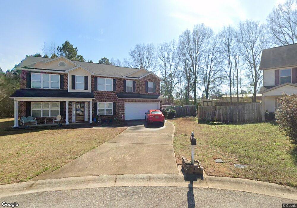
This home is located at 109 Tyndall Way, Perry, GA 31069 and is currently estimated at $334,208, approximately $119 per square foot. 109 Tyndall Way is a home located in Houston County with nearby schools including Morningside Elementary School, Perry Middle School, and Perry High School.
Ownership History
Date
Name
Owned For
Owner Type
Purchase Details
Closed on
Jun 29, 2011
Sold by
Sf Commuites Llc
Bought by
Forsee Russell A and Forsee Beverly
Current Estimated Value
Home Financials for this Owner
Home Financials are based on the most recent Mortgage that was taken out on this home.
Original Mortgage
$181,217
Outstanding Balance
$125,317
Interest Rate
4.62%
Mortgage Type
VA
Estimated Equity
$208,891
Purchase Details
Closed on
Jan 20, 2011
Sold by
Long Bridge Development Llc
Bought by
Sf Communities Llc
Home Financials for this Owner
Home Financials are based on the most recent Mortgage that was taken out on this home.
Original Mortgage
$121,425
Interest Rate
4.58%
Mortgage Type
Construction
Create a Home Valuation Report for This Property
The Home Valuation Report is an in-depth analysis detailing your home's value as well as a comparison with similar homes in the area
Home Values in the Area
Average Home Value in this Area
Purchase History
| Date | Buyer | Sale Price | Title Company |
|---|---|---|---|
| Forsee Russell A | $175,500 | None Available | |
| Sf Communities Llc | $12,900 | None Available |
Source: Public Records
Mortgage History
| Date | Status | Borrower | Loan Amount |
|---|---|---|---|
| Open | Forsee Russell A | $181,217 | |
| Previous Owner | Sf Communities Llc | $121,425 |
Source: Public Records
Tax History Compared to Growth
Tax History
| Year | Tax Paid | Tax Assessment Tax Assessment Total Assessment is a certain percentage of the fair market value that is determined by local assessors to be the total taxable value of land and additions on the property. | Land | Improvement |
|---|---|---|---|---|
| 2024 | $3,910 | $107,640 | $8,000 | $99,640 |
| 2023 | $3,738 | $101,040 | $8,000 | $93,040 |
| 2022 | $2,093 | $91,040 | $8,000 | $83,040 |
| 2021 | $1,881 | $81,360 | $8,000 | $73,360 |
| 2020 | $1,649 | $71,000 | $8,000 | $63,000 |
| 2019 | $1,649 | $71,000 | $8,000 | $63,000 |
| 2018 | $1,649 | $71,000 | $8,000 | $63,000 |
| 2017 | $1,605 | $69,000 | $6,000 | $63,000 |
| 2016 | $1,607 | $69,000 | $6,000 | $63,000 |
| 2015 | $1,518 | $65,040 | $6,000 | $59,040 |
| 2014 | -- | $65,040 | $6,000 | $59,040 |
| 2013 | -- | $65,040 | $6,000 | $59,040 |
Source: Public Records
Map
Nearby Homes
- 118 Farmers Way
- 311 Rusty Plow Ln Unit 16
- 307 Rusty Plow Ln
- 104 Red Barn Ct
- 102 Kanza Trail
- 307 Rusty Plow Ln Unit 14
- 108 Christine Cir
- 107 Lighterknot Trail
- 106 Raspberry Trail
- 500 Legacy Park Dr
- 110 Gwendolyn Ave
- 204 Susanne's Retreat
- 412 Legacy Park Dr
- 1008 Ridge Cir S
- 2111 N Us Hwy 41
- 314 Waxmyrtle Way
- 1015 Cherokee Rd
- 0 Perimeter Roads Unit 20145464
- 102 Seven Pines Ct
- 0 Perimeter Rd Unit 236479
- 111 Tyndall Way
- 107 Tyndall Way
- 0 Tyndall Way Unit 56- Westin 8826395
- 0 Tyndall Way Unit 58-Kendall I 8826394
- 201 Tyndall Way Unit 58-Kendall I
- 105 Tyndall Way
- 203 Tyndall Way Unit 57-Everest II
- 200 Tyndall Way Unit 80-PATRIOT
- 205 Tyndall Way Unit 47-Westin
- 205 Tyndall Way Unit 56 Westin
- 202 Tyndall Way
- 103 Tyndall Way
- 101 Tyndall Way
- 207 Tyndall Way Unit 55-Everest III
- 201 Longbridge Way
- 107 Longbridge Way
- 203 Longbridge Way
- 1831 Macon Rd
- 206 Tyndall Way
- 209 Tyndall Way Unit 54-Everest II