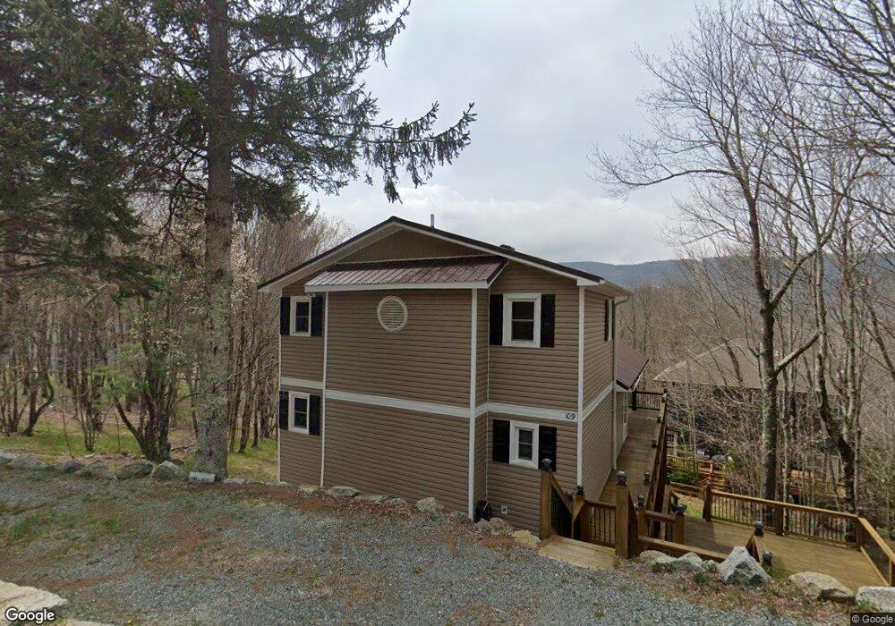
109 Upper Grouse Ridge Rd Beech Mountain, NC 28604
Estimated Value: $503,849 - $582,000
About This Home
This home is located at 109 Upper Grouse Ridge Rd, Beech Mountain, NC 28604 and is currently estimated at $543,212, approximately $289 per square foot. 109 Upper Grouse Ridge Rd is a home located in Watauga County with nearby schools including Valle Crucis Elementary School and Watauga High School.
Ownership History
We collect this data history from publicly available records. To have your information removed, we recommend requesting removal directly through your county’s website.
Purchase Details
Purchase Details
Home Financials for this Owner
Home Financials are based on the most recent Mortgage that was taken out on this home.Home Values in the Area
Average Home Value in this Area
Purchase History
We collect this data history from publicly available records. To have your information removed, we recommend requesting removal directly through your county’s website.
| Date | Buyer | Sale Price | Title Company |
|---|---|---|---|
| -- | None Listed On Document | ||
| $172,000 | None Available |
Mortgage History
We collect this data history from publicly available records. To have your information removed, we recommend requesting removal directly through your county’s website.
| Date | Status | Borrower | Loan Amount |
|---|---|---|---|
| Previous Owner | $80,000 |
Tax History
We collect this data history from publicly available records. To have your information removed, we recommend requesting removal directly through your county’s website.
| Year | Tax Paid | Tax Assessment Tax Assessment Total Assessment is a certain percentage of the fair market value that is determined by local assessors to be the total taxable value of land and additions on the property. | Land | Improvement |
|---|---|---|---|---|
| 2025 | $1,595 | $413,400 | $25,400 | $388,000 |
| 2024 | $4,105 | $413,400 | $25,400 | $388,000 |
| 2023 | $4,206 | $413,400 | $25,400 | $388,000 |
| 2022 | $4,206 | $413,400 | $25,400 | $388,000 |
| 2021 | $2,386 | $203,200 | $24,000 | $179,200 |
| 2020 | $2,386 | $203,200 | $24,000 | $179,200 |
| 2019 | $2,386 | $203,200 | $24,000 | $179,200 |
| 2018 | $2,151 | $190,900 | $24,000 | $166,900 |
| 2017 | $2,151 | $190,900 | $24,000 | $166,900 |
| 2013 | -- | $213,600 | $24,000 | $189,600 |
Map
- 106 Upper Grouse Ridge Rd
- 103 & 105 Upper Grouse Ridge
- 101 Upper Grouse Ridge Rd
- 108 Windridge Rd
- 114 Windridge Rd
- 111 Overbrook Trail
- 130 E Blueberry Ln
- 133 Greenbriar Rd
- 125 Lower Grouse Ridge Rd
- 129 Lower Grouse Ridge Rd
- 128 Wild Daisy Ln
- 701 Charter Hills Rd
- 134 Wild Daisy Ln
- 111 Locust Ridge Rd
- 110 Greenbriar Rd
- 216 Greenbriar Rd
- 140 Lower Grouse Ridge Rd
- 269 Greenbriar Rd
- 192 Wild Daisy Ln
- 203 Shagbark Rd
- 112 Upper Grouse Ridge Rd
- 104 Lower Grouse Ridge Rd
- 111 Upper Grouse Ridge Rd
- 102 Lower Grouse Ridge Rd
- 106 Lower Grouse Ridge Rd
- 106 Lower Grouse Ridge Rd Unit 329
- 220 Spring Branch Rd
- 113 Upper Grouse Ridge Rd
- 108 Upper Grouse Ridge Rd
- 108 Lower Grouse Ridge Rd
- 103 Upper Grouse Ridge Rd
- 200 Spring Branch Rd
- 115 Upper Grouse Ridge Rd
- 116 Upper Grouse Ridge Rd
- 3 Lower Grouse Ridge Rd
- 103 Windridge Rd
- 102 Blackberry Trail Unit 235/C
- 202 Spring Branch Rd
- 104 Windridge Rd
- 109 Lower Grouse Ridge Rd
Ask me questions while you tour the home.