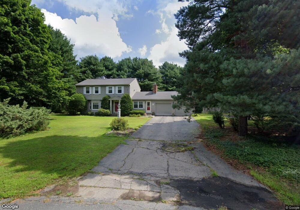
109 Victoria Rd Sudbury, MA 01776
Estimated Value: $907,523 - $1,072,000
3
Beds
3
Baths
1,972
Sq Ft
$484/Sq Ft
Est. Value
About This Home
This home is located at 109 Victoria Rd, Sudbury, MA 01776 and is currently estimated at $954,381, approximately $483 per square foot. 109 Victoria Rd is a home located in Middlesex County with nearby schools including Israel Loring Elementary School, Ephraim Curtis Middle School, and Lincoln-Sudbury Regional High School.
Ownership History
Date
Name
Owned For
Owner Type
Purchase Details
Closed on
Jul 24, 1989
Sold by
Walsh John J
Bought by
Ralby David
Current Estimated Value
Create a Home Valuation Report for This Property
The Home Valuation Report is an in-depth analysis detailing your home's value as well as a comparison with similar homes in the area
Home Values in the Area
Average Home Value in this Area
Purchase History
| Date | Buyer | Sale Price | Title Company |
|---|---|---|---|
| Ralby David | $270,000 | -- | |
| Ralby David | $270,000 | -- |
Source: Public Records
Mortgage History
| Date | Status | Borrower | Loan Amount |
|---|---|---|---|
| Open | Ralby David | $200,000 | |
| Closed | Ralby David | $35,000 |
Source: Public Records
Tax History Compared to Growth
Tax History
| Year | Tax Paid | Tax Assessment Tax Assessment Total Assessment is a certain percentage of the fair market value that is determined by local assessors to be the total taxable value of land and additions on the property. | Land | Improvement |
|---|---|---|---|---|
| 2025 | $12,381 | $845,700 | $439,800 | $405,900 |
| 2024 | $11,932 | $816,700 | $427,000 | $389,700 |
| 2023 | $11,394 | $722,500 | $395,400 | $327,100 |
| 2022 | $11,480 | $636,000 | $363,000 | $273,000 |
| 2021 | $11,181 | $593,800 | $363,000 | $230,800 |
| 2020 | $10,956 | $593,800 | $363,000 | $230,800 |
| 2019 | $10,635 | $593,800 | $363,000 | $230,800 |
| 2018 | $10,735 | $598,700 | $387,000 | $211,700 |
| 2017 | $10,254 | $578,000 | $368,200 | $209,800 |
| 2016 | $9,936 | $558,200 | $354,200 | $204,000 |
| 2015 | $9,516 | $540,700 | $340,600 | $200,100 |
| 2014 | $9,500 | $526,900 | $330,600 | $196,300 |
Source: Public Records
Map
Nearby Homes
- 63 Landham Rd
- 0 Wagonwheel Rd
- 216 Landham Rd
- 84 Hopestill Brown Rd
- 6 Old County Rd Unit 16
- 353 Old Connecticut Path
- 94 Goodmans Hill Rd
- 23 Massasoit Ave
- 29 Derby St
- 454 Old Connecticut Path
- 8 Clara Rd
- 96 Lakeshore Dr
- 96 Lake Shore Dr
- 24 Pinewood Dr
- 22 Lakeshore Dr
- 81 Nicholas Rd Unit B
- 36 Concord Rd
- 71 Nicholas Rd Unit H
- 154 Danforth St
- 14 Francine Rd
- 110 Victoria Rd
- 101 Victoria Rd
- 83 Victoria Rd
- 116 Victoria Rd
- 116 Victoria Rd Unit n/a
- 116 Victoria Rd
- 106 Victoria Rd
- 89 Victoria Rd
- 123 Victoria Rd
- 65 Victoria Rd
- 59 Victoria Rd
- 124 Victoria Rd
- 98 Victoria Rd
- 102 Victoria Rd
- 131 Victoria Rd
- 92 Victoria Rd
- 53 Victoria Rd
- 132 Victoria Rd
- 60 Victoria Rd
- 56 Victoria Rd