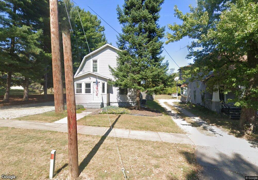
109 W Bacon St Hillsdale, MI 49242
Estimated Value: $159,000 - $195,000
3
Beds
1
Bath
1,978
Sq Ft
$92/Sq Ft
Est. Value
About This Home
This home is located at 109 W Bacon St, Hillsdale, MI 49242 and is currently estimated at $182,961, approximately $92 per square foot. 109 W Bacon St is a home located in Hillsdale County with nearby schools including Bailey Early Childhood Center, Gier Elementary School, and Davis Middle School.
Ownership History
Date
Name
Owned For
Owner Type
Purchase Details
Closed on
Jul 20, 2004
Sold by
Smoker Lori Ann
Bought by
Bowers Michael W and Bowers Julie M
Current Estimated Value
Home Financials for this Owner
Home Financials are based on the most recent Mortgage that was taken out on this home.
Original Mortgage
$62,500
Outstanding Balance
$31,591
Interest Rate
6.4%
Mortgage Type
Purchase Money Mortgage
Estimated Equity
$151,370
Purchase Details
Closed on
Jun 21, 2000
Sold by
Smoker Timothy and Longfield Lori
Bought by
Smoker Lori Ann
Create a Home Valuation Report for This Property
The Home Valuation Report is an in-depth analysis detailing your home's value as well as a comparison with similar homes in the area
Home Values in the Area
Average Home Value in this Area
Purchase History
| Date | Buyer | Sale Price | Title Company |
|---|---|---|---|
| Bowers Michael W | $62,500 | Chicago Title | |
| Smoker Lori Ann | -- | -- |
Source: Public Records
Mortgage History
| Date | Status | Borrower | Loan Amount |
|---|---|---|---|
| Open | Bowers Michael W | $62,500 |
Source: Public Records
Tax History Compared to Growth
Tax History
| Year | Tax Paid | Tax Assessment Tax Assessment Total Assessment is a certain percentage of the fair market value that is determined by local assessors to be the total taxable value of land and additions on the property. | Land | Improvement |
|---|---|---|---|---|
| 2025 | $1,574 | $73,100 | $0 | $0 |
| 2024 | $1,316 | $70,600 | $0 | $0 |
| 2023 | $1,264 | $59,400 | $0 | $0 |
| 2022 | $1,440 | $53,900 | $0 | $0 |
| 2021 | $1,354 | $50,800 | $0 | $0 |
| 2020 | $1,312 | $43,800 | $0 | $0 |
| 2019 | $1,271 | $48,200 | $0 | $0 |
| 2018 | $1,185 | $38,500 | $0 | $0 |
| 2017 | $1,146 | $43,200 | $0 | $0 |
| 2016 | $1,047 | $30,200 | $0 | $0 |
| 2015 | $874 | $30,200 | $0 | $0 |
| 2013 | -- | $28,280 | $0 | $0 |
| 2012 | -- | $32,650 | $0 | $0 |
Source: Public Records
Map
Nearby Homes
- 21 N Norwood St
- 19 S Norwood Ave
- 9 S West St
- 181 Spring St
- 95 S West St
- 108 Stony Ridge Ct
- 97 W Hallett St
- 56 Waldron St
- 10 Armstrong St
- 1806 Barr St
- 90 S Howell St
- 83 W Lynwood Blvd
- 76 Budlong St
- 18 Garden St
- 64 Union St
- 32 Garden St
- 134 S Howell St
- 172 S Manning St
- 32 Mcclellan St
- 16 W Lynwood Blvd
- 107 W Bacon St
- 3 Glendale Ave
- 17 Glendale Ave
- 112 W Bacon St
- 19 Glendale Ave
- 96 W Bacon St
- 11 Brookside Pkwy
- 2 Glendale Ave
- 25 Glendale Ave
- 12 Glendale Ave
- 16 Glendale Ave
- 18 Glendale Ave
- 94 W Bacon St
- 725 W Bacon St
- 120 W Bacon St
- 20 Glendale Ave
- 88 W Bacon St
- 22 Glendale Ave
- 26 Glendale Ave
- 31 Glendale Ave