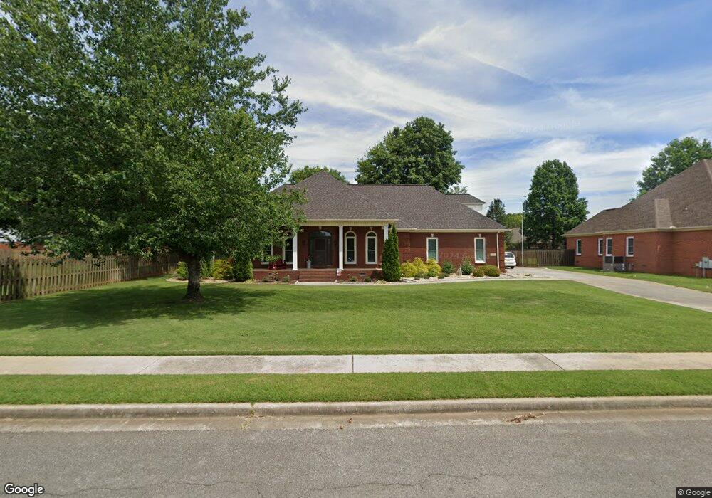
109 Waterleaf Rd Huntsville, AL 35811
Ryland NeighborhoodEstimated Value: $518,000 - $575,000
--
Bed
1
Bath
3,598
Sq Ft
$154/Sq Ft
Est. Value
About This Home
This home is located at 109 Waterleaf Rd, Huntsville, AL 35811 and is currently estimated at $553,228, approximately $153 per square foot. 109 Waterleaf Rd is a home with nearby schools including Mt Carmel Elementary School, Riverton Intermediate School, and Buckhorn Middle School.
Ownership History
Date
Name
Owned For
Owner Type
Purchase Details
Closed on
Oct 8, 2019
Sold by
Laidlaw Charles E and Laidlaw Lori E
Bought by
Laidlaw Charles E and Laidlaw Lori E
Current Estimated Value
Purchase Details
Closed on
Apr 27, 2007
Sold by
Brounoff Daniel E and Brounoff Stefani
Bought by
Laidlaw Charles E and Laidlaw Paula M
Home Financials for this Owner
Home Financials are based on the most recent Mortgage that was taken out on this home.
Original Mortgage
$379,191
Outstanding Balance
$229,768
Interest Rate
6.1%
Mortgage Type
VA
Estimated Equity
$323,460
Create a Home Valuation Report for This Property
The Home Valuation Report is an in-depth analysis detailing your home's value as well as a comparison with similar homes in the area
Home Values in the Area
Average Home Value in this Area
Purchase History
| Date | Buyer | Sale Price | Title Company |
|---|---|---|---|
| Laidlaw Charles E | -- | None Available | |
| Laidlaw Charles E | -- | -- |
Source: Public Records
Mortgage History
| Date | Status | Borrower | Loan Amount |
|---|---|---|---|
| Open | Laidlaw Charles E | $379,191 |
Source: Public Records
Tax History Compared to Growth
Tax History
| Year | Tax Paid | Tax Assessment Tax Assessment Total Assessment is a certain percentage of the fair market value that is determined by local assessors to be the total taxable value of land and additions on the property. | Land | Improvement |
|---|---|---|---|---|
| 2024 | $1,647 | $46,940 | $6,000 | $40,940 |
| 2023 | $1,647 | $45,880 | $6,000 | $39,880 |
| 2022 | $1,464 | $41,920 | $6,000 | $35,920 |
| 2021 | $1,322 | $38,040 | $6,000 | $32,040 |
| 2020 | $1,191 | $34,430 | $6,000 | $28,430 |
| 2019 | $1,144 | $33,130 | $6,000 | $27,130 |
| 2018 | $1,078 | $31,340 | $0 | $0 |
| 2017 | $1,049 | $30,560 | $0 | $0 |
| 2016 | $1,049 | $30,560 | $0 | $0 |
| 2015 | $1,049 | $30,560 | $0 | $0 |
| 2014 | $1,117 | $32,400 | $0 | $0 |
Source: Public Records
Map
Nearby Homes
- 290 River Cove Rd
- 132 Southfork Dr
- 606 Bell Factory Rd
- 114 River Meadow Way
- 143 River Mill Rd
- 100 Stone River Rd
- 111 Saint Clair Ln
- 215 Saint Clair Ln
- 296 Brevard Blvd
- 122 Mykeys Way
- 118 Stone River Rd
- 101 Whitetail Dr
- 208 Dinner Tree Square
- 212 Dinner Tree Square
- 135 River Mill Rd
- 142 River Mill Rd
- 115 Richard Rd
- 145 Bridge Arbor Ln
- 235 Catalyst St
- 313 Merrydale Dr
- 107 Waterleaf Rd
- 215 Wildflower Ct
- 106 Waterleaf Rd
- 217 Wildflower Ct
- 286 River Cove Rd
- 108 Waterleaf Rd
- 110 Waterleaf Rd
- 113 Waterleaf Rd
- 288 River Cove Rd
- 207 Wildflower Ct
- 219 Wildflower Ct
- 103 Waterleaf Rd
- 216 Wildflower Ct
- 278 River Cove Rd
- 218 Wildflower Ct
- 276 River Cove Rd
- 102 Waterleaf Rd
- 221 Wildflower Ct
- 205 Wildflower Ct
- 287 River Cove Rd